
Aside from a few high clouds passing along and south of the PA Turnpike, it’s a clear and cold start to the workweek. Low temperatures range from the upper 20s to upper 30s.As high pressure builds south from Canada, expect plentiful sunshine today, with seasonable highs near 60 degrees. Tonight, lows will fall to the mid-to-upper 30s under clear skies. Since growing season has officially ended across the Susquehanna Valley, Frost Advisories and Freeze Warnings will no longer be issued. Tuesday will feature mostly sunny skies through midday, then increasing evening clouds. Highs will be slightly cooler, in the upper 50s. Look for mostly cloudy skies Wednesday, with showers returning late in the evening, as low pressure develops in the Midwest. Highs will hit 56 degrees. Rain continues Wednesday night into Thursday, before tapering to showers Thursday afternoon. Highs will remain in the mid-50s.Isolated showers are possible Friday, as low pressure lifts into New England. It will be breezy to windy, and it looks mainly dry for trick-or-treaters. Breezy, cool weather follows Saturday under partly sunny skies. Sunday will feature more clouds and a few showers. Weekend temperatures will hover in the upper 50s.Next week, isolated rain chances are in the forecast Monday and Tuesday, along with breezy conditions and below average highs in the low-to-mid 50s.
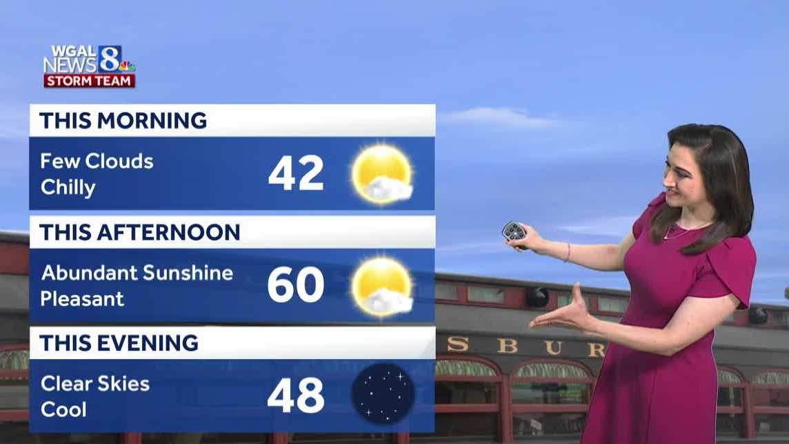
Aside from a few high clouds passing along and south of the PA Turnpike, it’s a clear and cold start to the workweek. Low temperatures range from the upper 20s to upper 30s.
As high pressure builds south from Canada, expect plentiful sunshine today, with seasonable highs near 60 degrees.
Tonight, lows will fall to the mid-to-upper 30s under clear skies. Since growing season has officially ended across the Susquehanna Valley, Frost Advisories and Freeze Warnings will no longer be issued.
Tuesday will feature mostly sunny skies through midday, then increasing evening clouds. Highs will be slightly cooler, in the upper 50s.
Look for mostly cloudy skies Wednesday, with showers returning late in the evening, as low pressure develops in the Midwest. Highs will hit 56 degrees.
Rain continues Wednesday night into Thursday, before tapering to showers Thursday afternoon. Highs will remain in the mid-50s.
Isolated showers are possible Friday, as low pressure lifts into New England. It will be breezy to windy, and it looks mainly dry for trick-or-treaters.
Breezy, cool weather follows Saturday under partly sunny skies. Sunday will feature more clouds and a few showers. Weekend temperatures will hover in the upper 50s.
Next week, isolated rain chances are in the forecast Monday and Tuesday, along with breezy conditions and below average highs in the low-to-mid 50s.