
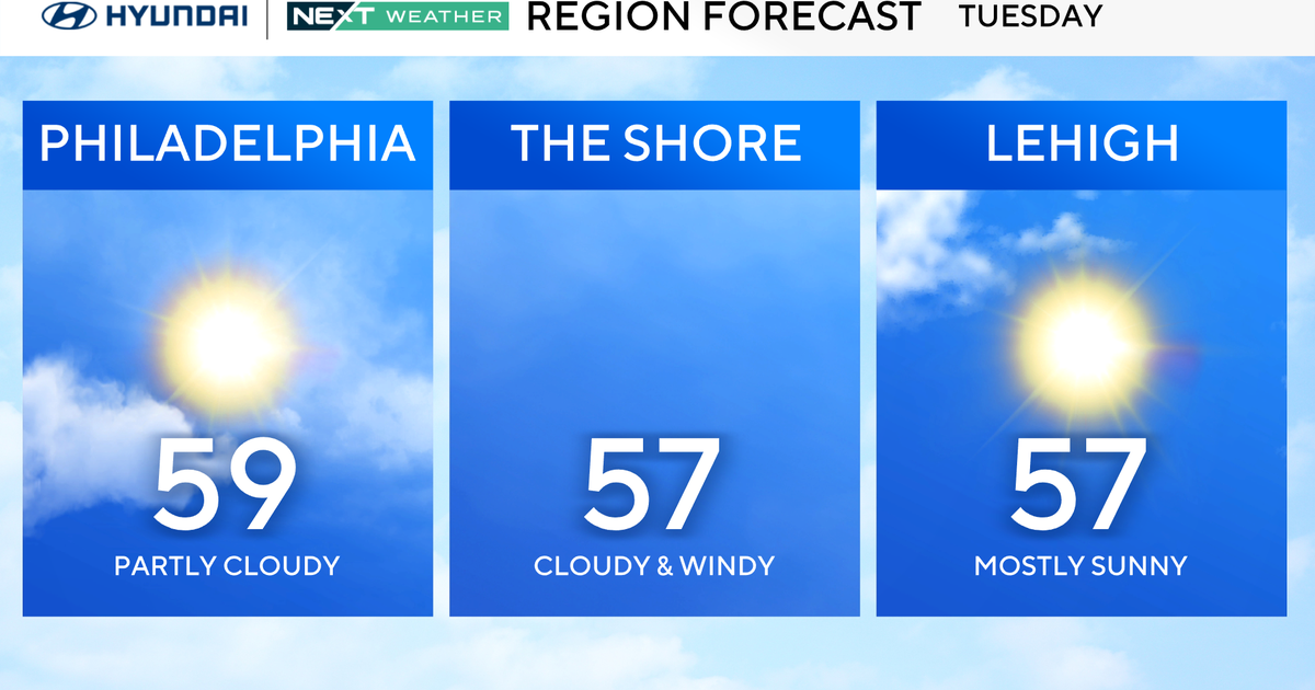
Tuesday will be another relatively quiet day in the Philadelphia area, similar to Monday with some added cloud cover filling in later in the day.
A storm system will pass by to our south but have little to no impact locally. The storm we are watching, however, will arrive later in the day Wednesday and bring widespread impacts to our area on Thursday in the form of wind and rain.

CBS News Philadelphia
Winds will pick up near the shore, gusting up to 30 or 35 mph and move across the entire Delaware Valley. The rainfall totals will likely end up in the 1 to 3 inches range, spread over the course of 6 to 12 hours. Because of the extended period, flash flooding isn’t likely but certainly bears watching.
A NEXT Weather Alert will be in effect Thursday because of rain and wind expected throughout the day.
The storm system should be out of our area by Friday, opening the door for cooler but dry conditions Halloween night. Not the 80s we had last year, but not stormy either. That dry weather will likely stay through the weekend.
Meanwhile, Hurricane Melissa has intensified into a powerful Category 5 storm with winds of 175 mph. The storm is moving slowly North, just south of Jamaica, and is expected to make landfall there Tuesday as a major hurricane. Catastrophic flash flooding, landslides, and storm surge up to 13 feet are likely along Jamaica’s southern coast. Heavy rain will also spread into southern Hispaniola and eastern Cuba, where flooding and destructive surf are expected through midweek.

CBS News Philadelphia
Stay with your NEXT Weather team for the latest.
Here’s your 7-day forecast:

CBS News Philadelphia
Tuesday: Clouding up. High 59, Low 43.
Wednesday: Shower late. High 58, Low of 48.
Thursday: NEXT Weather Alert for rain and wind. High 66, Low 54.
Friday/Halloween: Clearing. High 59, Low 50.
Saturday: Mostly sunny. High 62, Low 47.
Sunday: Pleasant. High 60, Low 44.
Monday: Partly cloudy. High 58, Low 44.
More from CBS News