
Bright sunshine on tap for Monday; shower chances return Tuesday for south-central Pennsylvania
High pressure building in from the Great Lakes brings bright sunshine back on Monday. Temperatures remain cooler than average through most of the week ahead.
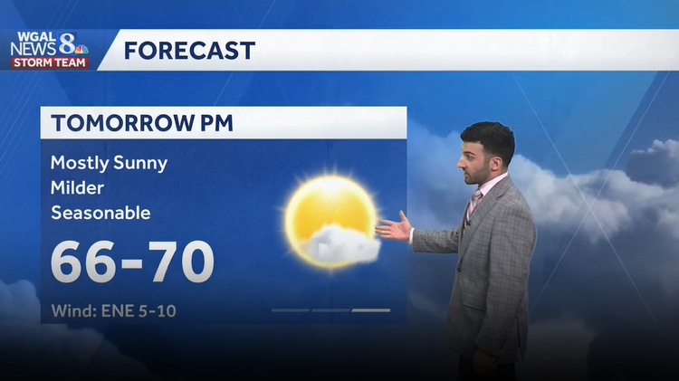
TEXAS TO IOWA. NOW, THE WGAL NEWS EIGHT STORM TEAM FORECAST, WITH METEOROLOGIST BRIAN ARGENTI. COMING TO THE OTHER SIDE OF THE COUNTRY, TOWARDS THE NORTHEAST, TOWARDS THE SUSQUEHANNA VALLEY. A LITTLE MORE CALM, I WOULD SAY FOR THIS FOR FOR US ACROSS THE AREA, WE HAVE HIGH PRESSURE BUILDING IN. THAT’S ALLOWING FOR SOME MAINLY CLEAR CONDITIONS ACROSS THE AREA AND TEMPERATURES REACHING THE UPPER 40S AT THIS TIME, 49 IN HERSHEY WITH A, I WOULD SAY A LIGHT AND VARIABLE NORTHERLY BREEZE RIGHT AROUND THREE MILES PER HOUR AT THIS TIME. BUT WHAT WE’RE TRACKING AS WE HEAD INTO THE WEEK, MOSTLY SUNNY CONDITIONS, FEELING PLEASANT TO START THE WEEK OFF RIGHT AROUND SEASONABLE CONDITIONS. SO 68 IS WHAT WE EXPECT FOR THIS TIME OF THE YEAR. AND THEN ONCE WE GET INTO THE REST OF THIS WEEK, WE ARE BACK TO THE LOWER 60S AND WE’LL SEE MORE RAIN CHANCES ON THE WAY. AND THEN HEADING INTO NEXT WEEKEND, THERE IS ANOTHER CHANCE FOR SOME SHOWERS, ESPECIALLY HEADING INTO OUR SATURDAY, BUT WE’LL BE SEEING THOSE COOLER TEMPERATURES REMAIN INTO NEXT WEEKEND. NOW, ALMANAC FOR THE DAY TODAY HIT A HIGH OF 57 DEGREES. BUT NOTICE HOW I MENTIONED 68 DEGREES IS WHAT WE EXPECT FOR THIS TIME OF THE YEAR. SO WE’RE ALMOST WE’RE BE WE’RE ALMOST WE’RE JUST BEYOND TEN DEGREES BELOW AVERAGE FOR THIS TIME OF THE YEAR. ALTHOUGH OVERNIGHT LOW TEMPERATURES, WE HIT A LOW OF 43 DEGREES EARLIER THIS MORNING. WE EXPECT THE MID 40S IN TERMS OF OVERNIGHT LOW TEMPERATURES. NO RAINFALL WAS RECORDED AT HARRISBURG INTERNATIONAL AIRPORT, SO MOSTLY CLEAR FOR THE REST OF THE NIGHT. TONIGHT. FEELING COOL? WE’RE CALM, BUT I DO SEE A CHANCE OF SEEING SOME PATCHY FOG DEVELOP IN SOME ISOLATED AREAS. SO YOU MAY SEE SOME SOME FOG WAKING UP FOR YOUR MONDAY MORNING COMMUTE, BUT TEMPERATURES WILL GO DOWN TO THE LOWER 40S FOR OVERNIGHT TONIGHT. THEN FOR TOMORROW, ABUNDANT SUNSHINE. IT’S GOING TO BE A QUICK WARM UP. I KIND OF EXPANDED THE TEMPERATURE RANGE HERE TO 52 TO 58 DEGREES BECAUSE WE’RE GOING TO BE SHOOTING UP TO THE TO THE UPPER 60S BY THE TIME WE GET TO THE AFTERNOON. SO CERTAINLY FEELING MILDER AND SEASONABLE FOR THIS TIME OF YEAR, MOSTLY SUNNY CONDITIONS WITH AN EAST NORTHEASTERLY BREEZE, I’D SAY RIGHT AROUND BETWEEN 5 AND 10MPH FOR US NOW, TREES AND GRASSES, THE POLLEN LEVELS FROM FROM THEM, IT’S IT’S GOING TO BE HIGH FOR TOMORROW. AND THEN LOW, LOW MOLD LEVELS THOUGH MODERATE AIR QUALITY FOR PARTICULATES AND OZONE. WE HAVE ABOUT A 30 MINUTE BURN TIME. SO WE RATED THAT WITH A AS A MODERATE UV INDEX FOR THE AFTERNOON AND PRECIPITATION CHANCES FOR THE FOR THE NEXT FOR THE NEXT FEW DAYS, TUESDAY, THERE’S A CHANCE OF SOME SHOWERS, BUT THEY LOOK ISOLATED OR FEW IN NATURE OR IN THE COVERAGE. NOW WE WON’T BE SEEING PERSISTENT SHOWERS UNTIL WE GET TO OUR WEDNESDAY, WHERE I DEFINITELY THINK WE’RE GOING TO BE SEEING. THAT’S OUR BEST CHANCE OF SOME SHOWERS, IS GOING TO BE IN THE MIDDLE OF THE WEEK THIS COMING WEEK, AND THEN HEADING INTO NEXT WEEKEND, ANOTHER SLIGHT CHANCE. BUT YOU SEE TEMPERATURES INTO THE UPPER 40S 50S FOR LANCASTER 52 AND GETTYSBURG 53 IN CHAMBERSBURG AT THIS TIME. YOU CAN SEE I DID OVERLAY SOME OF THAT SATELLITE IMAGERY THERE. YOU CAN SEE MAINLY CLEAR CONDITIONS OR THE SKIES BEGINNING TO CLEAR FROM NORTH TO SOUTH. WE’RE GOING TO CONTINUE TO GET THIS NORTHERLY FLOW THANKS TO HIGH PRESSURE THAT’S SITUATED TO THE NORTH. THAT’S WHAT’S HELPING TO PROMOTE THESE MAINLY CLEAR CONDITIONS THROUGH OUR DAY TOMORROW. BUT THEN HEADING INTO MONDAY EVENING, YOU CAN SEE SOME OF THOSE CLOUDS BEGINNING TO MOVE IN JUST AHEAD OF THIS NEXT SYSTEM THAT’S GOING TO START TO PUSH THROUGH THE SUSQUEHANNA VALLEY. THAT’S WHAT’S GOING TO BE ALLOWING OUR NEXT SHOWER CHANCE. BUT YOU CAN SEE HOW ISOLATED, REALLY BROKEN UP THAT IN NATURE THAT THESE SHOWERS LOOK TO BE. SO THAT’S WHY I WAS SAYING EARLIER, A FEW ISOLATED IN NATURE IS WHAT I EXPECT FOR OUR TUESDAY EVENING. BUT YOU CAN SEE TEMPERATURES REALLY LOOKING BELOW AVERAGE FOR THE NEXT SEVERAL DAYS HEADING INTO NEXT WEEKEND. ALTHOUGH I DO SEE MILDER TREND HEADING INTO THE END OF THE TEN DAY. SO FEW SHOWER CHANCES TUESDAY THROUGH THURSDAY. LOOKING AHEAD TO THE END OF THE TEN DAY FORECAS
Bright sunshine on tap for Monday; shower chances return Tuesday for south-central Pennsylvania
High pressure building in from the Great Lakes brings bright sunshine back on Monday. Temperatures remain cooler than average through most of the week ahead.

Updated: 10:49 PM EDT Apr 26, 2026
Tonight, mostly clear skies and light winds will allow temperatures to drop to the lower 40s.Bright sunshine is back on Monday. Highs are more seasonable in the upper 60s to around 70°High clouds move in ahead of our next system Monday night into early Tuesday, It will also bring a few showers during the afternoon. Highs are cooler in the low 60s.There is a better chance for wet weather on Wednesday, and temperatures trend cooler to around 60°.After morning showers, we dry out for the rest of Thursday. Skies become partly sunny. Highs are still cooler than average around 60°. Winds are breezy out of the northwest 10 to 20 mph. Less cloud cover expected Friday. Highs are a touch milder in the low 60s.With an upper-level low remaining overhead, it remains cooler than average through the weekend. Highs on Saturday are in the upper 50s under mostly cloudy skies. There may be a shower or two however, it still looks like a mainly dry weekend. The upper-level system is pushing east, so on Sunday we’ll see a little more sunshine and highs around 60°.Pleasant, milder air returns Monday and Tuesday with highs in the mid to upper 60s.Have a great rest of your night!~ Ryan
Tonight, mostly clear skies and light winds will allow temperatures to drop to the lower 40s.
Bright sunshine is back on Monday. Highs are more seasonable in the upper 60s to around 70°
High clouds move in ahead of our next system Monday night into early Tuesday, It will also bring a few showers during the afternoon. Highs are cooler in the low 60s.
There is a better chance for wet weather on Wednesday, and temperatures trend cooler to around 60°.
After morning showers, we dry out for the rest of Thursday. Skies become partly sunny. Highs are still cooler than average around 60°. Winds are breezy out of the northwest 10 to 20 mph. Less cloud cover expected Friday. Highs are a touch milder in the low 60s.
With an upper-level low remaining overhead, it remains cooler than average through the weekend. Highs on Saturday are in the upper 50s under mostly cloudy skies. There may be a shower or two however, it still looks like a mainly dry weekend. The upper-level system is pushing east, so on Sunday we’ll see a little more sunshine and highs around 60°.
Pleasant, milder air returns Monday and Tuesday with highs in the mid to upper 60s.
Have a great rest of your night!
~ Ryan