
Breezy & still cool this evening; milder early week; rain returns midweek for south-central Pennsylvania
Highs are still about 10 degrees cooler than average. A warming trend begins tomorrow with highs reaching the 70s, and 80s on Tuesday.
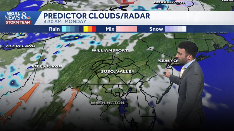
ALSO BE DELIVERED BY DRONE IN SELECT MARKETS, AND AMAZON LAUNCHED PRIME AIR IN EIGHT U.S. CITIES. METEOROLOGIST RYAN ARGENT JOINING US NOW. IT WAS A BEAUTIFUL DAY OUT THERE, BUT IS IT BEAUTIFUL ENOUGH FOR DRONE WEATHER? RYAN? YEAH, I DON’T KNOW HOW I FEEL ABOUT THAT. I’M NOT GOING TO LIE. I DON’T KNOW HOW I FEEL ABOUT THAT. JUST HAVING A DRONE PUT MY LITTLE CAESARS PIZZA. AND THEN LIKE, THE DRONES KNOW WHERE I’M LIVING AND STUFF LIKE THAT, I DON’T KNOW, THAT’S JUST THAT’S NOT FOR ME PERSONALLY. SORRY ABOUT THAT. BUT THE WEATHER IS GREAT. AJ’S QUESTION WAS, IS IT GREAT FOR DRONE FLYING WEATHER? WELL, AS YOU CAN SEE, BLUE SKIES IN THE BACKGROUND THERE. JUST A COUPLE PUFFY CLOUDS IN THE BACKGROUND THERE FOR THE LANCASTER SKYCAM. BUT TEMPERATURES RIGHT NOW SITTING INTO THE LOWER 60S WITH THE WESTERLY WIND, 13 MILE PER HOUR BREEZE. SO DEFINITELY A BIT OF A BREEZY DAY TODAY. I HEARD I HEARD THE WIND WHISTLING EARLIER THIS AFTERNOON, BUT IT WILL BE A BIT OF A CALMER EVENING. WE’LL SEE THOSE WINDS DIMINISHING. SKIES WILL CONTINUE TO CLEAR AS WE HEAD INTO TONIGHT. TEMPERATURES ARE GOING TO BE TRENDING WARMER. WE’LL SEE TEMPERATURES GETTING INTO THE 70S 80S AS WE GET INTO OUR TUESDAY. AND THEN AS WE HEAD INTO THE MIDDLE OF THE WEEK, SOME WET WEATHER DOES ARRIVE. WE’LL SEE SOME SCATTERED TO WIDESPREAD RAIN CHANCES RETURNING, WHICH IS STILL GOOD FOR THIS. FOR WHAT WE NEED. WE’RE STILL LOOKING AT A LITTLE BIT OF A DEFICIT ACROSS THE AREA, BUT YOU’LL SEE THOSE RAIN CHANCES HERE IN A SECOND. BUT TEMPERATURES RIGHT AROUND 62 DEGREES AVERAGE FOR THIS TIME OF THE YEAR, THOUGH 70 DEGREES. SO WE’RE ABOUT EIGHT DEGREES BELOW AVERAGE. BUT OVERNIGHT LOWS WE USUALLY EXPECT 49 FOR THIS TIME OF THE YEAR. 41 IS WHAT WE HIT EARLIER THIS MORNING, AND NO RAINFALL WAS RECORDED AT HARRISBURG INTERNATIONAL AIRPORT. SO FOR THE REST OF THIS EVENING, EXPECT PARTLY TO MOSTLY SUNNY CONDITIONS WITH THOSE DIMINISHING WINDS OUT OF THE WEST SOUTHWEST, 52 TO 56 DEGREES. AND THEN FOR TONIGHT, LIGHTER WINDS, WE’LL SEE 42 TO 46 DEGREES FOR TEMPERATURES. SO REMAINING COOLER IT WILL BE PARTLY CLOUDY OVERNIGHT. AND THEN AS WE HEAD INTO TOMORROW, THE BREEZE PICKS BACK UP. IT’S IT’S A GENTLE BREEZE. WE’LL SEE A FEW CLOUDS IN THE MIX, BUT WE’LL BE SEASONABLY WARM THOUGH. LOOK AT THIS. TEMPERATURES GETTING BACK INTO THE 70S, 70 TO 74 DEGREES FOR THE AFTERNOON. WE’LL ALSO SEE THE TREE AND GRASS POLLEN LEVELS REMAIN HIGH, MORE SO IN THE MODERATE LEVEL FOR GRASS. BUT TREE POLLEN LEVELS ARE GOING TO BE REMAINING HIGH FOR THE AFTERNOON. WE’LL HAVE LOW MOLD LEVELS. AIR QUALITY IS MODERATE. THAT’S THAT’S BECAUSE OF THE OZONE OR ELEVATED OZONE LEVELS. AND THEN UV INDEX IS MODERATE. WE HAVE ABOUT A 35 MINUTE BURN TIME. AND OUR PRECIPITATION CHANCES. YOU CAN SEE A SLIGHT PRECIPITATION CHANCE FOR YOUR TUESDAY AS WE HEAD INTO WEDNESDAY AND THURSDAY, THOUGH A LITTLE BIT BETTER. CHANCES ARE GOING TO BE COMING AROUND AS WE HAVE A SYSTEM THAT’S GOING TO PUSH THROUGH AND LINGER AS WE HEAD INTO THE MIDDLE OF THE WORKWEEK. TEMPERATURES ARE INTO THE 60S. WE’RE 59 IN LEWISTOWN, 62 IN CHAMBERSBURG, 66, THOUGH IN LEBANON AT THIS HOUR, STILL HAVE THAT PERSISTENT BREEZE OUT OF THE WEST. YOU CAN SEE, I’D SAY GENERALLY BETWEEN 10 AND 15MPH SO FAR THIS EVENING. NOW WE’RE SEEING CLEAR SKIES FOR THE MOST PART, TO SEEING SOME UPPER LEVEL CLOUDS JUST PASSING OVER THE AREA. BUT AS WE GO THROUGH THE REST OF THIS EVENING INTO TONIGHT, YOU CAN SEE HIGH PRESSURE SITUATED TO OUR SOUTH. THAT’S STILL GOING TO BE INFLUENCING OUR, OUR, OUR, OUR CONDITIONS HERE. BUT YOU CAN SEE THE ORANGE ARROW STARTING TO COME IN AS HIGH PRESSURE SHIFTS OFFSHORE. THE SOUTHERLY WINDS FROM THAT HIGH PRESSURE IS GOING TO USHER IN MILDER AIR FROM THE SOUTH. AND THAT’S GOING TO THAT’S WHAT’S GOING TO HELP US GET TO THE 70S FOR THE AFTERNOON, FOR YOUR MONDAY. AND HERE COMES TUESDAY, A BIT OF A ISOLATED SHOWER CHANCE AS WE HEAD INTO OUR TUESDAY, I WOULD SAY ISOLATED, MAYBE FEW IN NATURE AT THIS TIME, BUT WE’LL STILL BE SEEING WARMER CONDITIONS. BUT THEN THE BETTER RAIN CHANCES DON’T COME IN UNTIL THIS COLD FRONT STARTS TO MOVE THROUGH THE SUSQUEHANNA VALLEY. THAT’S WHAT’S GOING TO BE ALLOWING OUR OUR CHANCES FOR SHOWERS TO GO UP. BUT MAN, GETTING TO THAT 80 DEGREE MARK AS WE HEAD INTO OUR TUESDAY AFTERNOON, CERTAINLY GOING TO BE FEELING WARM THESE NEXT COUPLE OF DAYS. CHANCES FOR SHOWERS GO UP WEDNESDAY AND THURSDAY DOWN TO 62 DEGREES FOR YOUR FRIDAY, AND A CHANCE OF SOME SHOWERS FOR THE FIRST HALF OF MOTHER’S DAY WEEKEND. NOW, MOTHER’S DAY IS LOOKING MILD INTO THE MID 60S AND S
Breezy & still cool this evening; milder early week; rain returns midweek for south-central Pennsylvania
Highs are still about 10 degrees cooler than average. A warming trend begins tomorrow with highs reaching the 70s, and 80s on Tuesday.

Updated: 6:36 PM EDT May 3, 2026
Expect a mix of sun and clouds this evening. The winds start to decrease tonight out of the west-northwest to about 5 to 10 mph. Temperatures will fall through the lower 50s later this evening.Tonight, expect partly to mostly sunny conditions with lows dropping to the lower 40s. We’ll have a light wind out of the west-southwest between 5-10 mph.Warmer temperatures return with highs in the lower 70s on Monday with intervals of clouds and sunshine. It’s even warmer Tuesday with highs around 80 ° There may be some spotty afternoon showers otherwise, it’s dry with partly sunny skies. Rain threat increases and becomes more likely Wednesday and Thursday. Temperatures return to the 60s.Friday is mainly dry until evening when spotty showers are possible. Highs are in the low 60s.Looking ahead to Mother’s Day weekend, a few showers are possible on Saturday, but it’s not a washout, and temperatures are still cooler than average in the low 60s. It is dry for Mother’s Day with a sun and cloud mix and highs in the upper 60s to near 70 degrees.Have a great rest of your Sunday!~ Ryan
Expect a mix of sun and clouds this evening. The winds start to decrease tonight out of the west-northwest to about 5 to 10 mph. Temperatures will fall through the lower 50s later this evening.
Tonight, expect partly to mostly sunny conditions with lows dropping to the lower 40s. We’ll have a light wind out of the west-southwest between 5-10 mph.
Warmer temperatures return with highs in the lower 70s on Monday with intervals of clouds and sunshine. It’s even warmer Tuesday with highs around 80 ° There may be some spotty afternoon showers otherwise, it’s dry with partly sunny skies. Rain threat increases and becomes more likely Wednesday and Thursday. Temperatures return to the 60s.
Friday is mainly dry until evening when spotty showers are possible. Highs are in the low 60s.
Looking ahead to Mother’s Day weekend, a few showers are possible on Saturday, but it’s not a washout, and temperatures are still cooler than average in the low 60s. It is dry for Mother’s Day with a sun and cloud mix and highs in the upper 60s to near 70 degrees.
Have a great rest of your Sunday!
~ Ryan