
Warm, sunny, & dry for the evening; showers return Wednesday across south-central Pennsylvania
Highs will reach the 80s on Tuesday, then fall to the 60s for the rest of the week. Rain chances are back heading into Wednesday & Thursday this week.
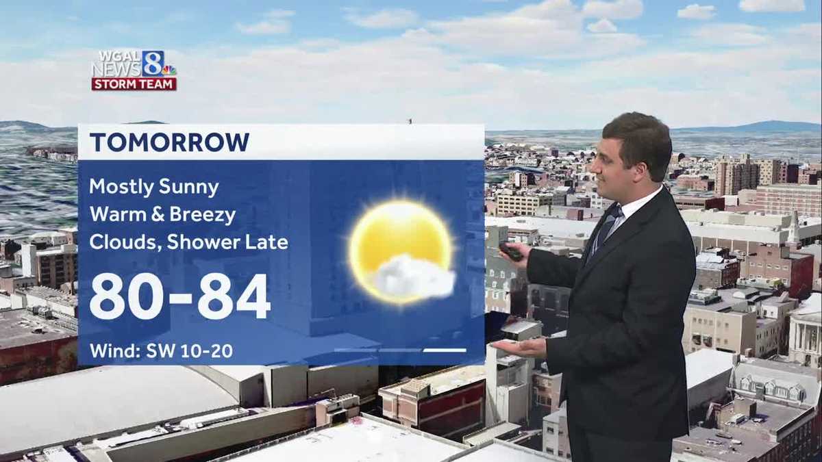
TOMORROW AT 6:00 BEFORE THE COUNCIL MEETING AT SEVEN. NOW, THE WGAL NEWS EIGHT STORM TEAM FORECAST WITH METEOROLOGIST MIKE SUSKO. GOOD MONDAY EVENING. OUR WARMING TREND CONTINUES ACROSS THE AREA FOR YOUR TUESDAY. WE GET OUR HIGHS BACK INTO THE 80S TOMORROW, AND THEN WIDESPREAD RAIN WILL ARRIVE AS WE HEAD INTO WEDNESDAY. THAT WILL BE THE BEST CHANCE FOR US TO GET SOME MUCH NEEDED RAIN INTO THE SUSQUEHANNA VALLEY AND THEN COOLER AS WE HEAD TOWARDS THURSDAY AND FRIDAY WITH HIGHS GOING BACK INTO THE 60S. SOME OF YOU MAY EVEN BE ONLY GETTING TO THE 50S BY THURSDAY, BUT YORK RIGHT NOW, IT’S A BEAUTIFUL EVENING OUT THERE. GOT BARELY A CLOUD IN THE SKY HERE IN YORK COUNTY. ACROSS THE AREA, TEMPERATURES STILL 73 IN YORK IN THE CITY. SAME THING IN LANCASTER. HARRISBURG. YOU’RE AT 73 AS WELL UP IN LEWISTOWN, SAME THING. 78, THE WARM SPOT IN LEBANON AND 77 IN CHAMBERSBURG. IT IS BREEZY ACROSS THE AREA. WE ARE SEEING THOSE GUSTS OUT OF THE SOUTH, ANYWHERE FROM 20 TO ABOUT 25MPH STILL. SO A LITTLE BIT OF BREEZE THERE FOR YOUR MONDAY EVENING. THAT CONTINUES, BUT THE WINDS DO RELAX AS WE HEAD TOWARDS THE OVERNIGHT HOURS. HERE WE GO FROM THE 60S AND LOW 70S DOWN TO THE MID 50S WITH A PARTLY CLOUDY SKY AND ISOLATED SHOWER AFTER SUNSET. TONIGHT FOR TOMORROW WE WILL BE SEEING HIGHS GET INTO THE LOW 80S, SO ABOVE AVERAGE. MOSTLY SUNNY FOR MAJORITY OF THE DAY BEFORE CLOUDS COME BACK AND SHOWERS RETURN LATE TOMORROW NIGHT AND INTO WEDNESDAY MORNING. YOU CAN SEE TOMORROW. ALSO GOING TO BE ANOTHER BREEZY DAY WITH THOSE WINDS OUT OF THE SOUTHWEST. GUSTS GOING TO BE ANYWHERE FROM AROUND 25, GETTING CLOSE TO 30MPH IN SOME CASES. SO FOR TRASH DAY TOMORROW, JUST BE AWARE OF THAT. YOU MAY FIND YOUR TRASH CAN DOWN THE ROAD A LITTLE BIT. STORM TEAM LIVE RADAR NETWORK. IT IS QUIET RIGHT NOW. WE DO HAVE A LITTLE BIT OF MOISTURE THOUGH, JUST TO THE SOUTH AND WEST PARTS OF WEST VIRGINIA, WESTERN VIRGINIA ITSELF, THEY’RE GOING TO MOVE INTO THE SUSQUEHANNA VALLEY AFTER SUNSET. SO IF YOU’RE OUT LATE TONIGHT, YOU MAY SEE A SPOTTY SHOWER OR TWO HERE. BUT THE WIDESPREAD RAIN THAT’S GOING TO BE FROM THAT COLD FRONT THERE OUT BY CHICAGO THAT WILL BE PUSHING IN AS WE HEAD INTO WEDNESDAY. SO TOMORROW WILL BE A PRETTY DECENT DAY. THEN WE HAVE THAT RAIN COMING ON IN. SO LET’S TIME THIS ALL OUT FOR YOU. WE HAVE THOSE SPOTTY SHOWERS OVERNIGHT TONIGHT AGAIN AFTER SUNSET. SO IF YOU HAVE DINNER IN TOWN TONIGHT, NO PROBLEM. AROUND MIDNIGHT WE’LL SEE THAT SPOTTY SHOWER CHANCE HERE. AND THEN AS WE HEAD INTO TOMORROW MORNING, MAJORITY OF THOSE SHOWERS STAY WELL TO THE NORTH HERE ALONG I-80 AND NORTH. THAT’S WHERE WE’LL BE TOMORROW. SO THE SUSQUEHANNA VALLEY GETS THE DRY WEATHER FOR YOUR TUESDAY. AS WE HEAD INTO TUESDAY NIGHT, CLOUDS RETURN TO THE SUSQUEHANNA VALLEY, AND THEN WE HAVE THAT RAIN APPROACHING FROM THE WEST. YOU CAN SEE THAT WIDESPREAD RAIN ARRIVING DURING THE MORNING COMMUTE ON WEDNESDAY. SO SIX, SEVEN, 8:00 IN THE MORNING. WE WILL HAVE SOME SHOWERS AROUND. IT COULD BE MODERATE AT TIMES. SO SOMETHING TO KEEP IN MIND FOR WEDNESDAY MORNING. BUT NOTICE HOW IT’S BROKEN UP AS WE HEAD TOWARDS THE LUNCHTIME HOUR THERE ON WEDNESDAY. WE START GETTING ON AND OFF PERIODS OF RAIN, SO THERE WILL BE SOME BREAKS AS WE HEAD LATER IN THE DAY ON WEDNESDAY. ONE OF THE REASONS WHY OUR RAINFALL TOTALS ARE GOING TO STAY FAIRLY LOW. BUT AS WE HEAD INTO THE AFTERNOON AND EVENING, THAT’S WHEN THE COLD FRONT COMES ON THROUGH. AND THEN WE SEE THINGS WIND DOWN FROM THERE. AS I MENTIONED, NOT REALLY A BIG RAIN PRODUCER HERE. WE’RE LOOKING AT A QUARTER TO HALF AN INCH OF RAIN, SO NOT A LOT ACROSS THE AREA. SOME PLACES MAY GET A LITTLE BIT MORE, BUT GENERALLY WE’RE LOOKING AT THAT A QUARTER OF AN INCH TO HALF AN INCH RANGE FOR THE SUSQUEHANNA VALLEY HERE FOR WEDNESDAY’S RAIN, WHICH IS GOOD BECAUSE THE GROUND CAN ACTUALLY SOAK IT UP AND IT’S NOT GOING TO RUN OFF. SO WE GET THE BENEFICIAL PART OF THE RAIN THAT WE NEED HERE TO HELP WITH THE DROUGHT CONDITIONS. UNFORTUNATELY, THOUGH, IF YOU WANT TO HEAD OUT TO THE GOLF COURSE, OBVIOUSLY WEDNESDAY IS NOT GOING TO BE THE BEST DAY. LOOKS LIKE TOMORROW WILL BE. JUST KEEP IN MIND THAT WIND IS GOING TO BE OUT OF THE SOUTHWEST. SO A LITTLE TIP THERE FOR YOU GOLFERS. YOU WANT TO MAKE SURE YOU’RE SHOOTING THE BALL THERE INTO THE WIND. AS WE HEAD TOWARDS THE WEEKEND, FRIDAY AND SATURDAY GOING TO BE BELOW AVERAGE IN THE 60S. A CHANCE FOR SHOWERS ON SATURDAY, BUT SUNDAY FOR MOTHER’S DAY ITSELF LOOKING PLEASANT WITH A HIGH OF 70 DEGREES. SO A NICE DAY FOR MOM THERE AS WE HEAD TOWARDS THE END OF THE WEEKEND AND YOUR TEN DAY FORECAST SHOWING THAT TEMPERATURES REALLY DON’T GET ABOVE AVERAGE EXCEPT FOR TOMORROW, WE STAY IN THE 60S HERE FOR THE FIRST PART OF MAY, WITH THOSE SHOWER CHANCES ON YOUR WEDNESDAY. A FEW ISOLATED SHOWERS ON THURSDAY, AND THEN AGAIN FOR SATURDAY. BUT AGAIN, I KNOW A LOT OF YOU AR
Warm, sunny, & dry for the evening; showers return Wednesday across south-central Pennsylvania
Highs will reach the 80s on Tuesday, then fall to the 60s for the rest of the week. Rain chances are back heading into Wednesday & Thursday this week.

Updated: 6:42 PM EDT May 4, 2026
Good evening,High pressure moving offshore will continue to provide mostly sunny skies this evening, with lighter southwesterly winds. Temperatures will lower through the upper 60s this evening.Tonight, lows will fall to the mid-to-upper 50s under partly cloudy skies. A stray shower is possible.Get ready for the warmest day of the week on Tuesday! Highs will soar to the low 80s under mostly sunny skies. Look for increasing clouds toward evening and isolated showers late.Periods of rain return on Wednesday as a cold front slowly moves across Pennsylvania. Highs will reach the mid-60s, and rain totals will range between 0.25″ to 0.50″ in most areas.Scattered showers continue on Thursday, as cool air moves overhead. Highs will be cooler, near 60 degrees.Drier weather is in store for Friday, but temperatures will remain cool, around 62.The chance of showers returns Saturday, then Mother’s Day looks dry and milder. Expect highs in the low 60s on Saturday and 70 degrees on Sunday.Next week, highs remain slightly below average, in the mid-to-upper 60s. A few showers are possible on Tuesday and Wednesday.Have a great night!
Good evening,
High pressure moving offshore will continue to provide mostly sunny skies this evening, with lighter southwesterly winds. Temperatures will lower through the upper 60s this evening.
Tonight, lows will fall to the mid-to-upper 50s under partly cloudy skies. A stray shower is possible.
Get ready for the warmest day of the week on Tuesday! Highs will soar to the low 80s under mostly sunny skies. Look for increasing clouds toward evening and isolated showers late.
Periods of rain return on Wednesday as a cold front slowly moves across Pennsylvania. Highs will reach the mid-60s, and rain totals will range between 0.25″ to 0.50″ in most areas.
Scattered showers continue on Thursday, as cool air moves overhead. Highs will be cooler, near 60 degrees.
Drier weather is in store for Friday, but temperatures will remain cool, around 62.
The chance of showers returns Saturday, then Mother’s Day looks dry and milder. Expect highs in the low 60s on Saturday and 70 degrees on Sunday.
Next week, highs remain slightly below average, in the mid-to-upper 60s. A few showers are possible on Tuesday and Wednesday.
Have a great night!