
MIGHT BE OKAY AS FAR AS THE RAIN, RIGHT? YEAH. IT DOES LOOK LIKE THE EARLIER, THE BETTER THE LATER WE GET IN THE SUN, THE MORE LIKELY YOU’RE GOING TO RUN INTO A RAIN SHOWER. SO IF YOU’RE TRYING TO FIGURE OUT WHEN TO GO WITH MOM AGAIN, THE EARLIER, MAYBE THE BETTER PLAN FOR YOU. ISOLATED SHOWERS WILL BE POSSIBLE TOMORROW. WATCHING SATURDAY MORNING. THAT’S REALLY THE WASHOUT OF THIS STRETCH. AND THAT PROMPTS AN IMPACT DAY FOR SATURDAY. AND AGAIN, THOSE SCATTERED SHOWERS WILL BE WITH US AS WE HEAD INTO MOTHER’S DAY. TONIGHT. WE HAVE ANOTHER FROST ADVISORY, THE SAME THREE COUNTIES FROM LAST NIGHT FOR US. VENANGO AND CLARION ARE UNDER FROST ADVISORY ALONG WITH ALL OF INDIANA COUNTY AND THEN THE LAUREL HIGHLANDS THROUGH WESTMORELAND, FAYETTE, MONONGALIA, PRESTON AND GARRETT COUNTIES. THIS GOES UNTIL 8:00 TOMORROW MORNING. SO IF YOU HAVE ANY SENSE OF PLANTS OUTSIDE, YOU WANT TO PROTECT THOSE OR BRING THOSE IN SO THEY CAN SURVIVE THE NIGHT, WE MAY HAVE ONE MORE FROST CONCERN FOR US AS WE HEAD INTO NEXT WEEK. WE’RE STARTING AT 42, EXCEPT FOR THOSE OUTSIDE OF ALLEGHENY COUNTY AND ESPECIALLY IN THE FROST ADVISORY, THE MIDDLE 30S ARE LIKELY WILL CLIMB TO 63 TOMORROW, 68 ON SATURDAY. THE RAIN IN THE MORNING, SHOWERS IN THE SECOND PART OF YOUR SUNDAY AT 69. THAT DROPS US BACK TO 60 ON MONDAY, 62 ON TUESDAY. THERE MAY BE ANOTHER FROST CONCERN TUESDAY MORNING, AS WE’LL START AT 38 AND THEN TEMPERATURES START WARMING FOR THE REST OF THE WEEK 63 ON WEDNESDAY WITH RAIN SHOWERS 65 THURSDAY 70. BY THE TIME WE GET TO NEXT FRIDAY, THAT’S THE ONLY 70 DEGREE DAY WE HAVE. THAT’S WHAT WE’RE SUPPOSED TO BE FOR THIS TIME OF YEAR. SO SHOWERS HAVE BEEN VERY DIFFICULT IN GETTING DEVELOPED SO FAR TODAY. SO LIKELY NOT WORRIED ABOUT A RAIN SHOWER THIS EVENING AS WE HEAD INTO TOMORROW MORNING. MAYBE AN EARLY PASSING SHOWER. OTHERWISE PARTLY TO MOSTLY CLOUDY, THEN AN ISOLATED SHOWER. CHANCE ROLLS IN LATE IN THE DAY. THEY WILL BE VERY FEW AND FAR BETWEEN, BUT A SHOWER COULD DEVELOP. IT’S AS WE GET TO IN PAST SUNSET ON FRIDAY INTO SATURDAY. THAT’S WHEN WIDESPREAD RAIN DEVELOPS ACROSS WESTERN PENNSYLVANIA. THAT’S WHAT PROMPTS THE IMPACT DAY. THOSE WIDESPREAD SHOWERS WILL LAST UNTIL WE GET TO ABOUT LUNCHTIME, AND THEN RAIN EXITS AND SKIES CLEAR AS WE HEAD INTO THE BACK PART OF YOUR SATURDAY BEFORE WE WATCH A COLD FRONT ARRIVING AS WE HEAD INTO YOUR SUNDAY THAT PROMPTS THE RAIN SHOWERS AS WE HEAD INTO YOUR SUNDAY AFTERNOON. SO BY THE TIME WE’RE DONE, WE COULD SEE A QUICK HALF AN INCH, PERHAPS UP TO AN INCH OF RAIN ACROSS WESTERN PENNSYLVANIA FROM THAT RAIN JUST ON SATURDAY, MOSTLY IN THE MORNING. SO IF YOU’RE MAKING PLANS WITH MOM EARLY, YOU’RE FINE. 54 A
Pittsburgh: Impact Day Saturday for morning rain
Shower chances will last through Mother’s Day.

Updated: 4:26 PM EDT May 7, 2026
Isolated showers can’t be ruled out to finish out the week, but the bulk of the weekend rain will come late Friday night and into Saturday morning, prompting an Impact Day.Frost Advisory tonight Temperatures tonight should once again drop to around 40 degrees with locations outside of Pittsburgh and Allegheny County, especially to the north and east, could wake up in the middle 30s allowing for frost to form. A Frost Advisory has been issued for Clarion, Venango, Forest, Indiana, eastern Westmoreland, eastern Fayette, eastern Monongalia, Preston, and Garrett counties until 8 a.m. Friday.Mother’s Day weekend: Impact Day SaturdayShowers are possible for a portion of the weekend. Pockets of heavier rain are expected early Saturday morning, making Saturday an Impact Day. Rain looks to push out by lunchtime on Saturday, and we will remain dry until a cold front approaches Sunday afternoon. Showers look more sporadic Sunday evening and linger into early Monday morning. Timing questions remain Sunday with the cold front, as rain could get here as soon as just after lunchtime or as late as after dinner. The cool start to May continues next week. Highs again return to the 60s with rain possible Wednesday. We look to try and start a warming trend heading into next weekend.TONIGHT: Mostly clear to partly cloudy. Low: 42°.FRIDAY: Patchy morning frost, mostly cloudy with isolated showers. High: 63°, low: 48°.SATURDAY – Impact Day: Morning rain then mostly cloudy. High: 68°, low: 52°.SUNDAY: Mostly cloudy with scattered showers. High: 69°, low: 43°.
PITTSBURGH —
Isolated showers can’t be ruled out to finish out the week, but the bulk of the weekend rain will come late Friday night and into Saturday morning, prompting an Impact Day.
Frost Advisory tonight
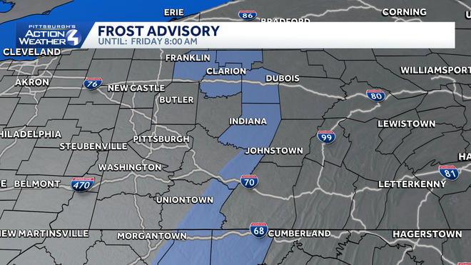
Temperatures tonight should once again drop to around 40 degrees with locations outside of Pittsburgh and Allegheny County, especially to the north and east, could wake up in the middle 30s allowing for frost to form. A Frost Advisory has been issued for Clarion, Venango, Forest, Indiana, eastern Westmoreland, eastern Fayette, eastern Monongalia, Preston, and Garrett counties until 8 a.m. Friday.
Hearst Owned
Frost Advisory Friday morning for the I-80 corridor and Laurel Highlands.
Mother’s Day weekend: Impact Day Saturday
Hearst Owned
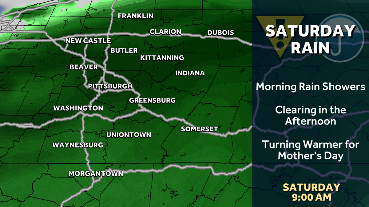
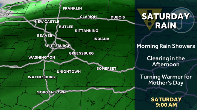
Impact Day Saturday for rain showers in the morning. Rain will come to an end around lunchtime.
Showers are possible for a portion of the weekend. Pockets of heavier rain are expected early Saturday morning, making Saturday an Impact Day. Rain looks to push out by lunchtime on Saturday, and we will remain dry until a cold front approaches Sunday afternoon. Showers look more sporadic Sunday evening and linger into early Monday morning. Timing questions remain Sunday with the cold front, as rain could get here as soon as just after lunchtime or as late as after dinner.
The cool start to May continues next week. Highs again return to the 60s with rain possible Wednesday. We look to try and start a warming trend heading into next weekend.
Hearst Owned
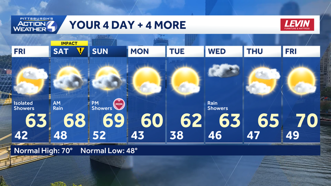
Shower chances each day through Sunday with below average temperatures continuing into next week.
TONIGHT: Mostly clear to partly cloudy. Low: 42°.
FRIDAY: Patchy morning frost, mostly cloudy with isolated showers. High: 63°, low: 48°.
SATURDAY – Impact Day: Morning rain then mostly cloudy. High: 68°, low: 52°.
SUNDAY: Mostly cloudy with scattered showers. High: 69°, low: 43°.