
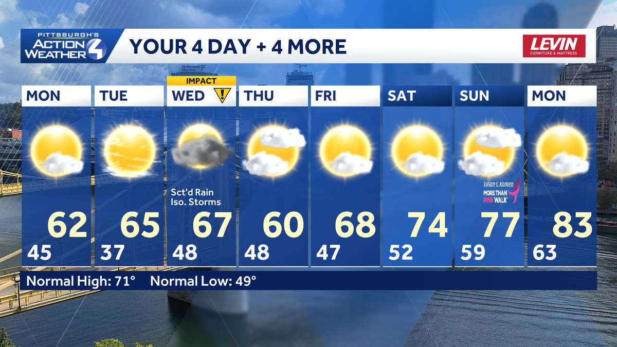
The cool for May trend continues this week. Our days will be dry and unseasonably cool, followed by frosty nights. Rain returns late Tuesday night with isolated storms possible Wednesday afternoon. Wednesday is now an Impact Day.Cool and dry days, frosty nightsHigh pressure is in charge to begin the week. That means a good deal of sunshine today and Tuesday. Temperatures are still on the cool side with highs near 60 degrees.A Frost Advisory is in effect until 8 a.m for areas to the north of Pittsburgh. These same counties are under a Freeze Watch for tonight. Clear, calm and quiet conditions will make areas of frost likely, a freeze possible overnight. Expect another round of frost and freeze alerts.Impact Day: Rain returns Wednesday with isolated stormsWe are watching our next system for Wednesday. Rain arrives late Tuesday night and carries over into the Wednesday morning commute. The wettest part of the day will be Wednesday morning. A lull through mid-day will help to produce isolated storms during the afternoon as a cold front approaches. Thunderstorms will be capable of producing damaging winds.A few leftover showers will linger into Thursday.Finally warming upFriday is our transition day away from the cool pattern and toward a more typical mid-May feeling. Highs will finally surge back into the 70s next weekend.TODAY: Sun and clouds, still cool. High: 62°.TONIGHT: Frosty temperatures with a possible freeze north. Clear and calm. Low: 37°.TUESDAY: Sunshine gives way to clouds. High: 65°, low: 48°.WEDNESDAY – Impact Day: Rain, especially during the morning. Isolated afternoon storms. High: 67°, low: 48°.THURSDAY: Leftover shower with some sun. High: 60°, low: 47°.
PITTSBURGH —
The cool for May trend continues this week. Our days will be dry and unseasonably cool, followed by frosty nights. Rain returns late Tuesday night with isolated storms possible Wednesday afternoon. Wednesday is now an Impact Day.
Cool and dry days, frosty nights
High pressure is in charge to begin the week. That means a good deal of sunshine today and Tuesday. Temperatures are still on the cool side with highs near 60 degrees.
Hearst OwnedHearst
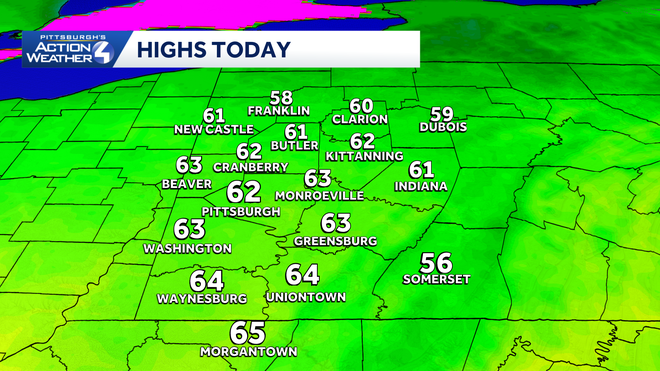
Still cool this afternoon with highs in the lower 60s under sun and clouds.
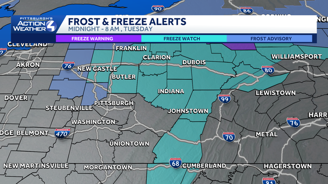
A Frost Advisory is in effect until 8 a.m for areas to the north of Pittsburgh. These same counties are under a Freeze Watch for tonight. Clear, calm and quiet conditions will make areas of frost likely, a freeze possible overnight. Expect another round of frost and freeze alerts.
Hearst OwnedHearst
Even colder tonight. A Freeze Watch is already in place for areas north of Pittsburgh.
Impact Day: Rain returns Wednesday with isolated storms
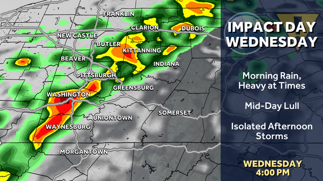
We are watching our next system for Wednesday. Rain arrives late Tuesday night and carries over into the Wednesday morning commute. The wettest part of the day will be Wednesday morning. A lull through mid-day will help to produce isolated storms during the afternoon as a cold front approaches. Thunderstorms will be capable of producing damaging winds.
Hearst OwnedHearst
Wednesday’s Impact Day comes in two parts: a morning wave of steady rain, followed by isolated afternoon storms.
A few leftover showers will linger into Thursday.
Finally warming up
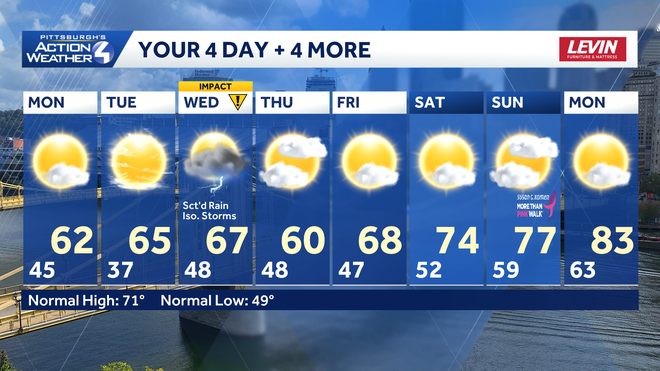
Friday is our transition day away from the cool pattern and toward a more typical mid-May feeling. Highs will finally surge back into the 70s next weekend.
Hearst OwnedHearst
Temperatures finally start warming up on Friday. And the warm air is here to stay.
TODAY: Sun and clouds, still cool. High: 62°.
TONIGHT: Frosty temperatures with a possible freeze north. Clear and calm. Low: 37°.
TUESDAY: Sunshine gives way to clouds. High: 65°, low: 48°.
WEDNESDAY – Impact Day: Rain, especially during the morning. Isolated afternoon storms. High: 67°, low: 48°.
THURSDAY: Leftover shower with some sun. High: 60°, low: 47°.