
Warm weekend, then summerlike early next week across south-central Pennsylvania
Warm weekend, then summerlike early next week in south-central Pennsylvania. We’re watching for more shower & storm chances next week.
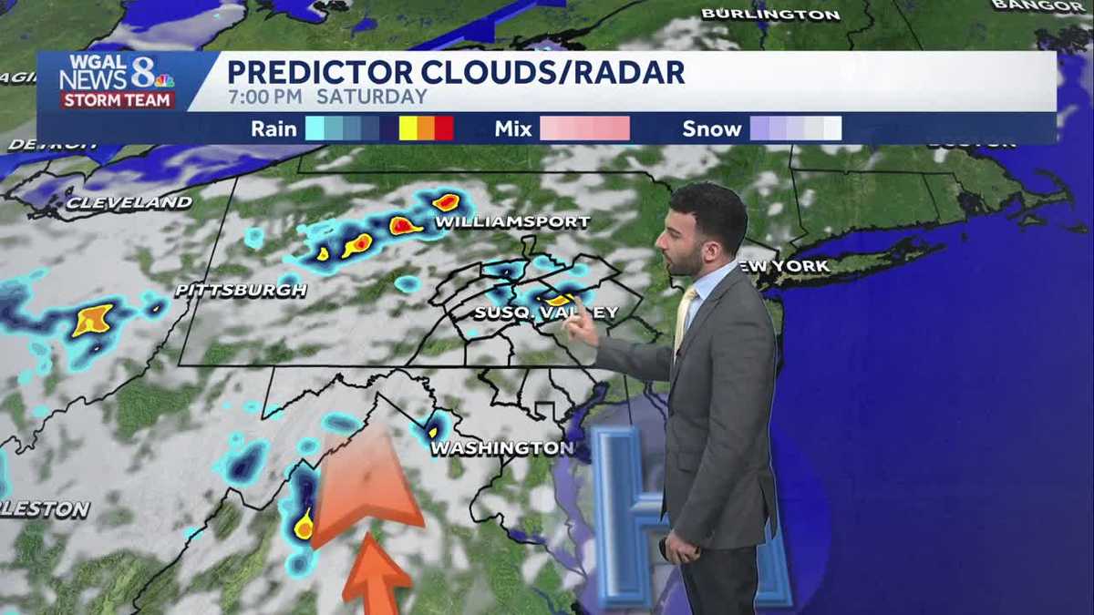
AT HOLY TRINITY LUTHERAN CHURCH. NOW, THE WGAL NEWS EIGHT STORM TEAM FORECAST WITH METEOROLOGIST RYAN ARGENTINA. WELL, MILD AND BREEZY FOR TODAY. IT’S GOING TO BE ONE OF THE HEADLINES. WE’LL SEE. HIGHS GET TO THE UPPER 60S FOR THE AFTERNOON, BUT WE’LL BE WARMING AS WE HEAD INTO BOTH HALVES OF THE WEEKEND. COMING UP, WE’LL HAVE HIGHS INTO THE 80S AND THEN SPECIFICALLY LOWER 80S IS WHERE WE’LL BE GOING FOR SATURDAY AND SUNDAY. THEN IT’S GOING TO BE GETTING HOT AS WE GET INTO MONDAY AND TUESDAY OF NEXT WEEK, WE’LL HAVE OUR FIRST 90 DEGREE DAYS OF THE YEAR FOR THE BEGINNING OF THE WORKWEEK FOR NEXT WEEK. SO IN TERMS OF THE REST OF THIS AFTERNOON, EXPECT A MIX OF SOME CLOUDS AND SUNSHINE, BREEZY AND MILD. WE’LL SEE THOSE TEMPERATURES REACH THE UPPER 60S. AND AS WE HEAD INTO THIS EVENING, YOU SEE PARTLY SUNNY SKIES, DIMINISHING WINDS. WE’LL HAVE RIGHT AROUND 64 DEGREES FOR THIS EVENING, THEN MAINLY CLEAR OVERNIGHT TONIGHT. TEMPERATURES DROPPING DOWN TO THE LOWER 50S. AND WE’LL BE REMAINING CALM. ALSO, WE WERE TALKING ABOUT THE PA GREEK FEST EARLIER. RIGHT. FRIDAY AND SATURDAY 11 A.M. TO 8 P.M. PARTLY SUNNY, 60 DEGREES 67. BY THE TIME WE GET TO RIGHT AROUND 4:00 IN THE AFTERNOON, AGAIN TOPPING OUT IN THE UPPER 60S FOR THE AFTERNOON AND STILL REMAINING MILD. BUT WE’LL BEGIN TO COOL TO THE LOWER 60S, CLOSER TO 8:00 THIS EVENING. NOW POLLEN LEVELS ARE GOING TO BE HIGH FOR TODAY. MOLD LEVELS ARE LOW, AIR QUALITY IS GOOD. GOT A MODERATE UV INDEX, ABOUT A 40 MINUTE BURN TIME FOR THIS AFTERNOON. TEMPERATURES ARE INTO THE LOWER 60S FOR THE MAJORITY OF THE AREA. SEE THE TEMPERATURE RANGES BETWEEN 60 AND 64. AS YOU CAN SEE ACROSS THE SUSQUEHANNA VALLEY AND WINDS COMING IN OUT OF THE NORTH NORTHWEST. I’D SAY GENERALLY BETWEEN 5 AND 10MPH, BUT STILL A LITTLE BIT OF A NOTICEABLE BREEZE OUT THERE. BUT STORM TEAM LIVE RADAR NETWORK, A LITTLE LESS CLOUD COVER. RIGHT NOW WE HAVE THIS DEPARTING LOW PRESSURE SYSTEM THAT’S THAT’S MOVING TOWARDS THE NORTHEAST. THAT’S GOING TO CONTINUE TO MOVE NORTHEAST AS WE HEAD THROUGH THE REST OF THE DAY TODAY INTO TONIGHT. NOW, WE DO HAVE AN AREA OF HIGH PRESSURE TO OUR SOUTH THAT’S IN CLOSE PROXIMITY OR JUST CLOSE ENOUGH TO THE SUSQUEHANNA VALLEY TO ALLOW FOR SOME CLEARING. AND WE’LL SEE SOME MAINLY CLEAR CONDITIONS DEVELOP OVERNIGHT TONIGHT. HEADING INTO TOMORROW MORNING, WE’LL SEE ABUNDANT SUNSHINE TO START AND THEN A BRIEF INCREASE IN SOME CLOUD COVER, ALONG WITH THE CHANCE OF AN ISOLATED SHOWER AS WE GET INTO LATER IN THE EVENING FOR SATURDAY. BUT THIS, THIS CENTER OF HIGH PRESSURE IS WHAT’S GOING TO BE USHERING IN THAT MILDER AIR FROM THE SOUTH. AND THAT’S WHAT’S GOING TO BE ALLOWING US TO WARM TO THE 80S FOR FOR BOTH SATURDAY AND SUNDAY. BUT STILL LOOKING AT THAT ISOLATED SHOWER CHANCE HEADING INTO THE SECOND HALF OF THE WEEKEND, TOO. NOW, HIGH TEMPERATURES, GETTING TO THE 90S FOR YOUR MONDAY AND TUESDAY, CERTAINLY UNSEASONABLY WARM FOR THIS TIME OF YEAR. THE RECORDS, BY THE WAY, MONDAY AND TUESDAY IT’S 94 DEGREES. IS THE RECORD SET BACK IN 1962. AND THEN FOR TUESDAY BACK IN 1962 IS 95. SO WE’RE GOING TO KEEP AN EYE ON THESE THESE HIGH TEMPERATURES. SOMETHING ELSE WE’RE GOING TO KEEP AN EYE ON. WE DID SET NEXT WEDNESDAY AS AN IMPACT DAY FOR THE THREAT FOR SOME POSSIBLE STORMS, SOMETHING WE’RE GOING TO KEEP AN EYE ON
Warm weekend, then summerlike early next week across south-central Pennsylvania
Warm weekend, then summerlike early next week in south-central Pennsylvania. We’re watching for more shower & storm chances next week.

Updated: 12:21 PM EDT May 15, 2026
Look for a mix of clouds and sun today, as low pressure spins over the Northeast. Highs will reach 68 degrees, almost a 10 degree warm up from yesterday. Breezy conditions will continue, diminishing late this evening.Tonight, lows will fall to 50 degrees under mostly clear skies.Look for morning sunshine Saturday, with highs near 80 degrees. Clouds will increase toward evening, and a stray shower is possible late.Sunday will feature partly sunny skies and isolated showers and thunderstorms. Highs will reach 84 degrees, 10 degrees above average.Summerlike warmth is in store early next week, as highs soar to 90 Monday and 92 Tuesday, but records are not in jeopardy. It will even be a bit sticky Tuesday, as dew points climb to the low 60s. A shower is possible late Tuesday.Higher rain chances come with a cold front Wednesday afternoon and evening. Temperatures will remain above average, near 86 degrees. Showers wrap up early Thursday, and highs will be much cooler, near 70.Temperatures will fall back to seasonal averages, in the low 70s, at the end of the week. A slim chance of showers is in the forecast Friday, but the upcoming weekend looks dry and pleasant.
Look for a mix of clouds and sun today, as low pressure spins over the Northeast. Highs will reach 68 degrees, almost a 10 degree warm up from yesterday. Breezy conditions will continue, diminishing late this evening.
Tonight, lows will fall to 50 degrees under mostly clear skies.
Look for morning sunshine Saturday, with highs near 80 degrees. Clouds will increase toward evening, and a stray shower is possible late.
Sunday will feature partly sunny skies and isolated showers and thunderstorms. Highs will reach 84 degrees, 10 degrees above average.
Summerlike warmth is in store early next week, as highs soar to 90 Monday and 92 Tuesday, but records are not in jeopardy. It will even be a bit sticky Tuesday, as dew points climb to the low 60s. A shower is possible late Tuesday.
Higher rain chances come with a cold front Wednesday afternoon and evening. Temperatures will remain above average, near 86 degrees. Showers wrap up early Thursday, and highs will be much cooler, near 70.
Temperatures will fall back to seasonal averages, in the low 70s, at the end of the week. A slim chance of showers is in the forecast Friday, but the upcoming weekend looks dry and pleasant.