
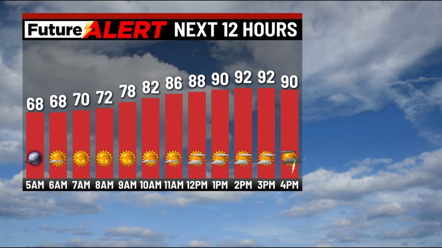
(WBRE/WYOU) — Near-record high temperatures will be expected today across northeast and central Pennsylvania!
The records for Avoca are 92 (1962) and 89 (1962); for Mount Pocono, 89 (1962); and for Williamsport, 96 (1996).
With a mix of clouds and sun, temperatures will climb to the lower 90s this afternoon, and it will be a bit humid. The only caveat to reaching these temperatures would be if a shower or storm passes through, especially in the afternoon.
Any storm may produce a downpour and gusty winds. Tonight will be partly cloudy with a stray shower or storm. Lows in the upper 60s.
Wednesday will start off sunny with increasing clouds as a cold front moves through. A few showers and storms will develop along the front with highs in the mid 80s (and muggy).
High pressure builds in from the north on Thursday with a mix of clouds and sun. With rain showers just to the south, a shower can’t be ruled out for our southern counties, highs in the upper 60s.
Friday will be partly sunny with late-day/overnight showers, highs in the mid 60s. The start of Memorial Day weekend looks soggy and cool. Saturday will be mainly cloudy with showers, with highs in the lower 60s. Sunday will be mostly cloudy with scattered showers, with highs near 70. Memorial Day Monday will have more clouds than sun with a shower possible, with highs in the lower 70s.
You can stay current on all the latest weather alerts and track the storm using the Future Alert Interactive Radar.
Copyright 2026 Nexstar Media, Inc. All rights reserved. This material may not be published, broadcast, rewritten, or redistributed.
For the latest news, weather, sports, and streaming video, head to 28/22 News.