
A soggy pattern sets up for Memorial Day weekend. Friday and Saturday Impact Days.Impact Days Friday and SaturdayThe front that brought our rain Wednesday into Thursday returns Friday afternoon to bring rain showers to Western PA. Rain looks to return starting around lunchtime from south to north through the day. The heaviest rain will fall Friday night into Saturday morning when heavy downpours are most likely. Isolated thunder cannot be ruled out, but severe weather is not expected.The widespread rain will begin to taper off after lunch on Saturday. Scattered showers will linger through the day with some dry times. By the time we get to Sunday, rainfall totals of one to two inches are possible with locally higher amounts. Highs will struggle both days ot make it into the lower and middle 60s. Warmer and drier next weekWe see more isolated showers Sunday before more rain is possible on Memorial Day. Right now, it looks like Memorial Day may be the driest day of the weekend. We will watch our rivers early next week, based on our weekend rainfall, for possible river rises.High temperatures will register closer to 80 degrees between the rain chances Sunday and Memorial Day. Conditions will remain mild and dry after the holiday. Highs should return to the lower 80s heading into the final weekend of May.TONIGHT: Mostly cloudy. Low 53°.FRIDAY – Impact Day: Mostly cloudy with afternoon rain. High: 66°, low: 51°.SATURDAY – Impact Day: Widespread rain, heavy at times, through the morning then scattered showers. High: 62°, low: 55°.SUNDAY: Mostly cloudy with scattered showers. High: 78°, low: 61°.
PITTSBURGH —
A soggy pattern sets up for Memorial Day weekend. Friday and Saturday Impact Days.
Impact Days Friday and Saturday
The front that brought our rain Wednesday into Thursday returns Friday afternoon to bring rain showers to Western PA. Rain looks to return starting around lunchtime from south to north through the day. The heaviest rain will fall Friday night into Saturday morning when heavy downpours are most likely. Isolated thunder cannot be ruled out, but severe weather is not expected.
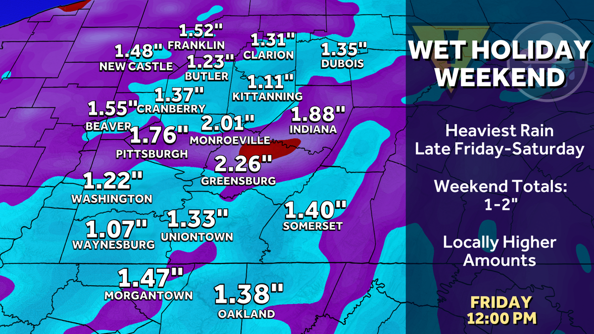
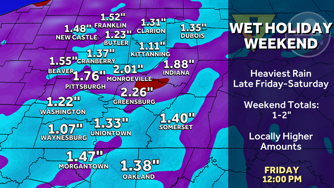
The widespread rain will begin to taper off after lunch on Saturday. Scattered showers will linger through the day with some dry times. By the time we get to Sunday, rainfall totals of one to two inches are possible with locally higher amounts. Highs will struggle both days ot make it into the lower and middle 60s.
Hearst Owned
Rainfall totals of one to two inches are possible just from the rain Friday and Saturday.
Warmer and drier next week
We see more isolated showers Sunday before more rain is possible on Memorial Day. Right now, it looks like Memorial Day may be the driest day of the weekend. We will watch our rivers early next week, based on our weekend rainfall, for possible river rises.
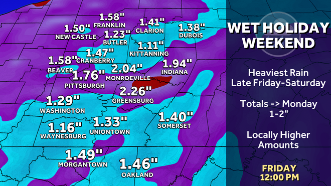
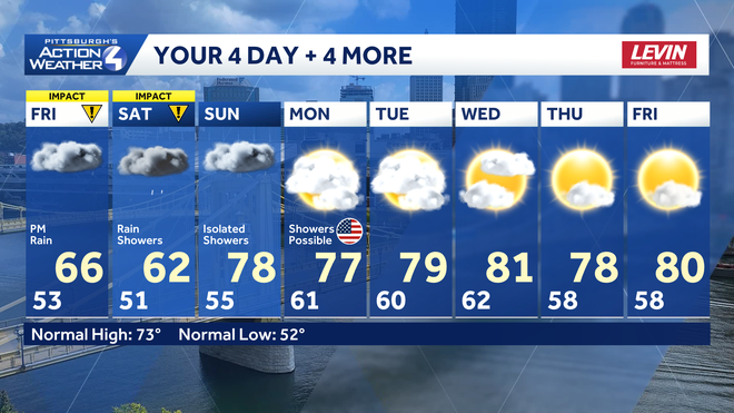
High temperatures will register closer to 80 degrees between the rain chances Sunday and Memorial Day. Conditions will remain mild and dry after the holiday. Highs should return to the lower 80s heading into the final weekend of May.
Hearst Owned
A very wet weekend with dry and mild conditions next week.
TONIGHT: Mostly cloudy. Low 53°.
FRIDAY – Impact Day: Mostly cloudy with afternoon rain. High: 66°, low: 51°.
SATURDAY – Impact Day: Widespread rain, heavy at times, through the morning then scattered showers. High: 62°, low: 55°.
SUNDAY: Mostly cloudy with scattered showers. High: 78°, low: 61°.