
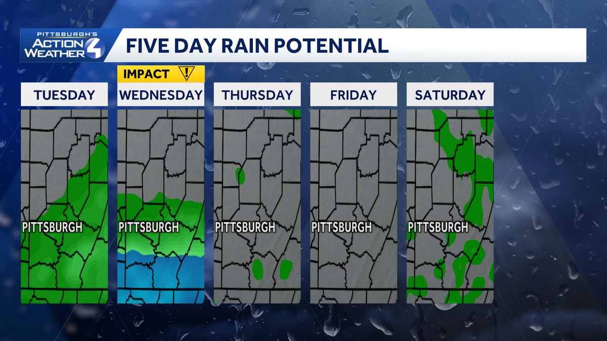
Today will be the warmest day of the week. This afternoon will feature intervals of sunshine and clouds, along with isolated showers for southwestern Pennsylvania. Wednesday is an Impact Day for better coverage of rain during the first half of the day.Warmer with isolated showers this afternoonThe summer trend continues today with highs peaking in the lower 80s. Humidity levels remain elevated too. We can expect a few more breaks for sunshine.The rain chance will all come down to location. Isolated showers could pop up south of Pittsburgh this afternoon. More rain arrives after sunset, leading to our Impact Day tomorrow.Impact Day Wednesday: Morning showersGiven proximity to the front, areas to the south of Allegheny County will be the wettest. The timing is holding; the best time to see rain will be Wednesday morning through mid-day, prompting the Impact Day. Heavier rain near I-70 to the West Virginia border could lead to isolated flash flooding. We will dry out in the afternoon.Sunny and comfortable heading into JuneWe will dry out and cool slightly after Wednesday’s showers. High temperatures will trend downward into the lower 70s by late week. High pressure becomes our dominant weather feature, so expect sunshine and relatively dry conditions into the start of June.TODAY: Intervals of sun and clouds with isolated afternoon showers south. Warm, high: 82°.TONIGHT: Showers arrive from the south. Mostly cloudy, low: 63°.WEDNESDAY – Impact Day: Showers, especially south of Pittsburgh, through mid-day. Mostly cloudy and mild afternoon. High: 78°, low: 58°.THURSDAY: Pleasant with sunshine and clouds. High: 73°, low: 50°.FRIDAY: Mostly sunny and comfortable. High: 72°, low: 52°.
PITTSBURGH —
Today will be the warmest day of the week. This afternoon will feature intervals of sunshine and clouds, along with isolated showers for southwestern Pennsylvania. Wednesday is an Impact Day for better coverage of rain during the first half of the day.
Warmer with isolated showers this afternoon
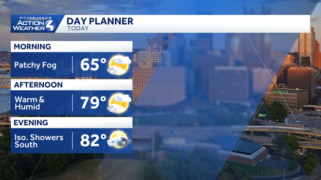
The summer trend continues today with highs peaking in the lower 80s. Humidity levels remain elevated too. We can expect a few more breaks for sunshine.
Hearst OwnedHearst
Feeling like summer this afternoon. Isolated showers will develop for areas south and east of Pittsburgh.
The rain chance will all come down to location. Isolated showers could pop up south of Pittsburgh this afternoon. More rain arrives after sunset, leading to our Impact Day tomorrow.
Hearst OwnedHearst
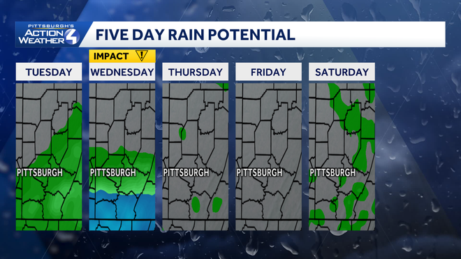
Shower chances over the next two days will be primarily confined to Pittsburgh and areas to the south.
Impact Day Wednesday: Morning showers
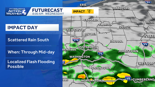
Given proximity to the front, areas to the south of Allegheny County will be the wettest. The timing is holding; the best time to see rain will be Wednesday morning through mid-day, prompting the Impact Day. Heavier rain near I-70 to the West Virginia border could lead to isolated flash flooding. We will dry out in the afternoon.
Hearst OwnedHearst
Locally heavy rain to the south of I-70 could lead to localized flash flooding Wednesday.
Sunny and comfortable heading into June
We will dry out and cool slightly after Wednesday’s showers. High temperatures will trend downward into the lower 70s by late week. High pressure becomes our dominant weather feature, so expect sunshine and relatively dry conditions into the start of June.
TODAY: Intervals of sun and clouds with isolated afternoon showers south. Warm, high: 82°.
TONIGHT: Showers arrive from the south. Mostly cloudy, low: 63°.
WEDNESDAY – Impact Day: Showers, especially south of Pittsburgh, through mid-day. Mostly cloudy and mild afternoon. High: 78°, low: 58°.
THURSDAY: Pleasant with sunshine and clouds. High: 73°, low: 50°.
FRIDAY: Mostly sunny and comfortable. High: 72°, low: 52°.