

Good local histories are often a sometime thing. If done correctly they can offer an accurate and interesting view of a region, state or town that enlightens, informs and entertains its readers. Or they can break down into a collection of labored names, dates and genealogical minutia that either bore or confuse the reader. Fortunately, the Lower Macungie Township Historical Society’s recent volume fits into the first category.

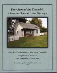
Tour Around the Township
Book III
Lower Macungie Township Historical Society
Titled “Tour Around the Township,” the third and final part in the series was published in 2025 and focuses on the northern part of the township along Hamilton Boulevard from Wescosville to Trexlertown. It was researched and written by members of the society who have long studied the region and lived in it.
The editor and designer of the history is Ann Bartholomew, a longtime resident and active historian in Lower Macungie, along with her late husband Craig Bartholomew. Contributing authors include Joshua Fink, Douglas Peters and Gary Heller. There is an extensive list of contributors in the acknowledgments section.

Ann Bartholomew discusses the book series inside the Lower Macungie Township Historical Society museum
WFMZ
This volume focuses on what began its existence as a King’s Highway. The great imperial powers of Europe, Spain, France and England mandated a King’s High Road for their New World domains. As in Europe it was a route on which royal proclamations would be carried out and communication to colonial officials and thence to other subjects in the New World would be made.
So, it was not unusual that King Charles II of Great Britain, aka “the Merry Monarch,” on turning over Penn’s Woods to young William Penn would require “that Great Roads from City-to-City not to contain less than forty feet in breadth shall first be laid out and declared to be for highways.” Penn was said to be horrified when the king told him he was naming it Pennsylvania; he feared people would think he was an egomaniac. “Don’t flatter yourself,” the king said. “We are naming it after your father.”
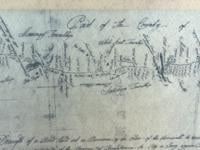
Map showing portion of former King’s Highway
It was not until 1753, when the English were on the verge of the French and Indian War that 30 residents, represented by Indian agent Conrad Weiser, presented a petition to the governor requesting that a new road from Easton, the county seat of Northampton County, to Reading be created. This was clearly also at the instigation of Thomas Penn, son of William Penn, who wanted to open the region up for development to the large number of settlers from the German states that were arriving.
By October 1755, as the whole frontier was horrified at Braddock’s defeat that previous summer, a German immigrant, David Shultze, completed a survey in just eight days for the inter-county, 50-mile King’s Road, which followed the Lenape’s Maxatawny Path. It was an extension that began in Somerville, New Jersey and ran to Phillipsburg, New Jersey and crossed the Delaware on a primitive ferry to Easton. This opened the road to Bethlehem.
History points out that this opened a road that is known by a variety of names: William Penn Highway, Easton Avenue, Hanover Avenue and the Lehigh River. If a traveler was lucky, they could find a ferry that could be summoned by blowing a large horn that was hung from a nearby tree.
If not, they would have to ride their horse or ford the body of water on foot. John Adams followed this route in part on his way down to the Continental Congress meetings in 1775-76. James Allen would later note in his diary that during the Revolution Adams stopped at the Dorneyville Inn on his way to New England, which in modern times became the King George Inn.
The Lower Macungie history offers plethora of dwellings and businesses that have come and gone along the route over the years.
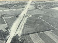
Aerial view of the Northeast Extension of the PA Turnpike under construction in 1955, as it cuts through Lower Macungie
But Hamilton Boulevard is only one of the routes down memory lane that is included in the book. There is Cedarbrook Road, East Texas Road and the ever-popular Elbow Lane. Krooks Road and Fish Hatchery Road were not overlooked, and neither was Schantz Road.
For the local historian, the long-time resident or the newcomer to the Lehigh Valley there will surely be something that will have the reader saying to themselves, I didn’t know that!
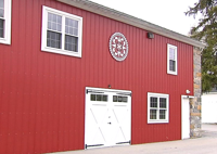
Exterior of Lower Macungie Township Historical Society
WFMZ
Books are available on the Lower Macungie Township Historical Society website. Or email info@lmthistory.org.