
Storms continue to move across South-Central Pennsylvania
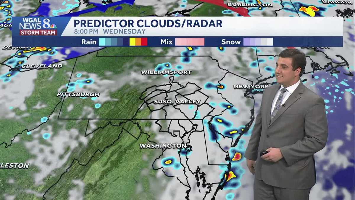
Thunderstorms will continue to pop up across the Susquehanna Valley; here are the impacts you need to know about.
FORMAL ARRAIGNMENT IS SET FOR LATE JULY. THE IMPACT DAY FORECAST. THE WGAL NEWS EIGHT STORM TEAM. GOOD AFTERNOON EVERYONE. WE’LL CONTINUE TO WATCH THESE SHOWERS AND THUNDERSTORMS PUSHING THROUGH THE SUSQUEHANNA VALLEY. RIGHT NOW, THOUGH, WE HAVE TWO AREAS THAT WE’RE WATCHING. ONE IN LANCASTER COUNTY AND SOUTHEASTERN YORK COUNTY, AND THEN ANOTHER ONE IN NORTHERN YORK COUNTY JUST PASSED THROUGH PARTS OF HARRISBURG, INCLUDING IN CARLISLE. SO LET’S ZOOM IN ON THIS. WE HAVE LEBANON RIGHT NOW JUST OUTSIDE OF LEBANON, TO THE EAST AND SOUTH. WE ARE GETTING A LITTLE BIT OF HEAVY RAIN THERE FROM MYERSTOWN DOWN TO SHEPHERDSTOWN, WEST TOWARDS CORNWALL. YOU CAN SEE GETTING A LITTLE BIT OF THAT HEAVY RAIN AT THE MOMENT THERE. LEBANON IS STARTING TO DRY OUT FOR YOU. SAME THING IN JONESTOWN. HERE’S THAT ROUND NUMBER TWO THAT JUST PASSED THROUGH PARTS OF YORK COUNTY NEAR YORK HAVEN. YOU’RE ABOUT TO GET SOME HEAVY RAIN, STILL THERE. AND ALSO IN MANCHESTER WHERE RYAN IS, HE’S ABOUT TO GET SOME HEAVY RAIN. AND WELLSVILLE IS IN THE THICK OF IT AT THE MOMENT. BUT WE ARE SEEING THINGS CLEAR OUT IN PARTS OF CARLISLE, MOUNT HOLLY SPRINGS, ALSO STARTING TO SEE THINGS WIND DOWN. HERE’S A LOOK AT THE STORM THAT RYAN WAS TALKING ABOUT. WE ARE SEEING A BIT OF A HOOK HERE ON OUR EXCLUSIVE LIVE LOCAL RADAR, A LITTLE BIT IN THE REFLECTIVITY OR THE TYPICAL RAIN PRODUCT THAT YOU NORMALLY ARE SEEING NEAR ANDERSON TOWN. BUT WHEN WE LOOK AT ROTATION, THERE IS A LITTLE BIT OF BROAD ROTATION THERE IN THE STORM, BUT IT’S NOT ENOUGH WHERE IT WOULD SIGNAL TO US AT LEAST THAT THERE’S ANYTHING TORNADIC. SO THAT’S THE GOOD NEWS. WE’LL KEEP AN EYE ON IT, BUT IT DOES LOOK LIKE THERE IS SOME BROAD ROTATION WITH THAT STORM THAT RYAN WAS JUST ON. WE ARE HERE IN LANCASTER COUNTY NOW, LANCASTER GETTING A LITTLE BIT OF A BREAK, BUT YOU HAVE THAT ROUND TO THE WEST THAT’S GOING TO EVENTUALLY PUSH THROUGH PARADISE. NEW HOLLAND OUT TOWARDS EPHRATA, GETTING SOME HEAVY RAIN. ALSO TOWARDS HONEYBROOK. YOU’RE GOING TO SEE SOME OF THAT HEAVY RAIN AND DOWN TOWARDS STRASBURG AND QUARRYVILLE GETTING SOME OF THAT LIGHT, SOME MORE MODERATE RAIN AT TIMES. SO THIS IS PUSHING THROUGH ONCE IT’S DONE WE SHOULD BE QUIET FOR THE REST OF THIS EVENING. OVERNIGHT. TONIGHT, MAYBE A SPOTTY SHOWER IS POSSIBLE IN SPOTS. THE RUMBLE OF THUNDER WITH A STRAY THUNDERSTORM OVERNIGHT TONIGHT. AROUND 2 OR 3 IN THE MORNING. BUT THEN TOMORROW IT’S GOING TO BE HOT. HUMID WITH ANOTHER ROUND OF SCATTERED SHOWERS AND THUNDERSTORMS IN THE AFTERNOON. SO HERE’S A LOOK AT THE COMPLEX THAT’S COMING THROUGH RIGHT NOW. ONCE WE GET THROUGH THAT, LIKE I SAID, THE REST OF THE EVENING SHOULD BE DRY. AND BY SIX, 7:00 THIS IS GOING TO BE DONE AS WE GO INTO THE NIGHT TONIGHT. AGAIN, SPOTTY SHOWER, THUNDERSTORM POSSIBLE FOR SOME OF US. BUT IT’S NOT EVERYONE WHO’S GOING TO HAVE AN OVERNIGHT STORM TOMORROW AROUND TWO, 3:00. ONCE AGAIN, WE’RE GOING TO HAVE SOME SHOWERS AND STORMS FIRE UP TO THE WEST AND THEY WILL PUSH INTO THE SUSQUEHANNA VALLEY. THESE STORMS WILL HAVE MORE FUEL TO WORK WITH AND MORE POTENTIAL TO PRODUCE GUSTY WINDS THAN TODAY. SO WE’LL KEEP AN EYE ON THAT FOR YOU. AND IT’S NOT DONE YET. FRIDAY IS ACTUALLY THE HIGHEST CHANCE OF SEEING SOME STRONG STORMS. IT’S GOING TO BE HOT, HUMID ONCE AGAIN ON FRIDAY. THAT ADDS MORE ENERGY FOR STORMS TO TAP INTO AND PRODUCE THOSE GUSTY WINDS. AS A COLD FRONT COMES THROUGH DURING YOUR FRIDAY EVENING. SO FRIDAY ACTUALLY HAS THE BEST CHANCE TO SEE THE DAMAGING WINDS AS THE SYSTEM PUSHES ON THROUGH. AND THEN ONCE THAT HAPPENS, EVERYTHING IS FINALLY GOING TO WIND DOWN. SO LET’S START THINGS OFF HERE WITH TOMORROW, 1:00 TO 9:00. AND THROUGHOUT THE DAY, SCATTERED SHOWERS AND THUNDERSTORMS ARE POSSIBLE, STRONG TO SEVERE. TODAY WAS A LEVEL ONE OUT OF FIVE THREAT. TOMORROW IS LEVEL TWO. SO WE HAVE A HIGHER THREAT TOMORROW FOR THOSE DAMAGING WINDS, LARGE HAIL, HEAVY RAIN AND FREQUENT LIGHTNING ON FRIDAY. SAME THING. THE ENTIRE AREA UNDER LEVEL TWO OUT OF FIVE RISK HERE FOR THOSE AFTERNOON SHOWERS AND THUNDERSTORMS, PRODUCING GUSTY WINDS AND EVEN SOME LARGE HAIL AND BRIEF DOWNPOURS. AND IN ADDITION TO THE STORM THREAT, TOMORROW AND FRIDAY, IT’S HOT AND HUMID. WE’RE GOING TO FEEL LIKE WE’RE IN THE MID TO UPPER 90S BOTH THURSDAY AND FRIDAY. THE GOOD NEWS, THOUGH, IS IT FEELS A LITTLE BIT BETTER AS WE HEAD INTO SATURDAY AND SUNDAY. STILL GOING TO GET A LITTLE STICKY AND A LITTLE HUMID OUT THERE. IT IS AFTER ALL, JUNE. BUT COMPARED TO TOMORROW AND FRIDAY, IT’S GOING TO BE A LOT DIFFERENT AS WE HEAD INTO THE WEEKEND. THURSDAY HIGH OF FORECAST 90 DEGREES. IT’S GOING TO BE A RECORD 96. SO WE’RE PROBABLY NOT GOING TO HIT THAT ONE. BUT FRIDAY COULD BE CLOSE 92, WHICH WOULD TIE THE RECORD FROM 2017. AND AS WE LOOK AT YOUR TEN DAY FORECAST, LIKE I SAID, THE WEEKEND NOT AS HUMID, STILL WARM THOUGH. HIGHS IN THE UPPER 80S WITH ANOTHER CHANCE FOR SOME THUNDERSTORMS. GUYS LATE SUNDAY EVENING. BUT THE REST OF THE MOST OF YOUR WEEKEND IS DRY AND THEN COOLER WITH ANOTHER ROUND OF SHOWERS AND STORMS AS WE HEAD INTO THE MIDD
Storms continue to move across South-Central Pennsylvania
Thunderstorms will continue to pop up across the Susquehanna Valley; here are the impacts you need to know about.

Updated: 4:39 PM EDT Jun 10, 2026
Showers and thunderstorms continue to sweep in from the west and into the Susquehanna Valley, preluding the arrival of a warm front. More thunderstorms are expected through the rest of this week, with Friday looking to host the most widespread chances.Due to the impacts associated with the storms, including strong wind gusts, hail, heavy rain, and frequent lightning, as well as the increasing heat and humidity, the WGAL News 8 Storm Team has designated Wednesday, Thursday, and Friday as Impact Days. Temperatures rise into the low 90s on Thursday and Friday, and, with rising humidity, will help the heat index feel like the mid-to-upper 90s. We get a brief break from the storms come this weekend – a nice change from the past few weeks – as we get partly sunny skies, temperatures around the 88-degree mark, and less humidity. Saturday will be the best day of the weekend, as some storms could make their way back into the Valley come Sunday night. Showers then look to continue come Monday, though we get a break from the heat as we return to more seasonable conditions all the way through Friday, with temperatures remaining in the low 80s. Skies also look to clear up slightly next week as we get partly sunny skies across the board with the chance of thundershowers Tuesday through Thursday.
Showers and thunderstorms continue to sweep in from the west and into the Susquehanna Valley, preluding the arrival of a warm front. More thunderstorms are expected through the rest of this week, with Friday looking to host the most widespread chances.
Due to the impacts associated with the storms, including strong wind gusts, hail, heavy rain, and frequent lightning, as well as the increasing heat and humidity, the WGAL News 8 Storm Team has designated Wednesday, Thursday, and Friday as Impact Days.
Temperatures rise into the low 90s on Thursday and Friday, and, with rising humidity, will help the heat index feel like the mid-to-upper 90s.
We get a brief break from the storms come this weekend – a nice change from the past few weeks – as we get partly sunny skies, temperatures around the 88-degree mark, and less humidity. Saturday will be the best day of the weekend, as some storms could make their way back into the Valley come Sunday night.
Showers then look to continue come Monday, though we get a break from the heat as we return to more seasonable conditions all the way through Friday, with temperatures remaining in the low 80s.
Skies also look to clear up slightly next week as we get partly sunny skies across the board with the chance of thundershowers Tuesday through Thursday.