
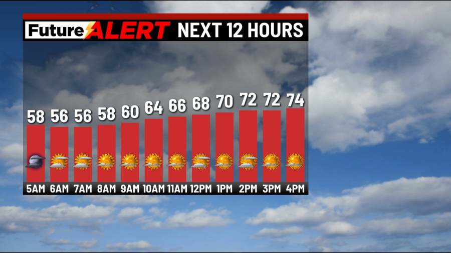
(WBRE/WYOU) — Today will be noticeably cooler and less humid across northeast and central Pennsylvania.
We’ll have a mix of clouds and sunshine with highs in the mid 70s. Tonight will be mostly clear and chilly. Lows fall to 50.
Tuesday will be another pleasant day with a mix of clouds and sun. Highs in the mid 70s. More clouds move in Wednesday with a few showers, perhaps a rumble of thunder. Highs in the upper 70s. A strong area of low pressure moves in Thursday, bringing the risk for showers and thunderstorms. Some of which may be on the stronger side.
It will be breezy and more humid with highs in the mid 80s. We will be watching this storm threat over the coming days. Friday will be mostly cloudy with a few showers. Highs in the upper 70s. So far, the weekend looks quiet and dry with a mix of clouds and sun each day. Highs in the upper 70s.
You can stay current on all the latest weather alerts and track the storm using the Future Alert Interactive Radar.
Copyright 2026 Nexstar Media, Inc. All rights reserved. This material may not be published, broadcast, rewritten, or redistributed.
For the latest news, weather, sports, and streaming video, head to 28/22 News.