
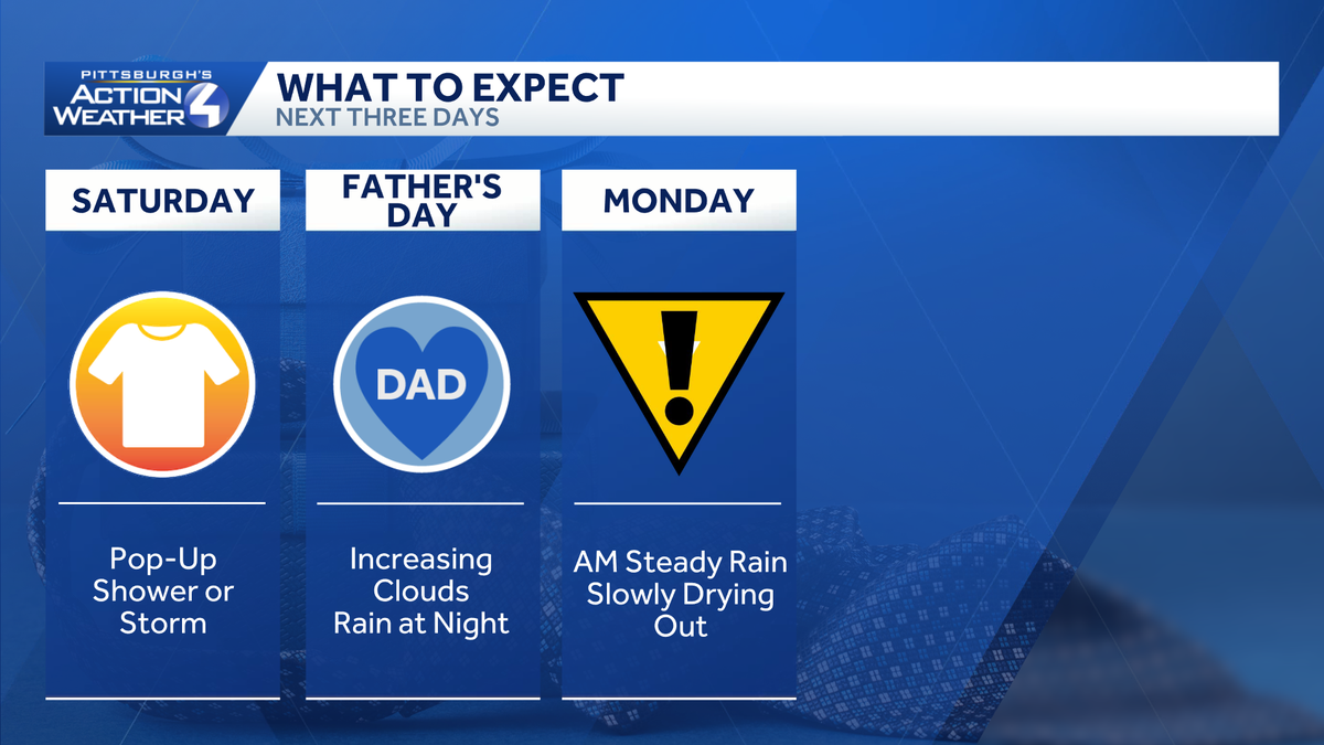
This weekend will be mainly dry and quiet. Rain chances pick up late Sunday night, leading to an Impact Day for Monday8 with soaking rain and storm chances.Quiet and mostly dry weekendShowers will be the exception, not the rule this weekend. A weak disturbance could spark a pop-up shower or storm this afternoon, especially near US-422. Any activity that pops up will be brief and very isolated in nature. Cells will fizzle after 8 p.m.Father’s Day will be dry too despite increasing clouds. Temperatures will run a little closer to 80 degrees.Impact Day Monday: Soaking rain, storms possibleThe area-wide rain threat holds off until late Sunday night. Monday is an Impact Day for periods of steady rain and possible storms. The heaviest rain will be falling during the morning commute with showers gradually decreasing once we get past lunch. A few thunderstorms may also be possible as the rain moves through the area.We are expecting about an inch of rain across western PA. Locally higher amounts from pockets of heavy rain and any embedded thunderstorms could show up south of Pittsburgh. Localized flooding may be an issue by late Monday.Seasonal start to summerTomorrow is also the Summer Solstice. Summer officially begins at 4:24 a.m. After Monday’s rain, we remain seasonal through next week with highs in the upper 70s to 80 degrees.TODAY: Partly cloudy, a tad breezy and seasonal. Pop-up shower or storm. High: 78°.TONIGHT: Drying out, mainly clear and pleasant. Low: 59°.SUNDAY: A bit warmer with increasing clouds. Rain arrives overnight. High: 80°, low: 63°.MONDAY – Impact Day: Steady morning rain, lingering afternoon showers with embedded storms. High: 74°, low: 57°.TUESDAY: Partly cloudy and pleasant. High: 77°, low: 56°.
PITTSBURGH —
This weekend will be mainly dry and quiet. Rain chances pick up late Sunday night, leading to an Impact Day for Monday8 with soaking rain and storm chances.
Quiet and mostly dry weekend
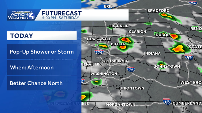
Showers will be the exception, not the rule this weekend. A weak disturbance could spark a pop-up shower or storm this afternoon, especially near US-422. Any activity that pops up will be brief and very isolated in nature. Cells will fizzle after 8 p.m.
Hearst OwnedHearst
Quick passing showers will pop up this afternoon around western PA.
Father’s Day will be dry too despite increasing clouds. Temperatures will run a little closer to 80 degrees.
Impact Day Monday: Soaking rain, storms possible
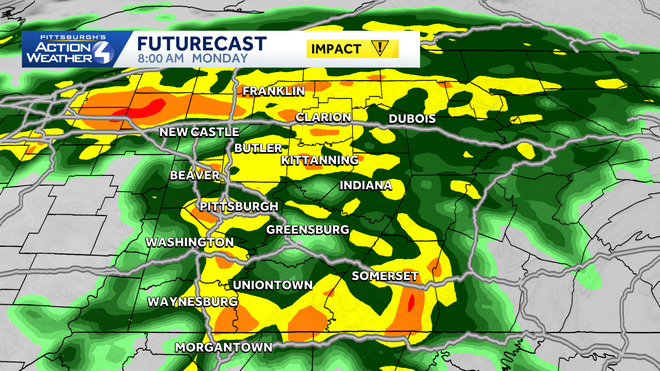
The area-wide rain threat holds off until late Sunday night. Monday is an Impact Day for periods of steady rain and possible storms. The heaviest rain will be falling during the morning commute with showers gradually decreasing once we get past lunch. A few thunderstorms may also be possible as the rain moves through the area.
Hearst OwnedHearst
Impact Day: Steady rain could be heavy at times for the Monday morning commute.
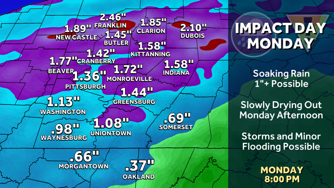
We are expecting about an inch of rain across western PA. Locally higher amounts from pockets of heavy rain and any embedded thunderstorms could show up south of Pittsburgh. Localized flooding may be an issue by late Monday.
Hearst OwnedHearst
Over an inch of rain could fall in 24 hours around western PA.
Seasonal start to summer
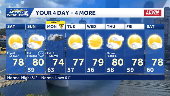
Tomorrow is also the Summer Solstice. Summer officially begins at 4:24 a.m. After Monday’s rain, we remain seasonal through next week with highs in the upper 70s to 80 degrees.
Hearst OwnedHearst
Monday is our best chance for rain over the next week.
TODAY: Partly cloudy, a tad breezy and seasonal. Pop-up shower or storm. High: 78°.
TONIGHT: Drying out, mainly clear and pleasant. Low: 59°.
SUNDAY: A bit warmer with increasing clouds. Rain arrives overnight. High: 80°, low: 63°.
MONDAY – Impact Day: Steady morning rain, lingering afternoon showers with embedded storms. High: 74°, low: 57°.
TUESDAY: Partly cloudy and pleasant. High: 77°, low: 56°.