
Comfortable, mild and dry over the next few days, shower chances return midweek for south-central Pennsylvania
Slightly above average temperatures and dry conditions persist until shower chances return Wednesday Night and again next weekend.
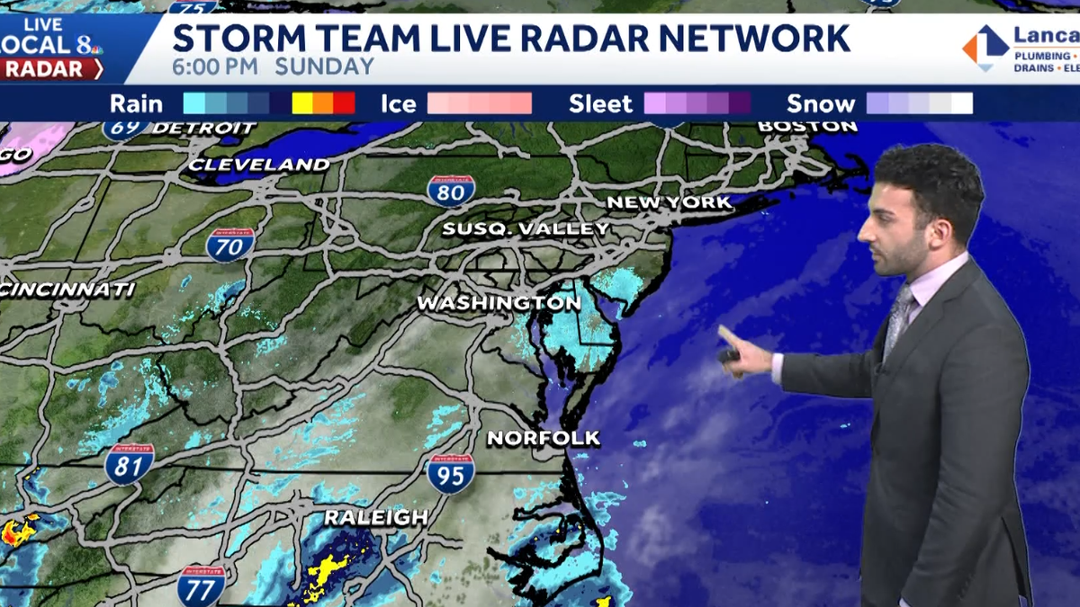
Good evening everyone. I’m meteorologist Ryan Argenti. We didn’t have *** 6 o’clock evening newscast due to the NASCAR championship being on NBC, but we wanted to at least put the weather forecast out for you on on the website. So here’s your forecast for the next couple of days dry and pleasant conditions, although the minimal rain chances will be coming around the corner from midweek, but like I mentioned, there, minimal. So it’s *** very slim chance that we’re gonna be seeing any, uh, real, like real good. Hours, but the better of those rain chances come around as we get into next weekend. Storm team live radar network, all is quiet in terms of precipitation, just starting to see an uptake in some of the cloud cover coming in from the south. That’s because we have *** little bit of *** disturbance that’s towards our south at this time. It’s moving north, northeast that we’ll soon be seeing as we get into late tonight and getting into tomorrow morning with in the form of some potential. stra showers. I’ll show you that here in the end the predictor coming up. But for the rest of this evening, expect increasing clouds. Seasonably cool for this time of the year, 48 to 52 degrees with calm winds. And as we get into the overnight period, expect *** seasonal chill in the air. It’ll be calm with light winds out of the west, but we’ll see some periods of cloud cover. I’d say partly to mainly clear overnight. You’ll just see some clouds rolling around here and there. And then for tomorrow, especially as we get into the morning hours, may see *** stray shower chance east, especially for southeastern communities towards uh Lancaster and York counties, although the majority of the area will be remaining dry with clouds and some sunshine and milder conditions, 62 to 66 degrees with *** 5 to 15 mile per hour southwesterly breeze. Now sunsets, they’re getting later and later, folks, or excuse me, not later earlier in. Earlier is what I should say. Sunset for your Tuesday is going to be 5 o’clock, *** 5 o’clock sunset as we get to the beginning of the, of the, uh, the work week. The next 5 o’clock sunset we’ll have, it will be January, uh, or the, uh, the next, the next sunset we should say will be January 10th of, uh, of next year. Monday, milder 64 degrees, so good conditions for your relief clean up forecast. Tuesday I rate it as fair because it’ll be *** little bit breezy now. It will be dry, 60 degrees, but just that breeze may be *** little bit of *** nuisance, so you want to keep that in mind as you, uh, as you do your leaf cleanup for or as you do your leaf leaf cleanup. Wednesday, pleasant 64 degrees looking good for the afternoon. Almanac for the day today, we hit *** high of 64 today, *** little bit above average for this time of the year. We expect 59 degrees for *** seasonable high temperatures. 37, that was the low from earlier this morning. So that’s just around par. For this time of the year, with average lows being right around 40 degrees. Temperatures into the 50s right now for most areas, 47 in ceilings Grove, 46 in New York right now. You can see just some clouds moving in from the south, but across the Commonwealth, not seeing any precipitation thanks to high pressure that’s settled in overhead the Susquehanna Valley. Now I mentioned that brief disturbance that’s coming in from the south. You can see that stray shower chance. It’s just side swiping the. Esquehanna Valley, so it may give us that stray shower chance for southeastern communities towards York and Lancaster counties. But once we get into the rest of the day, high pressure builds back in that helps to clear our skies. We have *** very dry cold front that’s going to quickly move through the Susquehanna Valley as we get into overnight Monday into Tuesday morning. You can see that there’s not *** lot of precipitation involved, but you might see an increase in some cloud cover as we get into the day on Tuesday. Then high pressure builds. Back in for the Susquehanna Valley, giving us partly to mainly clear conditions once again. So 8 to 14 day temperature outlook in terms of what we’re expecting for the next uh from November 9th through the 15th, really looking at uh equal chances neither above nor below average temperatures. And in terms of the temperature outlook, we’re slightly below average. That equal chances, uh, contour that you can see here outlined in the graphics. So really just looking at slightly. Below precipitation chances these next 8 to 14 days. But you can see for us locally though as we get into Saturday and Sunday, this is going to be the better time for that chance of showers. May get *** little bit of *** stray shower chance for Thursday, but majority of the work week is looking dry as we get into, as we get into the next several days. Next Monday, another chance of some showers, and as we get to Veterans Day, Tuesday and Wednesday looking partly sunny.
Comfortable, mild and dry over the next few days, shower chances return midweek for south-central Pennsylvania
Slightly above average temperatures and dry conditions persist until shower chances return Wednesday Night and again next weekend.

Updated: 6:42 PM EST Nov 2, 2025
High pressure settled in overhead the Susquehanna Valley has helped to clear our skies, relax winds, & allowed temperatures to drop to the lower 50s this evening. We’ll continue to see mainly clear skies before high cloud cover moves in as we approach nighttime.As low-pressure lifts northeast along the coast, we will see an uptick in cloud cover for tonight into early Monday. There may be a stray shower in far southeastern areas, otherwise clouds decrease allowing for more sunshine during the afternoon. A dry boundary helps to push the low away from the coast. With southwest winds picking up 5 to 15 mph, temperatures will be milder in the low to mid 60s.Mostly sunny skies are expected on Tuesday with seasonable highs around 60 degrees. Wednesday sees an increase in clouds ahead of the next frontal system. There may be a few showers overnight into early Thursday as the front passes through the Susquehanna Valley. Highs are mild in the low to mid 60s then fall to the 50s Thursday.With a series of fronts, there are better chances of rain arriving late Friday into Saturday, and again on Sunday. A deep trough brings much chillier air in the upper 40s to low 50s by the following Monday.Have a great rest of your evening!~ Ryan
High pressure settled in overhead the Susquehanna Valley has helped to clear our skies, relax winds, & allowed temperatures to drop to the lower 50s this evening. We’ll continue to see mainly clear skies before high cloud cover moves in as we approach nighttime.
As low-pressure lifts northeast along the coast, we will see an uptick in cloud cover for tonight into early Monday. There may be a stray shower in far southeastern areas, otherwise clouds decrease allowing for more sunshine during the afternoon. A dry boundary helps to push the low away from the coast. With southwest winds picking up 5 to 15 mph, temperatures will be milder in the low to mid 60s.
Mostly sunny skies are expected on Tuesday with seasonable highs around 60 degrees. Wednesday sees an increase in clouds ahead of the next frontal system. There may be a few showers overnight into early Thursday as the front passes through the Susquehanna Valley. Highs are mild in the low to mid 60s then fall to the 50s Thursday.
With a series of fronts, there are better chances of rain arriving late Friday into Saturday, and again on Sunday. A deep trough brings much chillier air in the upper 40s to low 50s by the following Monday.
Have a great rest of your evening!
~ Ryan