
There are a whole slew of Impact Days in your 4 Day + 4 More Forecast. Today’s Impact Day is for a brief window of downpours and garden variety thunderstorms. An intense heat wave begins on Tuesday with high heat and humidity extending through the 4th of July weekend.Impact Day: Dense fog to afternoon downpoursIt is a foggy start to the day, especially where showers were more persistent Saturday. Visibility could be less than a mile in spots. The fog will linger through 9 a.m.Sunny breaks plus the “stale” boundary will fuel another round of showers and storms. Today is now an Impact Day for that reason. While the coverage will be widely scattered, cells will pack a punch with downpours and garden variety thunderstorms. While you may be dry, your neighbor will be caught in a downpour. Activity could bubble up as early as 11 a.m. near the West Virginia border. The prime time for Pittsburgh looks to be between 2 p.m. and 6 p.m. More Impact Days for intense heat and humidityThe heat cranks up next week! And it’s not just the heat, “air you can wear” is ahead too. Scorching heat starts Tuesday and continues through at least Friday. Each day will be Impact Day with daytime highs in the mid 90s and the feels like temperatures potentially over 100 degrees. There is the potential to upgrade Wednesday and Thursday to Alert Days.One day of the high heat and humidity would be enough. There won’t be any relief at night either with lows in the mid 70s. We need to be especially cautious as a heat wave settles in around western PA.More sweltering heat, storms for the holiday weekendSome relief could come if storms happen to fire. Showers and/or storms are possible each day of the Independence Day weekend. It is hard to say this far out if this will hold, let alone if activity will impact daytime plans or fireworks displays.TODAY – Impact Day: Areas of dense fog. Sunny breaks with scattered afternoon downpours and thundershowers. High: 83°.TONIGHT: Clearing with patchy fog. Warm, low: 70°.MONDAY: Very warm and humid with mostly sunny skies. High: 88°, low: 73°.TUESDAY – Impact Day: Hot and humid with triple digit heat indices. High: 94°, low: 73°WEDNESDAY – Impact Day: Feels like over 100° with sunshine. High: 95°, low: 76°.
PITTSBURGH —
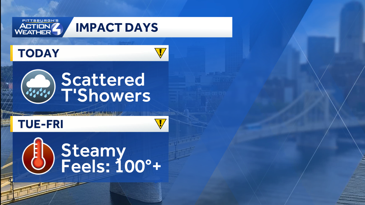
There are a whole slew of Impact Days in your 4 Day + 4 More Forecast. Today’s Impact Day is for a brief window of downpours and garden variety thunderstorms. An intense heat wave begins on Tuesday with high heat and humidity extending through the 4th of July weekend.
Impact Day: Dense fog to afternoon downpours
It is a foggy start to the day, especially where showers were more persistent Saturday. Visibility could be less than a mile in spots. The fog will linger through 9 a.m.
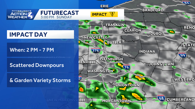
Sunny breaks plus the “stale” boundary will fuel another round of showers and storms. Today is now an Impact Day for that reason. While the coverage will be widely scattered, cells will pack a punch with downpours and garden variety thunderstorms. While you may be dry, your neighbor will be caught in a downpour.
Hearst OwnedHearst
An Impact Day for widely scattered showers that will pack a punch with heavy rain and some thunder.
Activity could bubble up as early as 11 a.m. near the West Virginia border. The prime time for Pittsburgh looks to be between 2 p.m. and 6 p.m.
More Impact Days for intense heat and humidity
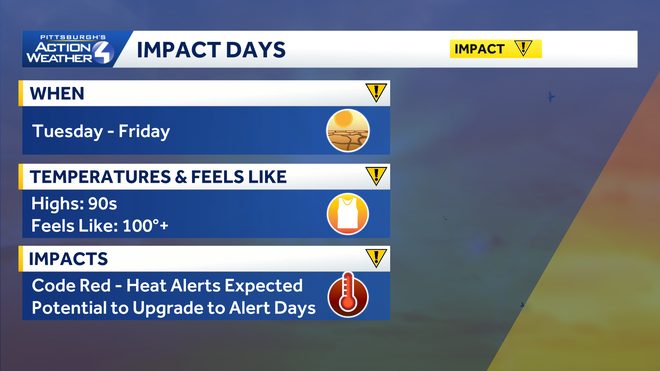
The heat cranks up next week! And it’s not just the heat, “air you can wear” is ahead too. Scorching heat starts Tuesday and continues through at least Friday. Each day will be Impact Day with daytime highs in the mid 90s and the feels like temperatures potentially over 100 degrees. There is the potential to upgrade Wednesday and Thursday to Alert Days.
Hearst OwnedHearst
Intense heat and humidity are brewing for the week ahead. Some days may need to be upgraded to Alert Days.
One day of the high heat and humidity would be enough. There won’t be any relief at night either with lows in the mid 70s. We need to be especially cautious as a heat wave settles in around western PA.
More sweltering heat, storms for the holiday weekend
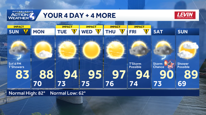
Some relief could come if storms happen to fire. Showers and/or storms are possible each day of the Independence Day weekend. It is hard to say this far out if this will hold, let alone if activity will impact daytime plans or fireworks displays.
Hearst OwnedHearst
Storm chance increase for the holiday weekend as the temperatures continue to sizzle.
TODAY – Impact Day: Areas of dense fog. Sunny breaks with scattered afternoon downpours and thundershowers. High: 83°.
TONIGHT: Clearing with patchy fog. Warm, low: 70°.
MONDAY: Very warm and humid with mostly sunny skies. High: 88°, low: 73°.
TUESDAY – Impact Day: Hot and humid with triple digit heat indices. High: 94°, low: 73°
WEDNESDAY – Impact Day: Feels like over 100° with sunshine. High: 95°, low: 76°.