
Scorching heat looms over Pennsylvania for 4th of July Weekend
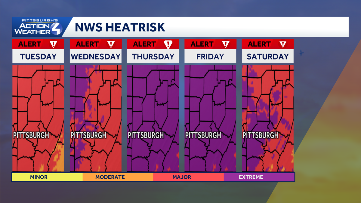
This morning we do have that dense fog around, but all eyes will be on our severe weather alert day starting Tuesday, extending into Saturday heading into the holiday weekend, and we are going to have our temperatures hitting into the low 90s and the real feel when you factor in that humidity. It’s over 100 degrees, so it’s the air you can wear. It’s very sticky. It’s very hard for your body to cool down. So we are in the moderate risk today with the heat risk from the National Weather Service, but this really starts to jump up starting tomorrow and again extending into Thursday and Friday when we will be in the major to extreme range and very, very dangerous. So like I said, we’re going to have our temperatures into the mid to upper 90s, and then when you Factor in that humidity, it’s going to feel like 100 to about 105 degrees. So very, very dangerous for us as we continue over the next few days. And you notice again our daytime highs will be hot, but so will the morning temperatures. I mean, we’re really not going to cool down too much. There’s not even going to be any relief as we head into the overnight hours in the low to mid 70s for our morning temperatures once we get through this morning where *** lot of us. are sitting into the 60s. We do have some fog. It is getting *** little bit better downtown Pittsburgh. We can actually see the North Shore here, but in those low lying areas into the valleys, we are going to be dealing with that dense fog. This extends into Armstrong and Indiana all the way up into Venango and Clarion County. Also in the portions of Washington and Greene along 70 and 79. You’ll hit some of that dense fog reporting down in some spots down to *** 0 mile. Visibility 66 degrees right now in Pittsburgh. 68. Waking up in Washington, you’re sitting at 63 in Franklin and Katanning, Clarion at 62 and 62 also in Beaver. So through the day today, most of us will be in the mid to upper 80s with our actual temperature. It’s still going to feel like we’re into the low 90s, so it is going to be *** hot afternoon, but it’s only going to get worse as We continue through the week. Saturday upgraded to *** severe weather alert day. It’s still going to be hot. Uh, we’ll have those, uh, again those heat indices into the upper 90s, but also *** chance for some thunderstorms, *** better chance, especially Saturday afternoon and evening, for some of those storms to pop, especially when *** lot of you want to be outside and enjoy the beautiful fireworks display that not only downtown Pittsburgh but all around the region. *** lot of towns just put on such *** nice spectacular show. So again it could be *** little tricky as we get into the holiday weekend, but severe weather alert days line up starting Tuesday, extending through Friday because of the high heat and humidity. Friday right now there is *** chance for *** few thunderstorms. It was looking *** little more on the dry side as I was forecasting this morning, but we will have *** chance for thunderstorms Saturday and even into Sunday. The bald
Scorching heat looms over Pennsylvania for 4th of July Weekend

Updated: 8:29 AM EDT Jun 29, 2026
An intense heat wave begins on Tuesday with high heat and humidity extending through the 4th of July weekend.Severe Weather Alert Days for Extreme HeatThe heat cranks up this week! And it’s not just the heat, “air you can wear” is ahead too. Scorching heat starts Tuesday and continues through at least Friday. Each day will be Severe Weather Alert Day with daytime highs in the mid 90s and the feels-like temperatures over 100 degrees.Tuesday through Saturday will be Severe Weather Alert Days and Sunday will be an Impact Day in Western Pennsylvania.One day of the high heat and humidity would be enough. There won’t be any relief at night either with lows in the mid 70s. We need to be especially cautious as a heat wave settles in around western PA.More sweltering heat, storms for the holiday weekendSome relief could settle in if storms happen to fire. Showers and/or storms are possible each day of the Independence Day weekend, especially on Saturday.TODAY: Very warm and humid with mostly sunny skies. High: 88°TONIGHT: Partly cloudy and warm. Low 72°TUESDAY: Severe Weather Alert Day: Hot and humid with triple digit heat indices. High: 94°WEDNESDAY: Severe Weather Alert Day: Feels like over 100° with sunshine. High: 96°THURSDAY: Severe Weather Alert Day: Feels like over 100° with sunshine. High: 98°
An intense heat wave begins on Tuesday with high heat and humidity extending through the 4th of July weekend.
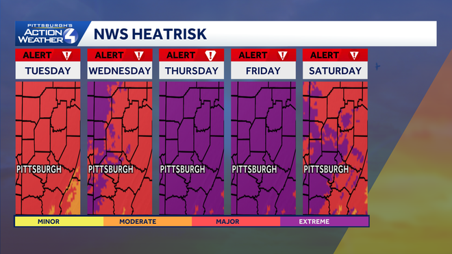
Severe Weather Alert Days for Extreme Heat
The heat cranks up this week! And it’s not just the heat, “air you can wear” is ahead too. Scorching heat starts Tuesday and continues through at least Friday. Each day will be Severe Weather Alert Day with daytime highs in the mid 90s and the feels-like temperatures over 100 degrees.
Tuesday through Saturday will be Severe Weather Alert Days and Sunday will be an Impact Day in Western Pennsylvania.
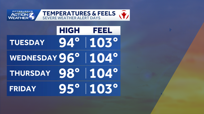
One day of the high heat and humidity would be enough. There won’t be any relief at night either with lows in the mid 70s. We need to be especially cautious as a heat wave settles in around western PA.
More sweltering heat, storms for the holiday weekend
Some relief could settle in if storms happen to fire. Showers and/or storms are possible each day of the Independence Day weekend, especially on Saturday.
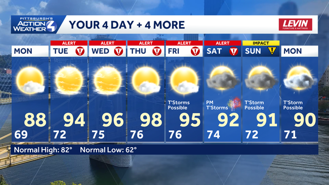
TODAY: Very warm and humid with mostly sunny skies. High: 88°
TONIGHT: Partly cloudy and warm. Low 72°
TUESDAY: Severe Weather Alert Day: Hot and humid with triple digit heat indices. High: 94°
WEDNESDAY: Severe Weather Alert Day: Feels like over 100° with sunshine. High: 96°
THURSDAY: Severe Weather Alert Day: Feels like over 100° with sunshine. High: 98°