
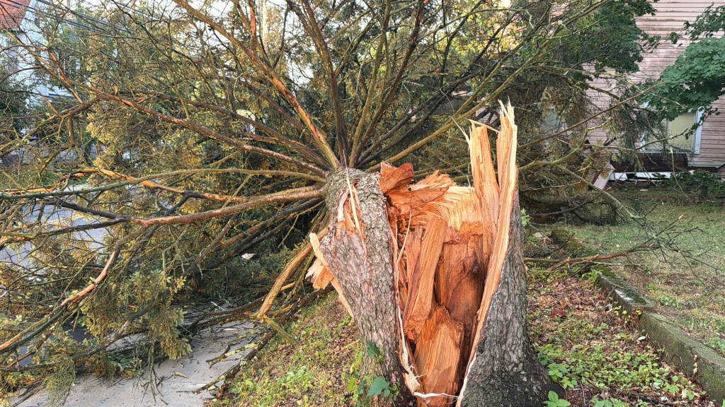
As the Lehigh Valley is cleaning up from storms that downed trees and power lines Friday night, another round of severe weather is possible Saturday evening just as Fourth of July fireworks displays are set to get under way.
The National Weather Service has issued a severe thunderstorm watch for the region until 11 p.m.
A severe thunderstorm watch has been issued for parts of Delaware, Maryland, New Jersey, New York and Pennsylvania until 11 PM EDT pic.twitter.com/870TI7XCJ8
— NWS Mount Holly (@NWS_MountHolly) July 4, 2026
Scattered thunderstorms are expected starting late Saturday afternoon, according to a briefing from the weather Service’s forecast office in Mount Holly, New Jersey. Stronger storms could again produce damaging winds due to the extreme heat and humidity, along with frequent cloud to ground lightning and even some isolated hail.
The weather service’s severe weather outlook map for Saturday shows most of eastern Pennsylvania and New Jersey at a “slight risk” of severe weather. In addition to possibly damaging winds, locally heavy rainfall could cause the potential for flash flooding.
Storms are most likely to develop between 3 p.m. and 11 p.m. across the entire region. In the Lehigh Valley, storms are expected to develop after 5 p.m., according to the weather service forecast. There is a 70% chance of precipitation Saturday night.
The weather service advises anyone planning to be outdoors for Fourth of July celebrations to monitor the latest forecast and be able to receive severe weather alerts from the weather service.
As the Lehigh Valley braces for more severe weather, the region is still cleaning up from severe storms Friday night that downed numerous trees and cut power to around 13,000 customers. The Macungie and Alburtis areas were particularly hard hit, with Alburtis officials declaring a “state of emergency.”
As of Saturday morning, more than 2,000 PPL and Met-Ed customers in Lehigh and Northampton counties remained without power.
The power outages come at a bad time: The region is set to deal with one more day of temperatures around 100 degrees. An extreme heat warning remains in effect until 8 p.m.
A high temperature of 96 is expected Saturday in the Lehigh Valley, just a few degrees cooler than Friday’s high of 99 at Lehigh Valley International Airport. However, the humidity will send heat index values into the low 100s.
Relief will finally come Sunday, with high temperatures only reaching the mid- to upper-80s. However, thunderstorms are again expected to return in the late afternoon and evening hours, though the threat of the most severe weather is expected to be more to our south.
However, any storms that do occur could produce the potential for flash flooding, according to the weather service. There is a 60% chance of precipitation during the day Sunday and a 90% chance Sunday night.
More showers and thunderstorms are expected Monday, but it will be much cooler, with a high of just 78, according to the forecast.
Here is the extended National Weather Service forecast:
Sunday: A chance of showers, then showers and thunderstorms likely after 4 p.m. Partly sunny, with a high near 84. Calm wind becoming east around 5 mph. Chance of precipitation is 60%. New rainfall amounts between a tenth and quarter of an inch, except higher amounts possible in thunderstorms.
Sunday Night: Showers and thunderstorms likely before 8 p.m., then showers and possibly a thunderstorm between 8pm and 2am, then showers likely after 2am. Low around 66. East wind around 5 mph. Chance of precipitation is 90%. New rainfall amounts between three quarters and one inch possible.
Monday: Showers likely, with thunderstorms also possible after 11 a.m. Cloudy, with a high near 78. East wind around 5 mph. Chance of precipitation is 70%. New rainfall amounts between a quarter and half of an inch possible.
Monday Night: Showers likely and possibly a thunderstorm. Mostly cloudy, with a low around 64. Chance of precipitation is 70%. New rainfall amounts between a tenth and quarter of an inch, except higher amounts possible in thunderstorms.
Tuesday: Showers likely and possibly a thunderstorm. Mostly cloudy, with a high near 81. Chance of precipitation is 60%.
Tuesday Night: A chance of showers before 2 a.m. Mostly cloudy, with a low around 65. Chance of precipitation is 40%.
Wednesday: Partly sunny, with a high near 84.
Wednesday Night: Partly cloudy, with a low around 66.
Thursday: A chance of showers and thunderstorms. Partly sunny, with a high near 89. Chance of precipitation is 30%.