
IMPACT DAY: Flood watch issued for south-central Pennsylvania with additional storms possible
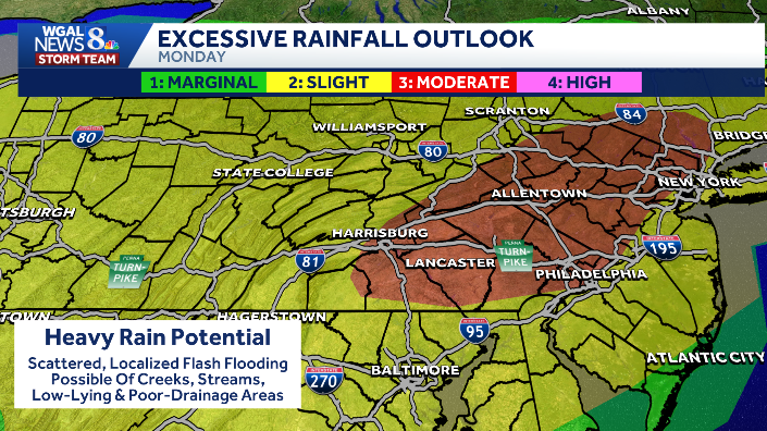
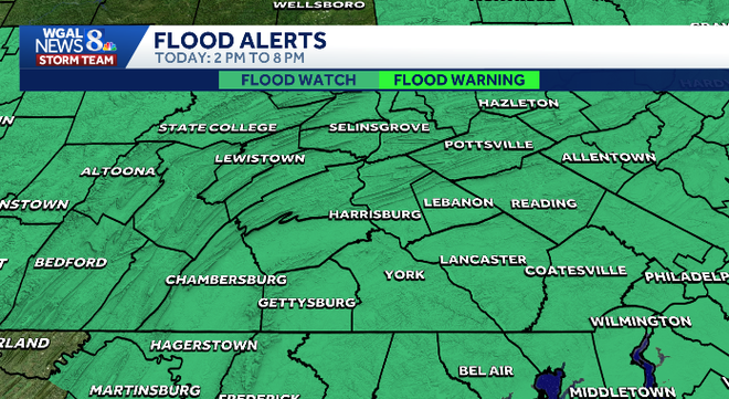
Well, we certainly needed some rain, but definitely didn’t want to get it with the, the damage that we saw from the storms last night. However, here’s *** look at the estimated 24 hour rainfall. Many areas with this darker brown or darker orange shade, uh, where 34, even 5 inches of rain fell from storms that were very slow moving, almost training, almost sitting over the same spots, and that’s how you get those impressive rain. Fall amounts is with the storms just not moving through the area very quickly. Uh, some areas to the south and southwest seeing much lesser amounts of rain, but, uh, still picking up on 1 inch, 1.5 inch here. It’s an impact day today. Here’s *** look at what you can expect again slow moving storms will be possible later in the afternoon into the evening hours. They’ll have the potential to produce some heavy rain with rainfall rates of 2 inches per. Per hour up to 2 inches per hour. Again, the timing would be late afternoon into the evening, and there’ll be the potential for flash flooding on some of the smaller rivers, creeks, streams, low lying areas, poor drainage areas, uh, especially because the ground is so saturated from last night’s storms. So storms, so *** flood flood watch goes into effect at 2 p.m. today, and that will continue until 8:00 p.m. today. Now the severe weather threat. Is pushed well to the south, so I don’t anticipate those widespread severe storms like we had the last couple of nights. However, you could see there is *** marginal risk across Franklin and Adams County. There is the potential that an isolated severe storm may pop up with damaging winds *** possibility. So we’ll keep an eye on that. We’ll also keep an eye on if this has expanded or not, but I think the best chance is going to be to the south across Maryland. Here’s *** look at your News 8 storm team forecast for today. Uh, there’ll be plenty of dry hours to get out there if you have some cleanup to do, just isolated showers, but afternoon and evening we could see those showers and storms moving in. Temperatures ranging from the upper 70s to the low 80s, even some mid 80s, uh, across our. Southwestern areas tonight, mostly cloudy, spotty showers possible. Muggy temperatures in the upper 60s, and tomorrow again we’ll see showers and storms, but they’ll be fewer and far between, more dry hours. Temperatures right around 80 degrees, so another day below average before we start to see temperatures warming back up. We’re in the low 70s. We’ve been sitting there, uh, for, uh, *** little while now. Dew points are also in the 70s, so it is feeling quite soupy outside. There’s the frontal boundary. It’s been stalled across the. To our south, but high pressure to the north will help build in and push this system further away from us. So that’s why I anticipate rain chances, storm chances really going down then, uh, from today to tomorrow. So this particular model not showing *** whole lot of activity for our eastern counties, but some other data I’m looking at does show the possibility of some showers and thunderstorms. Um, anything that does develop will be putting down some healthy downpours. So just keep that in mind, have that umbrella with you as well. And then tonight. Fairly quiet. Just some spotty showers possible tomorrow. You can see not *** whole lot of activity, just ***, *** few showers, maybe *** rumble of thunder, and then we continue to see those drying conditions as we head into our Wednesday sunshine returns and temperatures will get *** little bit closer to average but still falling short. 84 for the high. Now Thursday, storm chances return. Temperatures in the upper 80s where we should be for this time of the year. We’ll continue with the storm threat for for Friday and even into the upcoming weekend, although the weekend is not *** washout. We’ll pinpoint that forecast in *** little bit more in the coming days. Temperatures staying in the mid 80s if you’re.
IMPACT DAY: Flood watch issued for south-central Pennsylvania with additional storms possible

Updated: 6:32 AM EDT Jul 6, 2026
A flood watch was issued for south-central Pennsylvania from 2 p.m. to 8 p.m. on Monday after severe thunderstorms swept through the region, with additional rain in the forecast. The WGAL News 8 Storm Team has declared Monday an Impact Day, meaning the weather will likely disrupt your normal daily schedule or routine. Flooding concernsShowers are possible early Monday, followed by scattered showers and thunderstorms expected to develop in the afternoon. Highs will drop back to near 80 degrees. While widespread severe weather is not expected, the threat of excessive runoff and localized flooding remains in place. Areas most vulnerable to flooding: Creeks and streamsLow-lying areas Flood-prone roadsUrban locationsPoor-drainage areas In south-central Pennsylvania, the eastern counties are under a Slight Risk (level 2/5) for excessive rainfall, while western counties are under a Marginal Risk (level 1/5). What’s nextUnsettled weather is expected to continue into Tuesday, with additional showers and isolated thunderstorms possible. Highs should remain near 80 degrees before warmer temperatures return later in the week. The pattern is expected to gradually turn drier, though a few showers and storms may still develop through the rest of the week. Do you have photos or videos of storm damage and would like to share with News 8? Send them to https://www.wgal.com/upload.
A flood watch was issued for south-central Pennsylvania from 2 p.m. to 8 p.m. on Monday after severe thunderstorms swept through the region, with additional rain in the forecast.
The WGAL News 8 Storm Team has declared Monday an Impact Day, meaning the weather will likely disrupt your normal daily schedule or routine.
Flooding concerns
Showers are possible early Monday, followed by scattered showers and thunderstorms expected to develop in the afternoon. Highs will drop back to near 80 degrees.
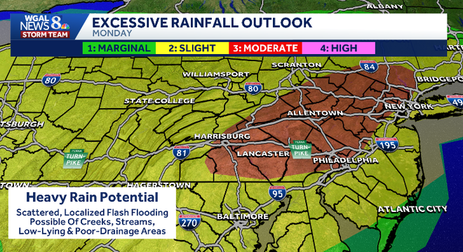
While widespread severe weather is not expected, the threat of excessive runoff and localized flooding remains in place.
Areas most vulnerable to flooding:
Creeks and streamsLow-lying areas Flood-prone roadsUrban locationsPoor-drainage areas
In south-central Pennsylvania, the eastern counties are under a Slight Risk (level 2/5) for excessive rainfall, while western counties are under a Marginal Risk (level 1/5).
What’s next
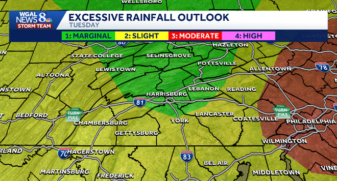
Unsettled weather is expected to continue into Tuesday, with additional showers and isolated thunderstorms possible. Highs should remain near 80 degrees before warmer temperatures return later in the week.
The pattern is expected to gradually turn drier, though a few showers and storms may still develop through the rest of the week.
Do you have photos or videos of storm damage and would like to share with News 8? Send them to https://www.wgal.com/upload.