
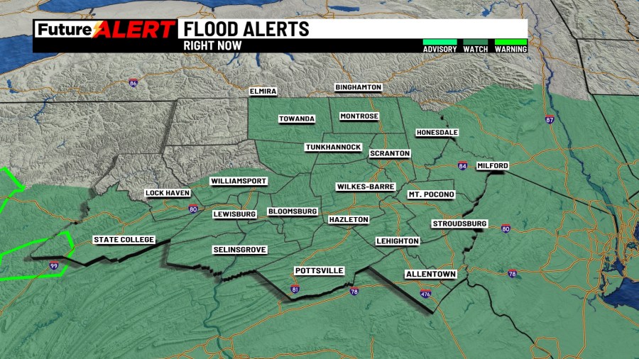
(WBRE/WYOU) — The National Weather Service (NWS) announced Sunday night that multiple counties were placed under a Flash Flood Warning and a Severe Thunderstorm Watch.
Several counties, listed below, were placed under a Flash Flood Warning by the NWS until 2:30 a.m. at the latest.
The NWS announced the warning after a storm was detected by radar, and automated rain gauges showed thunderstorms passing through the Keystone State, bringing heavy rain.
Officials say one to two inches of rain have already fallen, with one-half to one inch of rain predicted to fall in the areas anticipated to be impacted.
Authorities say flash flooding of small creeks and streams, urban areas, streets, highways, and underpasses is expected, in addition to other low-lying and poor drainage areas.
The NWS warns residents to take proper precautions when encountering an area experiencing flash flooding.
Check out the Regional Weather Forecasts
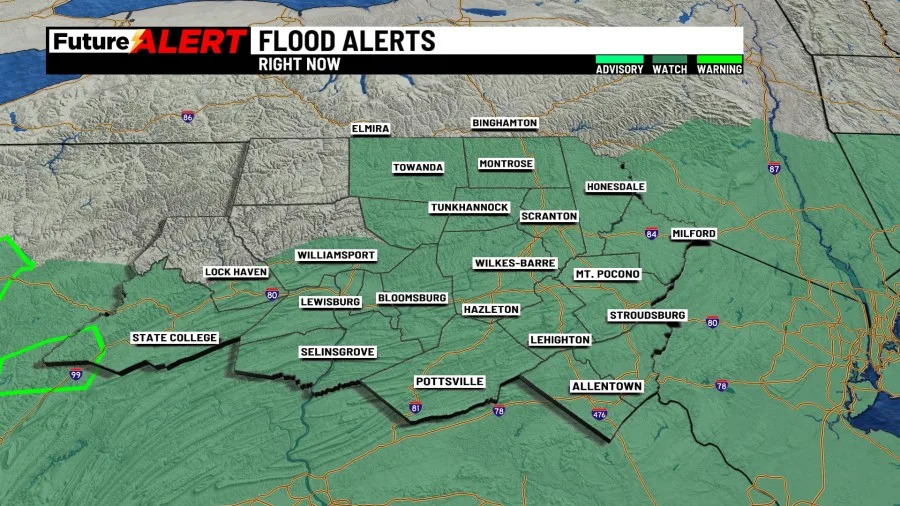
Additionally, the following counties are under a Flood Watch until Tuesday morning:
Meanwhile, Schuylkill County is under a Severe Thunderstorm Watch until 1:00 a.m. Monday.
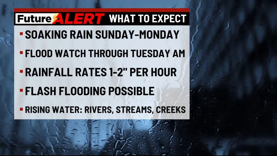
Heavy rain is set to move through the area between Sunday and Tuesday, prompting the National Weather Service to issue a Flood Watch for much of NE and Central Pennsylvania until Tuesday morning.
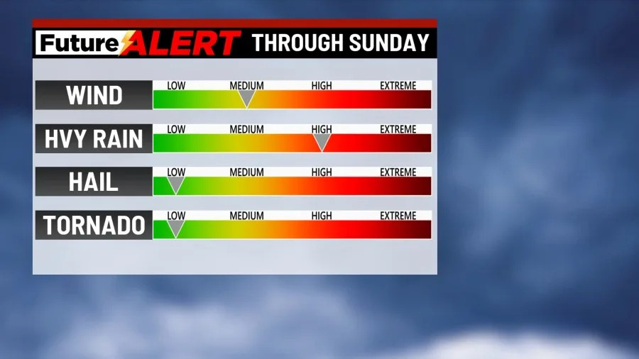
Your Future Alert Weather Forecast is tracking the chance for showers and storms Sunday night, in which a few could be stronger. Damaging winds and heavy rain will be the primary threats. Lows in the mid-60s.
Much of the week ahead will be unsettled, especially on Monday. It’ll be mostly cloudy, with additional rounds of showers and storms that may produce heavy rain.
While storms won’t be as prevalent on Tuesday, they are still possible. By the time all is said and done, rainfall totals between Sunday night and Tuesday can be anywhere from one to two and a half inches with locally higher amounts.
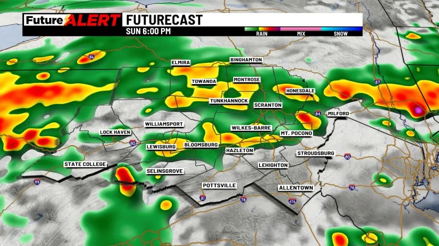
Some of the hardest hit areas could pick up one to two inches of rain per hour. Flash flooding remains an issue for rivers, streams, creeks, low-lying and poor drainage areas. We top out in the mid 70s on both days.
We’ll get a brief break from the wet weather on Wednesday as highs get back into the low 80s.
Another front will push into the area Thursday and Friday.
A few showers will be in place for Thursday, and storms will come back to the area Friday.
Some of those showers and storms may linger into Saturday, with showers forecast for Sunday.
We’ll wrap up the end of the week and weekend with highs in the low to mid 80s.
You can stay current on all the latest weather alerts and track the storm using the Future Alert Interactive Radar.
Copyright 2026 Nexstar Media, Inc. All rights reserved. This material may not be published, broadcast, rewritten, or redistributed.
For the latest news, weather, sports, and streaming video, head to 28/22 News.