
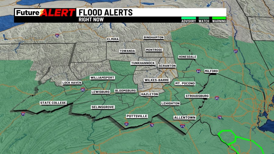
(WBRE/WYOU) — While northeast and central Pennsylvania saw a soaking rain last night, there will be rain showers that linger into your Monday.
It’ll be cooler into the upper 60s and low 70s for most. Rainfall amounts are expected to range from a quarter to a half an inch with locally higher amounts of 1 to 2″. Isolated flash flooding can still occur today, but it is not expected to be a widespread concern. The heaviest rain is expected into Central Pennsylvania for today. Flood watches are in effect until 8pm for central PA and the Poconos, while the rest of us are in a flood watch until 8am tomorrow.
We will slowly warm up through the coming week, but temperatures will warm to near average with more rain and storm chances in the forecast.
There will be a few showers and mostly cloudy skies on Tuesday with highs into the middle 70s. Wednesday is expected to be a partly sunny and dry day with highs into the low 80s. Thursday and Friday will feature shower and storm chances with highs into the middle 80s. Shower chances are possible on Saturday, while it leans dry for Sunday. Afternoon highs will be closer to average.
You can stay current on all the latest weather alerts and track the storm using the Future Alert Interactive Radar.
Copyright 2026 Nexstar Media, Inc. All rights reserved. This material may not be published, broadcast, rewritten, or redistributed.
For the latest news, weather, sports, and streaming video, head to 28/22 News.