
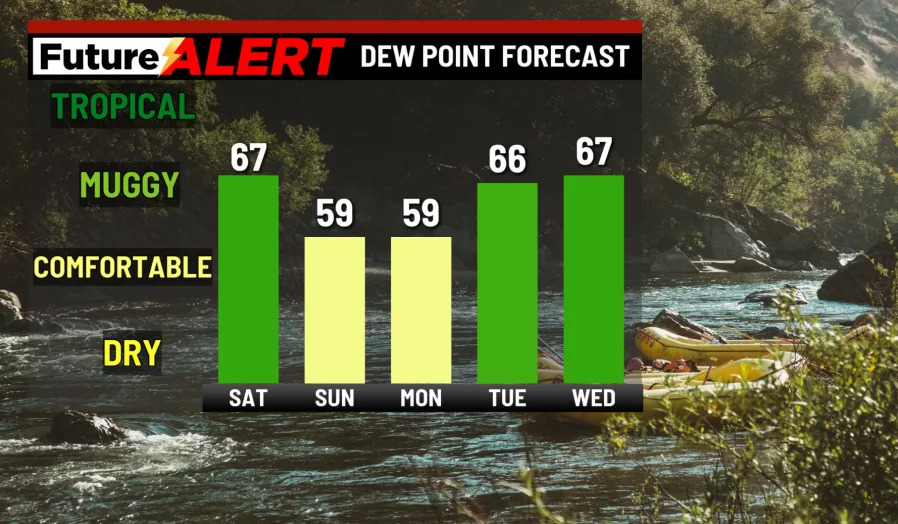
(WBRE/WYOU) — A stationary front that is just to our south will give us a chance of scattered showers and thunderstorms Saturday afternoon.
High pressure builds in for Sunday, with just a slight chance of a shower to the north. Humidity will lessen Sunday and Monday. The heat returns next week, along with the chance of a shower or storm for Thursday and Friday.
For today, you can expect partly sunny skies, with a chance of scattered afternoon showers and thunderstorms and highs in the mid 80s. Tonight could see a shower or storm early, before becoming mostly clear and comfortable. Lows will be near 60.
Sunday will see partly cloudy skies, and it’ll be pleasant with a slight chance of a shower north. Highs will be in the mid 80s.
Monday will be partly cloudy with highs in the upper 80s. Tuesday will warm up to the low 90s and the clouds will part for a mostly sunny day. Wednesday will be partly cloudy with highs also in the low 90s.
Thursday will cool down a few degrees, with partly cloudy skies and a chance of an isolated thunderstorm. Friday will cool down further to the mid 80s, accompanied by a chance of a scattered shower or storm.
You can stay current on all the latest weather alerts and track the storm using the Future Alert Interactive Radar.
Copyright 2026 Nexstar Media, Inc. All rights reserved. This material may not be published, broadcast, rewritten, or redistributed.
For the latest news, weather, sports, and streaming video, head to 28/22 News.