
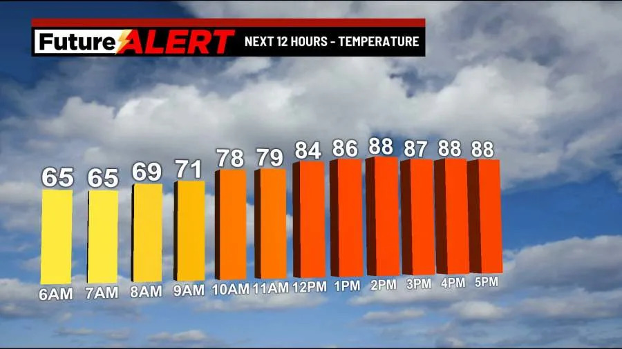
(WBRE/WYOU) — Despite a small chance for a stray shower, most of us will be dry with plenty of sunshine!
Highs reach the mid 80s. Tonight will be mostly clear and a bit muggy. Lows in the mid 60s.
A large ridge of high pressure will keep our weather pattern generally quiet, but hot! Tuesday will be a hotter and slightly more humid day with a mostly sunny sky. Highs climb to the lower 90s. Heat Advisories are in effect for a majority of northeast and central PA, which is why we’ve made Tuesday a “Weather Alert” day.
Wednesday will be another hot day with plenty of sunshine. Highs in the mid 90s. Thursday will bring us a mix of clouds and sun with highs in the upper 80s. The ridge breaks down by the end of the week with daily chances for showers and storms by Friday, Saturday, and Sunday. Highs return to the mid 80s each day.
You can stay current on all the latest weather alerts and track the storm using the Future Alert Interactive Radar.
Copyright 2026 Nexstar Media, Inc. All rights reserved. This material may not be published, broadcast, rewritten, or redistributed.
For the latest news, weather, sports, and streaming video, head to 28/22 News.