
It’s going to be a pleasant day today in the Pittsburgh area before rain chances return to the forecast tomorrow.
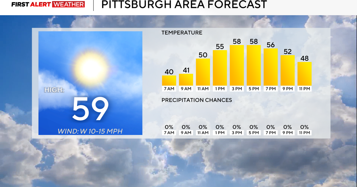
High temperatures will be close to 60 degrees with breezy winds out of the west. Wind gusts could near 30mph.
While most of the day will be sunny, a couple of cloudy hours are expected this morning. I have noon temperatures in the low 50s.

KDKA Weather Center
Temperatures will hit the mid-60s on Wednesday ahead of the rain with just a hundredth of an inch to two hundredths. It won’t be much. The chance for rain on Friday will be better with another chance for rain occurring once again on Sunday into Monday morning.
The biggest story may very well end up being just how cool we turn next week with temperatures taking a tumble. I have next Monday’s high only hitting 39 degrees. We will see highs in the 40s on Tuesday and Wednesday of next week.

KDKA Weather Center
By next weekend, temperatures should soar to well above average, with the middle of the month up through Thanksgiving looking VERY warm for this time of the year.
There will be a chance for rain and snow early next week
Yes, there is a chance for some snow on Sunday afternoon into Monday morning. If you are south of I-80, you aren’t going to see anything more than a dusting of snow at most. The issue is that with temperatures rapidly dipping to near 30 degrees, we could have some slick spots out there on the roads.
Due to that, expect to see salt trucks out and about on Sunday evening and Monday morning, making sure roads don’t turn icy. Besides a slick spot or two, that is certainly dangerous; you won’t see much of an impact from the impending snow.
WEATHER LINKS:
Current Conditions | School Closings & Delays | Submit Your Weather Photos
More from CBS News