
Alert Day: Dangerous Air QualityHazy skies will increase as smoke from wildfires in western Ontario, Canada filter into our region. The smoke will start to thicken late this morning and continue to get worse through the day. The concern for the intensity of the smoke could allow for it to reach the ground. This would cause breathing problems for those who are sensitive to pollutants and have other underlying health concerns, like asthma. Due to the risk of increased smoke at the surface, the PA Department of Environmental Protection has issued a Code Red Air Quality Alert Day for all of Pennsylvania.High Heat & HumidityOn top of the dangerous air quality, we also have the high heat and humidity lingering through Friday. Highs will climb in the low 90s through Friday. The feels like temperature will be in the mid 90s when combining temperature with humidity in the area.Impact Day Saturday as Rain, Storms ReturnThe good news is the heat, and humidity will be short lived as highs start dropping as we approach the weekend. As the heat drops, the chance for rain and thunderstorms increases. We could have showers very late Friday night.The soggiest day will be Saturday with rain and embedded thunderstorms off and on through the day. Rain may be heavy at times, especially in any thunderstorms, with some locations potentially picking up close to inch of rain. The flooding threat makes Saturday an Impact Day.Rain may linger into early Sunday. Temperatures will drop below normal as we move into next week after another chance at rain on Tuesday.THURSDAY – Impact Day: Hazy, hot, and humid. High: 90°, low: 67°. Heat index in the upper 90s. Code Red Air Quality Alert Day.FRIDAY: Partly cloudy and hot. High: 89°, low: 70°.SATURDAY – Impact Day: Periods of heavy rain and embedded thunderstorms. High: 84°, low: 68°.
Alert Day: Dangerous Air Quality
Hazy skies will increase as smoke from wildfires in western Ontario, Canada filter into our region. The smoke will start to thicken late this morning and continue to get worse through the day.
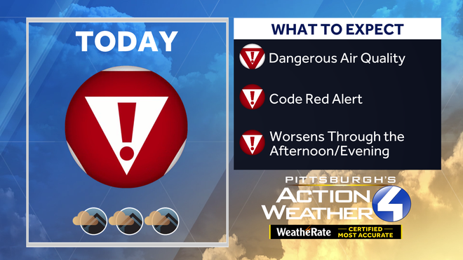
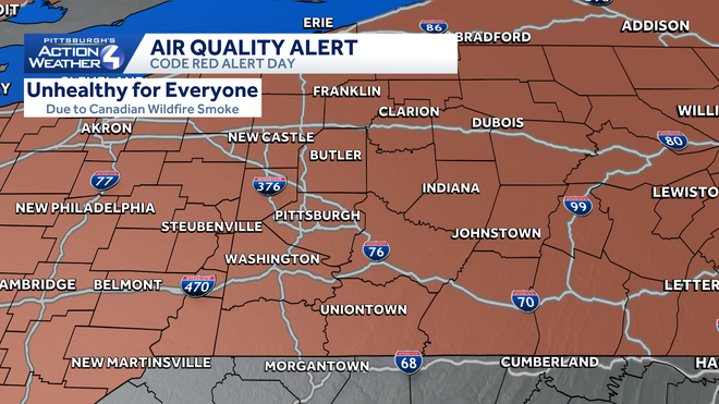
The concern for the intensity of the smoke could allow for it to reach the ground. This would cause breathing problems for those who are sensitive to pollutants and have other underlying health concerns, like asthma. Due to the risk of increased smoke at the surface, the PA Department of Environmental Protection has issued a Code Red Air Quality Alert Day for all of Pennsylvania.
High Heat & Humidity
On top of the dangerous air quality, we also have the high heat and humidity lingering through Friday. Highs will climb in the low 90s through Friday. The feels like temperature will be in the mid 90s when combining temperature with humidity in the area.
Impact Day Saturday as Rain, Storms Return
The good news is the heat, and humidity will be short lived as highs start dropping as we approach the weekend. As the heat drops, the chance for rain and thunderstorms increases. We could have showers very late Friday night.
The soggiest day will be Saturday with rain and embedded thunderstorms off and on through the day. Rain may be heavy at times, especially in any thunderstorms, with some locations potentially picking up close to inch of rain. The flooding threat makes Saturday an Impact Day.
Rain may linger into early Sunday. Temperatures will drop below normal as we move into next week after another chance at rain on Tuesday.
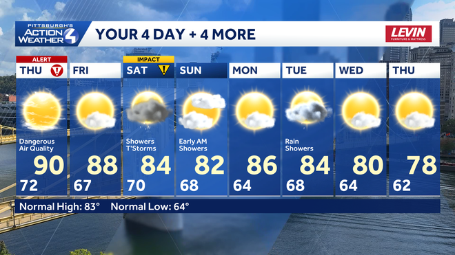
THURSDAY – Impact Day: Hazy, hot, and humid. High: 90°, low: 67°. Heat index in the upper 90s. Code Red Air Quality Alert Day.
FRIDAY: Partly cloudy and hot. High: 89°, low: 70°.
SATURDAY – Impact Day: Periods of heavy rain and embedded thunderstorms. High: 84°, low: 68°.