
IMPACT SATURDAY: Smoke lingers as storms bring risk of damaging winds, tornado and flooding to south-central Pennsylvania
It’s 6:57. Time for WJAL News 8 to go. We do have live team coverage on this alert day. Let’s begin with Christine. Let’s take *** look at the sky in Harrisburg. You can’t see very far in front of you. Visibility is quite low due to the thick wildfire, smoke, and haze, and you can see it here in our sky cam. The river kind of disappears out in the distance. We are under *** code purple, *** very rare air quality alert for the entire state of Pennsylvania. That means the air quality. is harmful or very unhealthy for everybody. You could experience coughing, stinging, or itching eyes, breathing difficulties, especially if you have heart or lung conditions. So some recommendations keep your windows and doors closed at home. Keep your air on recirculate as you’re out on your morning drive in your car and at your home. If you have filters, you can run those as well. Current air quality readings right now, we have harmful that purple for the entire Susquehanna. Valley, but this one sticks out in your county, reading in at hazardous. That’s as bad as it gets. So please limit your time outdoors today and be cautious in the smoke. Right now temperatures are in the 60s to 70s. Dew points have dropped, but it’s not *** good day to be outdoors. Still going to be hot and hazy, blocking the sunshine throughout the day. Tonight we have 72 for the low, smoky and hazy. Tomorrow, scattered storms. We’ll talk more about those coming up. Good morning. I’m Gabrielle Thomas live here in Lancaster Lancaster City along East James Street. If you take *** look here, you can see how hazy the sky is. It’s looked like this all morning and across the Susquehanna Valley for sure. Doctors say that the message is very clear today. Please stay indoors. If you don’t have to be outside. Stay inside. Those that are most at risk though are people with chronic lung or heart diseases. Good morning, I’m Cameron Loy. We’re live at Samuel Lewis Park in York County. I want to give you *** look at what we’re seeing from our vantage point right now. You can see how this haze is just really making the visibility here *** lot more difficult, really making that distant, uh, picture *** lot more gray with this, uh, conditions that we’re seeing today. Obviously we want to reiterate, if you do plan on going outside, reconsider with these conditions still in effect, staying inside is one of the best ways to stay safe while this, uh, while this code purple is in effect. And as we saw with Cameron and with with Gabrielle, you can see it’s very hazy outside. Wanted to give you *** look from our penda cameras, other parts of the Susquenna Valley, East Lampeter Township, Lancaster County, Route 30 at Route 462 there, giving you *** look on Route 30 at Columbia Marietta. Can’t get over this shot. It is just absolutely so hazy there. Uh, be careful as you’re making your way out. More on those storms for Saturday on our impact day. Scattered showers and thunderstorms are expected. I think there may be *** round of morning showers, but sometimes this wildfire smoke inhibits storm production, so we might not see much tomorrow morning. I do expect the strongest storms though around dinner time to about midnight tomorrow as *** cold front approaches. So all threats of severe weather on the table. We’ll be with you throughout those storms and of course the air quality.
IMPACT SATURDAY: Smoke lingers as storms bring risk of damaging winds, tornado and flooding to south-central Pennsylvania

Updated: 9:33 AM EDT Jul 17, 2026
The Susquehanna Valley is in for an active Saturday as a warm front brings thunderstorms while lingering wildfire smoke continues to affect the region. The WGAL News 8 Storm Team has declared Saturday an Impact Day, meaning the weather will likely disrupt your normal daily schedule or routine. Storm timing A warm front will bring a few showers and thunderstorms Saturday morning into the afternoon. As a cold front approaches later in the day, scattered thunderstorms are expected to develop. The highest chance for stronger storms is between 4 p.m. and midnight. Below: Swipe through the predicted radar for Saturday’s storms. CONDITIONS: Humidity will increase on Saturday with highs in the low-to-mid 80s. Main threats Storm impacts are expected from Saturday afternoon through the night, with the greatest concern focused on stronger evening storms. Some isolated storms could produce: Damaging wind gusts Heavy rain Isolated flash flooding Large hail A low risk of a spin-up tornado Slight severe weather risk The entire Susquehanna Valley is under a slight risk (level 2/5) for severe weather on Saturday. Code Orange issued as wildfire smoke lingersA Code Orange air quality alert has been issued for Saturday as wildfire smoke lingers across the region.Higher smoke concentrations are expected in the morning, with improving conditions during the afternoon as the warm front lifts north. By evening, air quality should improve significantly. The WGAL News 8 Storm Team will continue to monitor the forecast and provide updates as they become available.Did you capture a moment that you would like to share with News 8? Send us your photos or videos at https://www.wgal.com/upload.
The Susquehanna Valley is in for an active Saturday as a warm front brings thunderstorms while lingering wildfire smoke continues to affect the region.
The WGAL News 8 Storm Team has declared Saturday an Impact Day, meaning the weather will likely disrupt your normal daily schedule or routine.
Storm timing
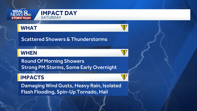
A warm front will bring a few showers and thunderstorms Saturday morning into the afternoon. As a cold front approaches later in the day, scattered thunderstorms are expected to develop. The highest chance for stronger storms is between 4 p.m. and midnight.
Below: Swipe through the predicted radar for Saturday’s storms.
CONDITIONS: Humidity will increase on Saturday with highs in the low-to-mid 80s.
Main threats
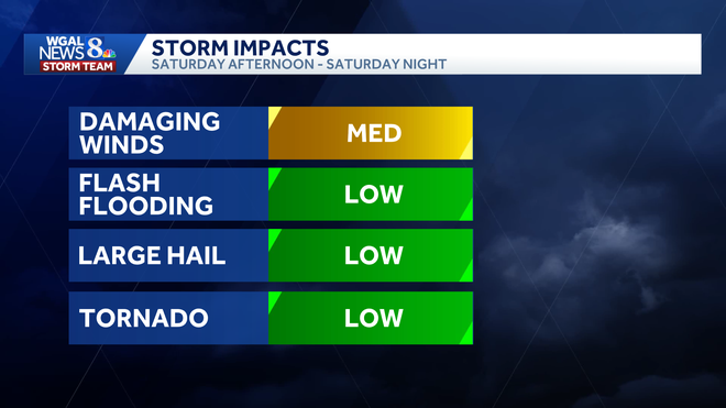
Storm impacts are expected from Saturday afternoon through the night, with the greatest concern focused on stronger evening storms.
Some isolated storms could produce:
Damaging wind gusts Heavy rain Isolated flash flooding Large hail A low risk of a spin-up tornado
Slight severe weather risk
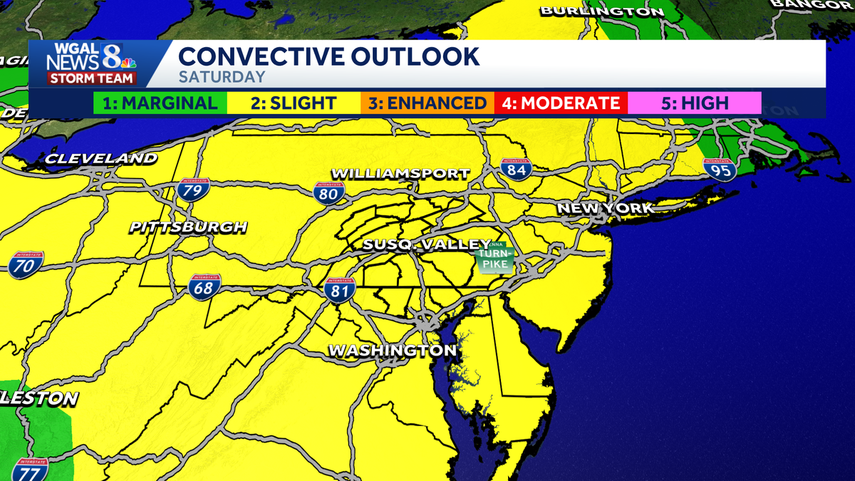
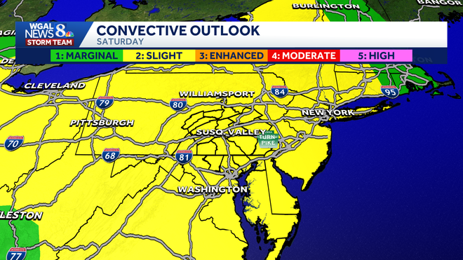
The entire Susquehanna Valley is under a slight risk (level 2/5) for severe weather on Saturday.
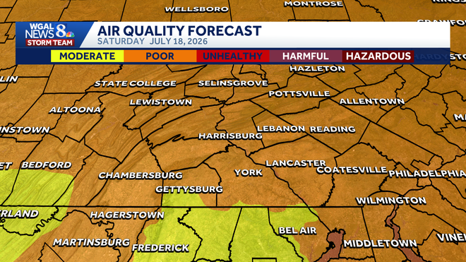
Code Orange issued as wildfire smoke lingers
A Code Orange air quality alert has been issued for Saturday as wildfire smoke lingers across the region.
Higher smoke concentrations are expected in the morning, with improving conditions during the afternoon as the warm front lifts north. By evening, air quality should improve significantly.
The WGAL News 8 Storm Team will continue to monitor the forecast and provide updates as they become available.
Did you capture a moment that you would like to share with News 8? Send us your photos or videos at https://www.wgal.com/upload.