
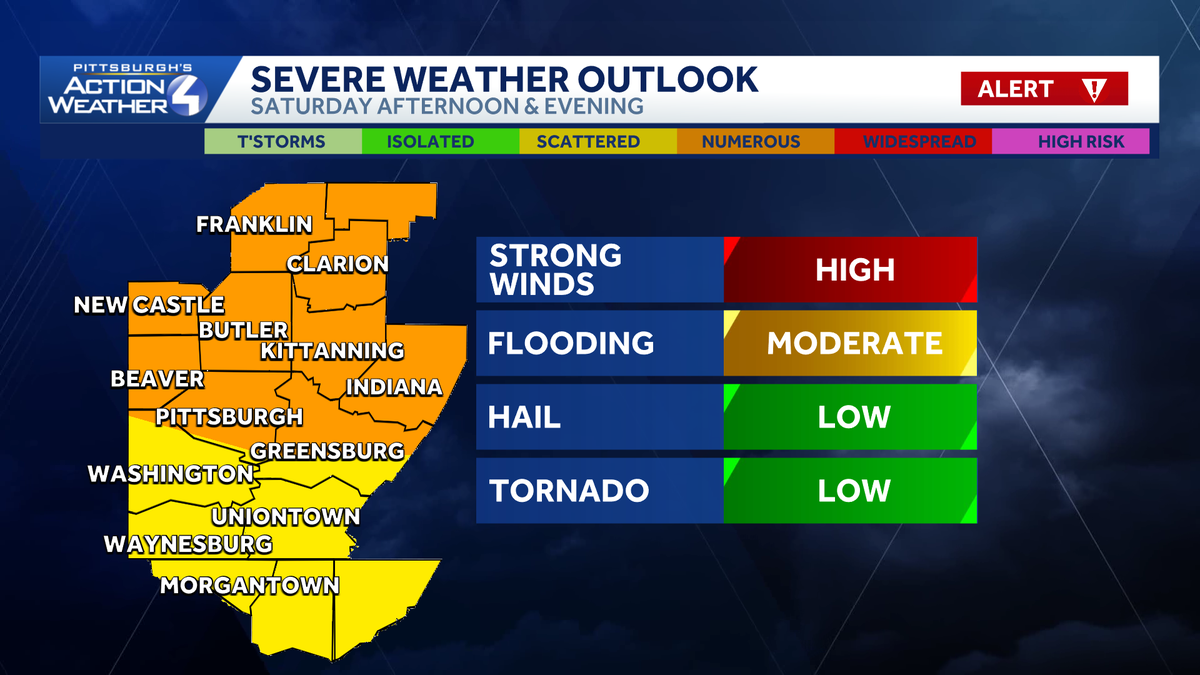
Strong to severe storms Saturday in Western Pennsylvania
Saturday is a Severe Weather Alert Day for storms in Western Pennsylvania.
We remain on alert day tomorrow. However, the smoke clears. We are watching for the chance for strong, severe thunderstorms in the second half of the day. And as we get towards sunset, we could potentially though see some smoke returning on Sunday as our winds again turn around from the north. And then we will drop the humidity as we head into Monday, and that’ll last through most of next week. Air quality remains poor across western Pennsylvania, really the entirety of the Great Lakes region, and this will not improve until. We get to tomorrow morning, so it’s going to be another rough night tonight with poor air quality. Then overnight our winds turn southwest that starts removing the smoke. By 9 o’clock tomorrow morning you’ll see the difference, and then the smoke should be gone by the time we get to midday on Saturday before our showers and storms arrive. After our rain, the wind turns back from the north, and that could bring smoke again into Western Pennsylvania as we get into Sunday. We’ll have to see how much of that is able to cross. Into our direction, so we’ll be watching that through the weekend, but we may not be done completely with the smoke as we start next week. 83 is your high temperature tomorrow. 80 on Sunday, 85 on Monday. We’ll drop the humidity briefly before rain and storms return on Tuesday. Another cold front arrives. This will bring rain and we’ll have the potential to bring some thunderstorms that could get strong to severe again as we head through the day on Tuesday. Behind that cold front, we drop the heat and humidity as we head. Wednesday, Thursday, and Friday as highs in the upper 70s to 80s and lows drop back into the 50s as we head towards the end of next week and we stay seasonal as we head into next weekend. So rain chances look to get here late tomorrow. Tomorrow morning we should generally be dry. Once the smoke clears, once we get past midday, we’ll be watching for showers and storms developing, likely well north of our area first, not making it into our neck of the woods until we get closer to about 4 or 5 o’clock. That’s when showers and storms will be possible north of 422 and especially along I-80. As we get closer to 6 and 7 o’clock, these storms should be into the city of Pittsburgh, towards Indiana and back down towards Washington. And then by the time we get to 9 o’clock, these are down along the I-68 corridor. And then after about 10 or 11 o’clock, the rain is gone, and we will see clearing skies as we head into Sunday. Main concern tomorrow will be strong winds as well as some flooding, although hail and *** brief tornado. Cannot be ruled out. We’re at *** level 2 and 3 out of 5 from the storm prediction Center. It’s one of the highest categories we usually see here in Western Pennsylvania. So the smoke is still here for now. 82 is the current temperature. Winds are currently east. They will turn southwest as we head into the day tomorrow. That will get rid of the smoke before our showers and thunderstorms arrive as we head into the late afternoon and early evening. So the best window to get outside tomorrow is from late morning to early afternoon.
Strong to severe storms Saturday in Western Pennsylvania
Saturday is a Severe Weather Alert Day for storms in Western Pennsylvania.

Updated: 8:09 PM EDT Jul 17, 2026
Saturday is a Severe Weather Alert Day in western Pennsylvania.A cold front will bring the potential for strong to severe storms Saturday afternoon and evening.Alert Day for severe stormsThe good news is the rain will help knock the smoke out of the air Saturday. The bad news is the potential for strong and severe thunderstorms with the front. Spotty showers will be off and on throughout the day. Activity could pop up as early as the morning. Rain may be heavy at times, especially in any thunderstorms, with some locations potentially picking up close to inch of rain. We will watch for a severe threat after 4 p.m. through sunset as a line of storms move south across Lake Erie. Damaging wind and flooding are the primary concerns. Hail and tornadoes are a lower, but non-zero threat with this line.
PITTSBURGH —
Saturday is a Severe Weather Alert Day in western Pennsylvania.
A cold front will bring the potential for strong to severe storms Saturday afternoon and evening.
Hearst Owned
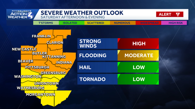
Damaging winds and flooding are the top storm threats late Saturday.
Alert Day for severe storms
The good news is the rain will help knock the smoke out of the air Saturday. The bad news is the potential for strong and severe thunderstorms with the front.
Hearst OwnedHearst
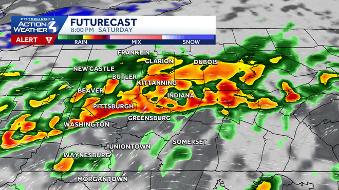
A line of potentially severe thunderstorms will drop southward Saturday afternoon and evening.
Spotty showers will be off and on throughout the day. Activity could pop up as early as the morning. Rain may be heavy at times, especially in any thunderstorms, with some locations potentially picking up close to inch of rain. We will watch for a severe threat after 4 p.m. through sunset as a line of storms move south across Lake Erie. Damaging wind and flooding are the primary concerns. Hail and tornadoes are a lower, but non-zero threat with this line.
Hearst Owned
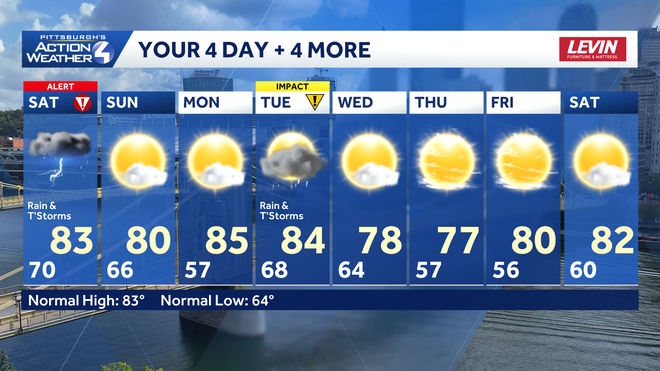
Sunday is the best day of the weekend. The summer heat gets toned down for the second half of next week.