
Wildfire smoke will improve by late morning and in the afternoon with help from the rain, which means the off-and-on thunderstorms continue through the morning.

Air quality alerts end just before 10 a.m. on Saturday
KDKA Weather Center
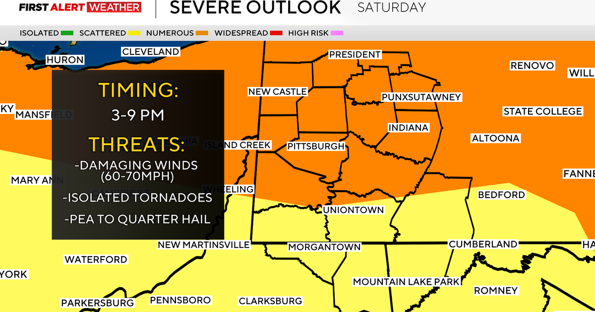
Then this afternoon, strong to severe storms move in as a line, bringing damaging winds, hail, and even possible tornadoes after 3 p.m. north and move through Pittsburgh and south into the evening. This can delay games and even pause events for some time.

Threats of severe weather on Saturday
KDKA Weather Center
Secure those loose outdoor items and stay weather aware! We are under an Enhanced Risk for severe weather, which means a higher confidence for more numerous storms to be severe. It’s a 3 out of 5 on the severe weather scale and doesn’t happen very often here.

Conditions through Sunday morning
KDKA Weather Center
After storms move out, it’ll be calm Sunday and Monday with sunny skies, but hazy skies stick around through Sunday; air quality won’t be as bad as it was on Friday. It may be a clean-up day for many.
Tuesday will be our next chance for storms, then temperatures drop below normal for several days with lower humidity and dry conditions!
Hazy skies could return for next weekend!

7-day forecast: July 18, 2026
KDKA Weather Center