
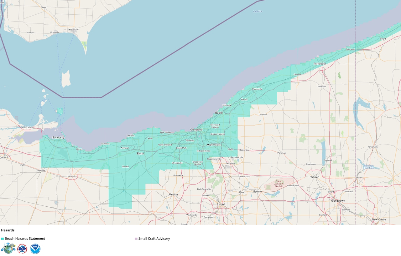
CLEVELAND, Ohio — Dangerous swimming and boating conditions are expected along Lake Erie on Saturday as thunderstorms approach.
Strong wind gusts in the storms are expected over the lake Saturday afternoon and evening, while shifting winds and waves as high as 5 feet will continue into Sunday morning, according to the National Weather Service in Cleveland.
The lake hazards come as a cold front approaches Northeast Ohio, helping trigger strong to severe thunderstorms from about 3 to 9 p.m. Damaging winds are the primary threat, with scattered gusts possibly reaching 70 mph across the region.
Beach hazards statements and small craft advisories cover much of the shoreline and nearshore waters.
Swimmers urged to stay out of Lake Erie
A high risk of rip currents will develop along the lakeshore as wind and waves strengthen.
Beach hazards statements are in effect from 10 a.m. Saturday through Sunday morning in Cuyahoga, Lake and Ashtabula counties. The alert begins at 10 p.m. Saturday in Lorain County and continues through Sunday morning.
The weather service urges swimmers to remain out of the water while the alerts are in effect.
The wind and waves can create currents that carry swimmers away from shore, through breaks in sandbars and along piers, breakwalls and other structures extending into the lake.
Thunderstorms add to boating danger
Southwest winds will increase to 15 to 25 knots ahead of an approaching cold front Saturday. Winds will abruptly shift toward the north behind the front Saturday evening and overnight, remaining around 15 to 20 knots.
Waves could build to between 2 and 5 feet, forecasters said.
Small craft advisories are in effect from 10 a.m. Saturday through 8 a.m. Sunday for the nearshore waters from Avon Point east to Conneaut. The advisories expand west from Avon Point toward the Lake Erie islands beginning at 10 p.m.
The weather service advises inexperienced mariners, particularly those operating smaller vessels, to avoid navigating in hazardous conditions.
Thunderstorms will create an additional hazard during the afternoon and evening. Strong to severe storms could begin developing around 3 p.m. and move northwest to southeast through the region until about 9 p.m.
Damaging winds are the primary severe-weather threat, and scattered gusts could reach 70 mph on land. Storms over Lake Erie also could produce strong wind gusts, frequent lightning, hail and torrential rainfall.
The storms are expected to move quickly and could cause conditions on the lake to deteriorate with little warning. Boaters should closely monitor weather alerts and be prepared to return to shore before storms arrive.
Conditions improve Sunday
Winds will gradually diminish to less than 10 knots by Sunday afternoon as high pressure moves into the region.
The cold front also will bring cooler and less humid weather, with mostly sunny skies and temperatures in the upper 70s to around 80 degrees.