
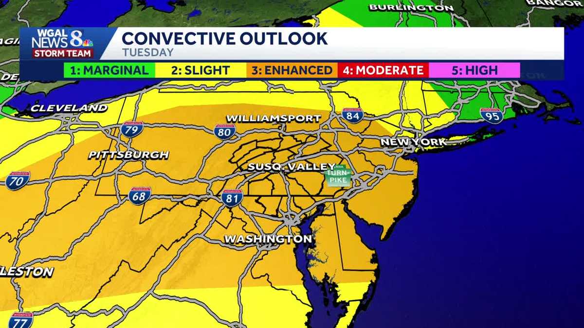
ALERT TUESDAY: Severe storms possible with risk of damaging winds, flash flooding in south-central Pennsylvania
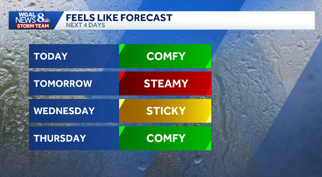
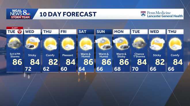
The Tropical storm is not expected to impact us here weather wise. There are still storms on the way tomorrow, and we’re kind of concerned about them either. Yes, we do have the threat for severe weather once again. The highest threat will be during the early afternoon and evening hours, similar to what we saw this past weekend and also for the 4th of July. It’s *** storm system coming in from the northwest, tapping in the increasing high humidity and also higher temperatures through the day tomorrow. Right now, still comfortable and still. Calm. We’re at 69 right now in Lancaster with starting to see the clouds move on in and thicken up over our western communities. Still reporting clear, but we do have some high level clouds right now on the satellite over Lancaster County. Here’s what we’re monitoring. Notice the swirl in the clouds and the showers over Ontario. It’s coming down from the northwest, and we will just see our shower and thunderstorm chances increase slowly through the night tonight. May see some spotty thundershowers as we get closer to dawn, along with the development of some fog thanks to an approaching warm front. Lows tonight will be down to near 70 degrees. Be prepared for some scattered showers and *** few thunderstorms tomorrow morning as it does turn muggier with temperatures in the 70s, and the amount of rain and the thickness of the cloud cover will have *** direct impact on the threat for severe weather for tomorrow afternoon, tomorrow evening. It’s, I’d say, from 1:00 to 8:00. That’s what we have to watch out for these stronger thunderstorms as temperatures will top off in the mid to upper 80s. On *** scale of 1 to 5, the threat for severe weather tomorrow is *** level. 3. That is quite high for us here in the Susquenna Valley. Window of opportunity looks best from 1 o’clock to 8 o’clock. All modes of severe weather will be possible, with the highest threat once again being damaging winds, and it is *** high threat for us, *** little bit lower threat, but still *** moderate threat for heavy downpours that could lead to flash flooding. It’s possible, but *** lower threat for tornadoes and storms that produce some hail. Temperatures again will top off in the mid 80s, may see some isolated showers or thundershowers through, I’d say, Wednesday. Morning into Wednesday afternoon, but then drier air moves on in. It’s going to feel much more comfortable for Thursday into Friday, and then it starts to turn sticky again on Saturday. May see some isolated thundershowers for Sunday. Better chances for showers and storms will return early next week, most likely Tuesday. Made it to 83 for our high today. Start the day off at 59. It’s still 75 in Harrisburg, 69 at this hour in Lancaster, and also 69 in York. There’s the warmer air off to our west. We’ve been talking about that big heat dome, and on the periphery. Of the heat dome, we’ve just seen these complexes of showers and thunderstorms move in from the northwest as we’ve seen that warm front lift on by like we saw on Saturday that gave us the opportunity for these passing showers and storms. So notice here on the predictor overnight some spotty showers and thundershowers will be possible. That’s the key word for tomorrow scattered. So that means some areas across the valley may not see anything, but some areas could get hit quite hard with these stronger thunderstorms during the early afternoon evening hours you can see. At 3 o’clock fairly widespread and then starting to taper in the number of storms and the intensity as we get closer to sunset. Cold front will approach from the northwest. I still think we could see some isolated showers or thundershowers by until roughly around midday Wednesday. Here’s the latest on Bertha. Right now it’s just sitting off the coast of Florida in the northern Gulf. Right now it’s stationary. Bertha’s expected to continue to move to the northwest, possibly making landfall across southeast Louisiana. As *** tropical storm and then continue its westward trek into Texas as we head into the weekend. This will not have *** direct impact on our weather here in the Susquenna Valley. So be on alert for the threat for strong to severe thunderstorms, especially during the afternoon, early evening hours. Quiet weather, more comfortable weather will be around Thursday into Friday. Then it starts to turn sticky again for the weekend, with shower and thunderstorm chances increasing by late in the day on Sunday. Better chances for showers and storms will hold off until Tuesday of next week.
ALERT TUESDAY: Severe storms possible with risk of damaging winds, flash flooding in south-central Pennsylvania

Updated: 11:27 PM EDT Jul 20, 2026
Strong to severe thunderstorms are possible Tuesday as warm, humid air returns to the Susquehanna Valley, raising the threat for damaging winds, heavy rain and flash flooding. The WGAL News 8 Storm Team has declared Tuesday an ALERT Day, meaning the threat of extreme, severe and possibly life-threatening weather is possibleDew points are expected to climb back into the 70s, creating a more tropical feel and supplying plenty of moisture to fuel storms. High will be in the mid-80s, making it the warmest day of the week. Storm timing 3 a.m. to 9 a.m. | A few showers and rumbles of thunder are possible as a warm front moves through. 1 p.m. to 8 p.m. | This is the primary window for scattered strong to severe thunderstorms. After 8 p.m. through midnight | Showers and a few storms may linger into the evening. Severe weather risk The Storm Prediction Center has placed south-central Pennsylvania under an Enhanced Risk (level 3/5) for numerous severe storms. Main threats Some storms may produce: Damaging straight-line winds in excess of 70 mph Heavy rain that could lead to localized flash flooding Large hail An isolated tornado or two The damaging wind risk for the entire Susquehanna Valley is at 45%.Heavy rainfall could lead to localized flash flooding, especially in creeks and streams as well as low-lying and poor-drainage areas. While tornadoes and hail are considered lower threats than wind and flooding, they are still possible in the strongest storms. Looking ahead A few showers may linger into early Wednesday as a cold front moves through, but skies should gradually clear as humidity drops. The rest of the week looks quieter and drier, with slightly cooler-than-average daytime highs and overnight lows. The WGAL News 8 Storm Team will continue to monitor the forecast and will provide updates as they become available. Did you capture the weather and would like to share with News 8? Send us your photos or videos at https://www.wgal.com/upload.
Strong to severe thunderstorms are possible Tuesday as warm, humid air returns to the Susquehanna Valley, raising the threat for damaging winds, heavy rain and flash flooding.
The WGAL News 8 Storm Team has declared Tuesday an ALERT Day, meaning the threat of extreme, severe and possibly life-threatening weather is possible
Dew points are expected to climb back into the 70s, creating a more tropical feel and supplying plenty of moisture to fuel storms. High will be in the mid-80s, making it the warmest day of the week.
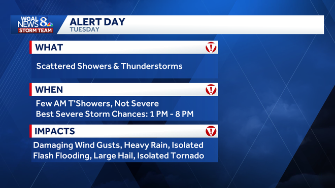
Storm timing 3 a.m. to 9 a.m. | A few showers and rumbles of thunder are possible as a warm front moves through. 1 p.m. to 8 p.m. | This is the primary window for scattered strong to severe thunderstorms. After 8 p.m. through midnight | Showers and a few storms may linger into the evening.
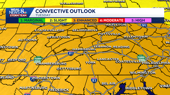
Severe weather risk
The Storm Prediction Center has placed south-central Pennsylvania under an Enhanced Risk (level 3/5) for numerous severe storms.
Main threats
Some storms may produce:
Damaging straight-line winds in excess of 70 mph Heavy rain that could lead to localized flash flooding Large hail An isolated tornado or two
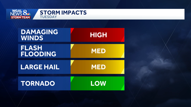
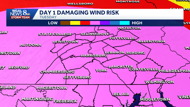
The damaging wind risk for the entire Susquehanna Valley is at 45%.
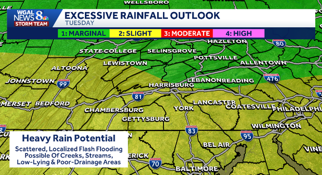
Heavy rainfall could lead to localized flash flooding, especially in creeks and streams as well as low-lying and poor-drainage areas.
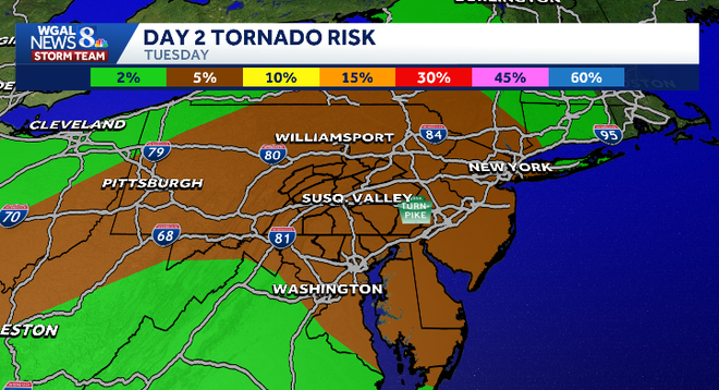
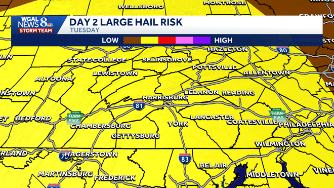
While tornadoes and hail are considered lower threats than wind and flooding, they are still possible in the strongest storms.
Looking ahead
A few showers may linger into early Wednesday as a cold front moves through, but skies should gradually clear as humidity drops.
The rest of the week looks quieter and drier, with slightly cooler-than-average daytime highs and overnight lows.
The WGAL News 8 Storm Team will continue to monitor the forecast and will provide updates as they become available.
Did you capture the weather and would like to share with News 8? Send us your photos or videos at https://www.wgal.com/upload.