
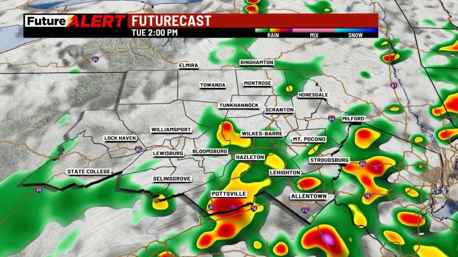
(WBRE/WYOU) — A warm front will move into the region this morning, bringing clouds and a few showers to the area. A rumble of thunder or two is possible.
It will become noticeably more humid once the front passes through. By the afternoon and evening, scattered showers and storms are expected to develop as a cold front moves from west to east. Depending on whether we see enough sunshine and instability, some storms may become strong to severe. Main threats would be downpours and damaging winds. However, a low-end/secondary threat is an isolated tornado or two. Highs near 80. A few showers and storms linger this evening before giving way to a mostly cloudy sky. Lows in the mid 60s.
An upper-level low remains over the region Wednesday with clouds and some sun. A few showers or storms are possible, but most of the day is dry. Highs near 80.
High pressure builds in Thursday and Friday with plenty of sunshine. Highs on Thursday in the upper 70s, lower 80s Friday. Saturday and Sunday look nice with a mix of clouds and sun. Highs on Saturday in the lower 80s, mid 80s Sunday. Our next chance for any showers or storms will be on Monday. Highs in the mid 80s.
You can stay current on all the latest weather alerts and track the storm using the Future Alert Interactive Radar.
Copyright 2026 Nexstar Media, Inc. All rights reserved. This material may not be published, broadcast, rewritten, or redistributed.
For the latest news, weather, sports, and streaming video, head to 28/22 News.