
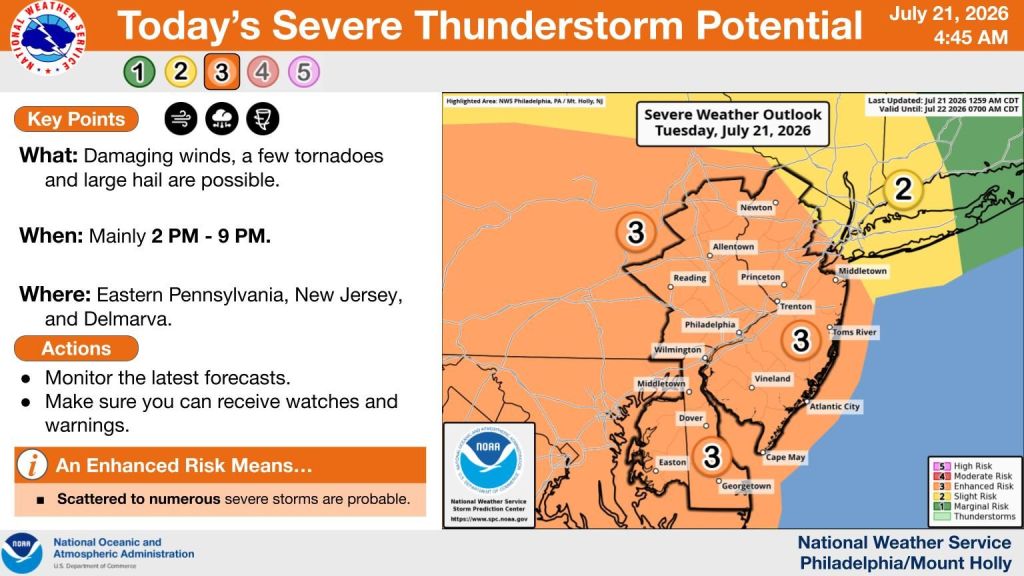
The National Weather Service said there is an enhanced risk for severe weather for the Philadelphia region Tuesday, July 21, 2026.
Eastern Pennsylvania, New Jersey and the Delmarva peninsula were listed at risk for severe thunderstorms packing damaging winds, the possibilities of tornadoes and large hail on the severe thunderstorm potential map issued at 4:45 a.m.
The risk was listed as most likely between 2. and 9 p.m. and scattered to numerous severe storms are probable, according to the forecast.
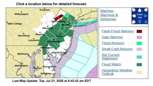 A screenshot of a National Weather Service flash flood watch map issued Tuesday morning, July 212, 2026. (MediaNews Group screenshot/NWS)
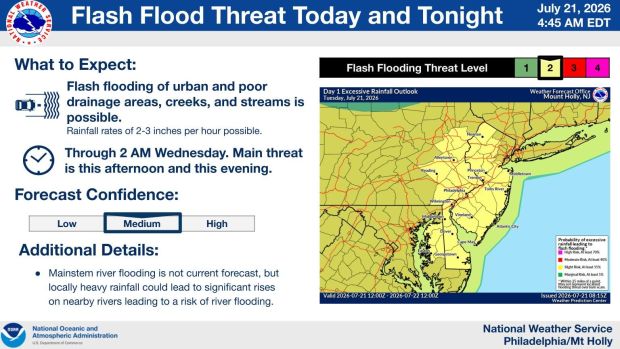 A map issued by the National Weather Service Mount Holly, N.J. office shows the risk for flash flooding for the region that is in effect from Tuesday afternoon through 2 a.m. Wednesday. (Courtesy of the National Weather Service)
There is a slight risk of flash flooding in effect from 2 p.m. Tuesday until 2 a.m. Wednesday, the National weather Service stated.
Wednesday’s risk for severe thunderstorm potential is lower than today’s, the NWS forecast said, noting 2 to 8 p.m. as the most likely times for it to occur.
“A strong upper-level trough is forecast to pivot into and across the Northeast and Mid-Atlantic later this afternoon and tonight, thenremain in place through Wednesday,” the Tuesday morning NWS forecasters’ discussion stated. “This will drive surface low pressure well to our north, however an associated warm front will lift north across our region today followed by a cold front late this afternoon and tonight.”
Make sure to monitor local alerts throughout the afternoon and evening.