
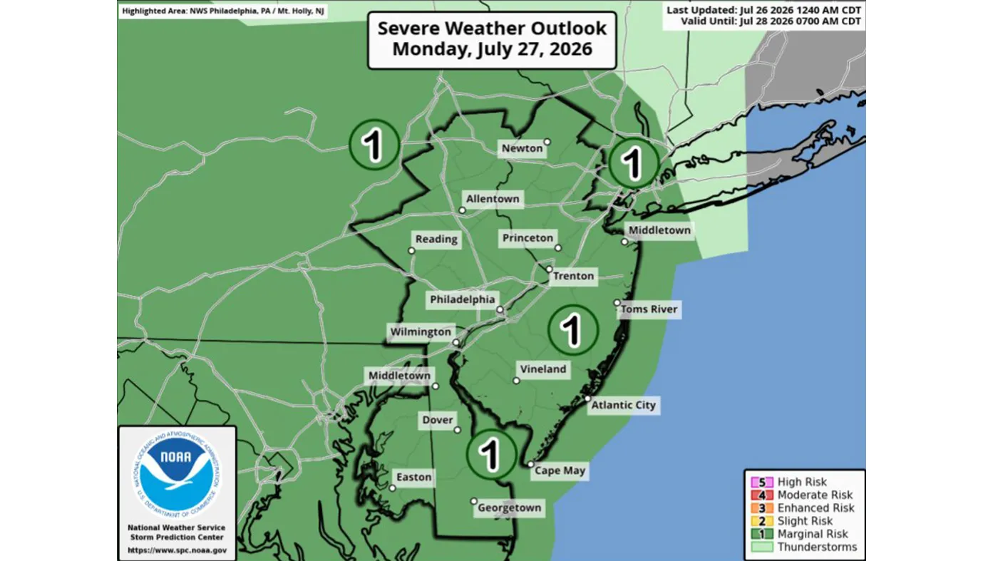
Strong storms that could bring heavy rain and flash flooding are possible Monday and Tuesday in the Lehigh Valley.
Showers and thunderstorms could develop Monday afternoon, and more widespread showers and thunderstorms are expected Tuesday, according to the National Weather Service in Mount Holly, New Jersey. The region is under a marginal risk of severe thunderstorms both days.
Additionally, there is a possibility of flooding Tuesday morning and evening. Forecasters said rainfall rates of up to 2 inches per hour are possible. Locally heavy rain could cause significant rises in rivers, which could lead to river flooding, the weather service said.
“Heavy rain leading to flash flooding could end up being a bigger concern and greater impact than the severe thunderstorm threat,” meteorologists wrote Sunday in their daily forecast discussion.
⚠️⛈️ Showers, storms, & humidity return to the area starting Mon through at least Thurs. Scattered “hit or miss” type storms Mon, with some isolated severe storms possible. Widespread showers & storms Tues, with a threat of flash flooding & severe storms. #PAwx #NJwx #DEwx #MDwx pic.twitter.com/K5tIdvtkcn
— NWS Mount Holly (@NWS_MountHolly) July 26, 2026
All of the Lehigh Valley, as well as neighboring Berks, Bucks, Carbon and Monroe counties are under a slight risk of excessive rainfall Tuesday.
Rain could continue into Wednesday, but forecasters said the threat of severe weather looks to be lower.
Any rain that falls this week will be beneficial. Most of Lehigh County is under moderate drought conditions, and most of Northampton County is under abnormally dry conditions, according to the U.S. Drought Monitor.
Lehigh County has had about 5 inches below normal rainfall over the past six months, and Northampton County has had about 4 inches below normal in that same time frame, according to weather service data.
The Pennsylvania Department of Environmental Protection has placed Lehigh County under a drought warning.
There is a chance of scattered showers Thursday and Friday. Here is the extended forecast from the National Weather Service:
Monday: Scattered showers and thunderstorms after 2 p.m. Patchy fog before 8am. Otherwise, increasing clouds, with a high near 85. Calm wind becoming southwest around 5 mph in the afternoon. Chance of precipitation is 40%. New rainfall amounts of less than a tenth of an inch, except higher amounts possible in thunderstorms.
Tuesday: Showers, with thunderstorms also possible after 11 a.m. Some of the storms could produce heavy rainfall. High near 79. South wind around 5 mph. Chance of precipitation is 90%. New rainfall amounts between three quarters and one inch possible.
Wednesday: A chance of showers, then showers likely and possibly a thunderstorm after 2 p.m. Mostly cloudy, with a high near 79. Chance of precipitation is 70%.
Thursday: A chance of showers between 8am and 2pm, then a chance of showers and thunderstorms after 2pm. Partly sunny, with a high near 81. Chance of precipitation is 30%.
Friday: Sunny, with a high near 83.
Saturday: A chance of showers. Mostly sunny, with a high near 85. Chance of precipitation is 30%.