
Unsettled weather, with a chance of flash flooding, is making its way to southeastern Pennsylvania and the Philly region this week.
“Most impactful weather likely comes on Tuesday with the highest chance for severe weather and flash flooding,” the Monday morning forecaster discussion for the Mount Holly, N.J., office of the National Weather Service stated. “Unsettled weather continues through midweek though.”
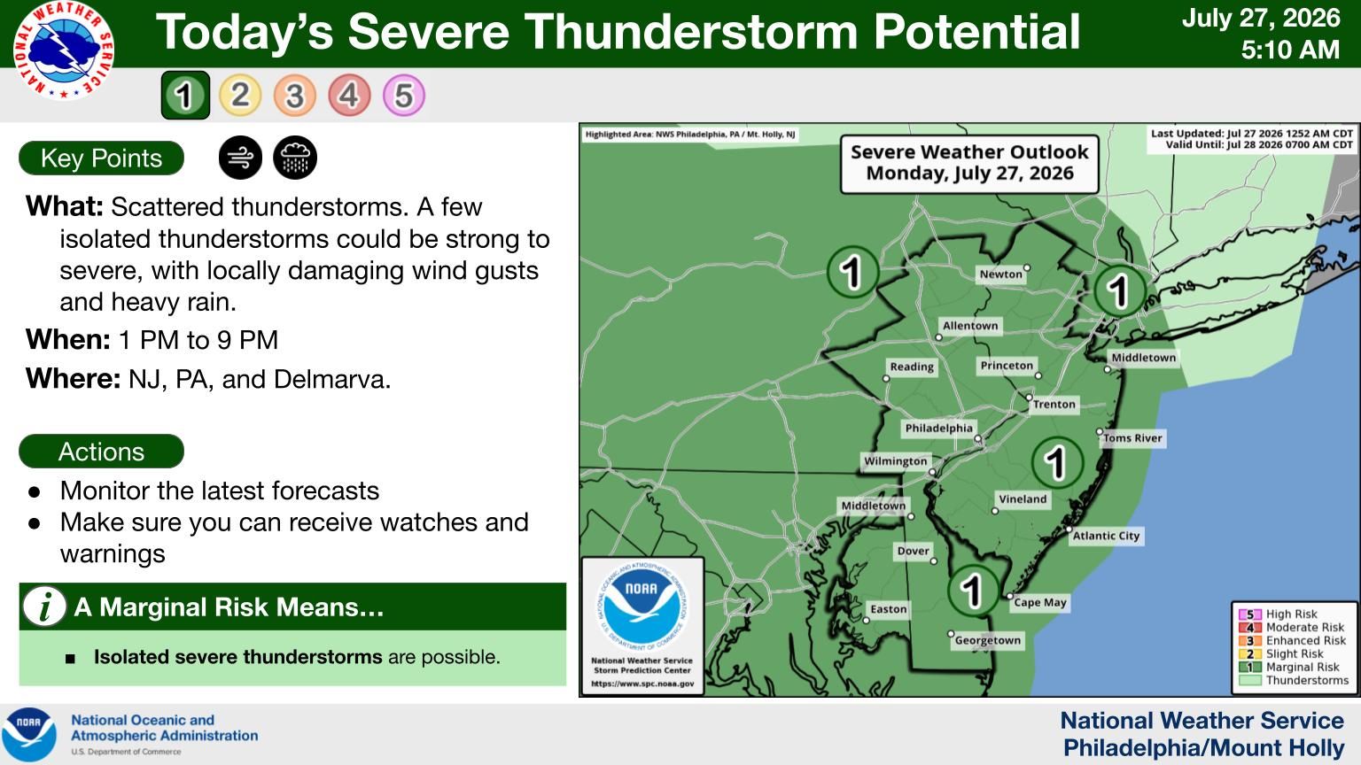
Today, the NWS predicted there will be “hit-or-miss type showers and thunderstorms developing during the afternoon hours, with a marginal risk of severe thunderstorms. Any stronger storms could produce isolated strong to marginally severe wind gusts and brief heavy downpours.”
“Tuesday looks to feature the most widespread showers and thunderstorms,” the NWS forecasters stated. “Height falls and jet dynamics aloft will favor convective development nearly all day as surface low pressure develops just to our west. This will keep a steady stream of warm, moist air pumping into the area and keeping the environment conditionally unstable despite cloud cover.”
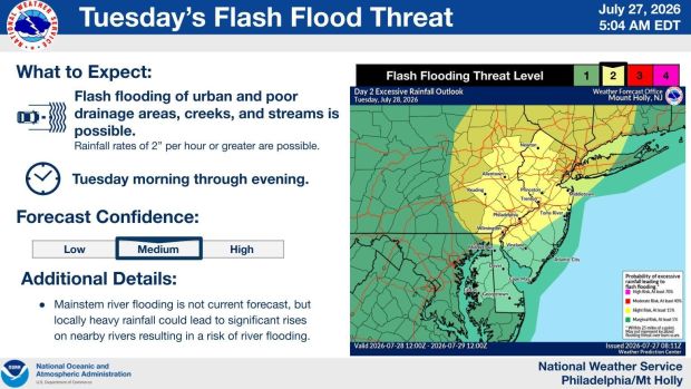 The National Weather Service map issued Monday, July 27, 2026 at 8:11 a.m. shows a slight risk for flash floods on Tuesday. (Courtesy of NWS)
There was a stark difference in rainfall amounts from Sundays’ storms throughout the region.
In the previous 48 hours, as of 11 a.m., the Fleetwood area received 2.57 inches of precipitation according to the NWS, while the Allentown area received .15 of an inch , Glenmoore received 1.86 inches, Downingtown got .92 of an inch, Brandywine Regional airport received just .05 of an inch and Chadds Ford got .4 of an inch. A tiny portion of Montgomery County received a trace of rain, while the Trenton area received none.
NWS extended forecast
Today: A chance of showers and thunderstorms, mainly after 3 p.m. Otherwise, mostly sunny, with a high near 88. Calm wind becoming west around 5 mph in the afternoon. Chance of precipitation is 30%. New rainfall amounts of less than a tenth of an inch, except higher amounts possible in thunderstorms.
Tonight: A chance of showers and thunderstorms before 11 p.m., then a slight chance of showers between 11 p.m. and 2 a.m. Patchy fog after 1 a.m. Otherwise, mostly cloudy, with a low around 68. Calm wind. Chance of precipitation is 30%. New precipitation amounts of less than a tenth of an inch, except higher amounts possible in thunderstorms.
Tuesday: Showers and thunderstorms. Patchy fog before 9 a.m. High near 81. South wind 5 to 10 mph, with gusts as high as 25 mph. Chance of precipitation is 100%. New rainfall amounts between a half and three-quarters of an inch possible.
Tuesday night: Showers and thunderstorms before 2 a.m., then a chance of showers. Low around 66. South wind around 5 mph becoming west after midnight. Winds could gust as high as 20 mph. Chance of precipitation is 80%. New rainfall amounts between a half and three-quarters of an inch possible.
Wednesday: A chance of showers before 11 a.m., then a chance of showers and thunderstorms between 11 a.m. and 2 p.m. Showers and possibly a thunderstorm after 2 p.m. High near 81. Northwest wind around 10 mph, with gusts as high as 20 mph. Chance of precipitation is 80%. New rainfall amounts between a tenth and quarter of an inch, except higher amounts possible in thunderstorms.
Wednesday night: Showers and thunderstorms before 11pm, then a chance of showers between 11 p.m. and 2 a.m. Low around 65. Chance of precipitation is 80%. New precipitation amounts of less than a tenth of an inch, except higher amounts possible in thunderstorms.
Thursday: A chance of showers after 2 p.m. Partly sunny, with a high near 82. Chance of precipitation is 30%.
Thursday night: A chance of showers before 8 p.m. Partly cloudy, with a low around 64. Chance of precipitation is 30%.
Friday: Sunny, with a high near 86.
Friday night: Partly cloudy, with a low around 65.