
Western PA: Trending drier this weekend
The unsettled pattern may relax, but more rain is on the way next week.
 PITTSBURGH —
Western Pennsylvania will catch a break from repetitive downpours this weekend. An area of rain with embedded heavy rain and storms will cross before 9 a.m. More dry hours are in our future, for now. Impact Days have been hoisted for Monday and Tuesday.
Steamy with morning rain and storms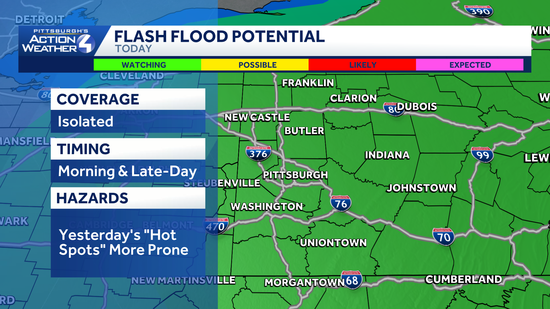
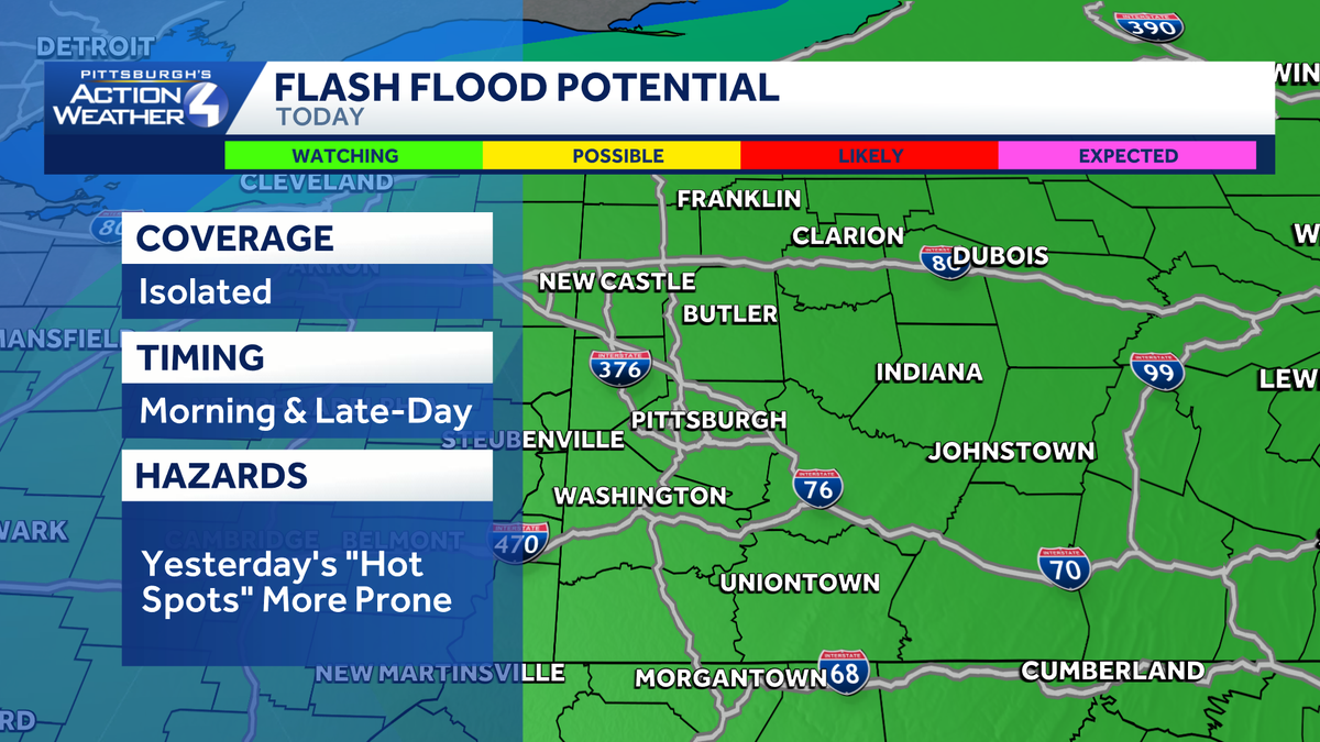
Isolated flash flooding concerns continue today, especially in areas hardest hit yesterday.
Areas of rain with embedded downpours and storms will cross the Pittsburgh area to start the day. Spots that were hit hard by flash flooding yesterday will be vulnerable to more flooding this morning. Activity should clear us by 9 a.m. An isolated downpour or storm are possible this afternoon, but the coverage and impact will be very limited.
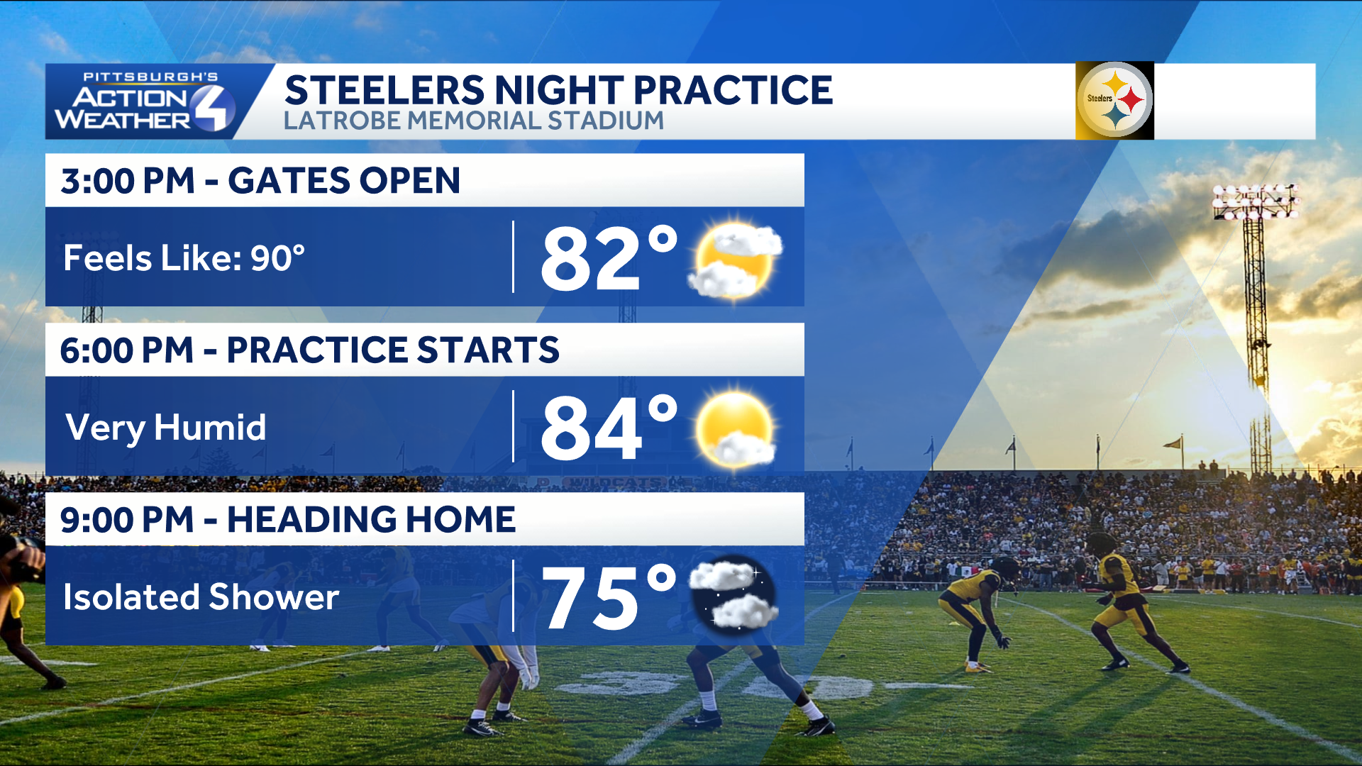
Humidity hangs high for the Steelers Night Practice in Latrobe.
Humidity hangs high this afternoon! Feels like temperatures will run in the lower 90s. A breeze will pick up to try and take move around the “sticky” air. Another round of scattered rain and storms will develop late night, likely after the Steelers Night Practice in Latrobe.

Scattered rain and a few storms will pop back up tonight.
Finally, a dry day
Sunday will begin with areas of fog. It will be the driest day that we have seen in a while. Sunshine takes over after the fog with only a slim shower chance near and south of I-70. The humidity drops slightly.
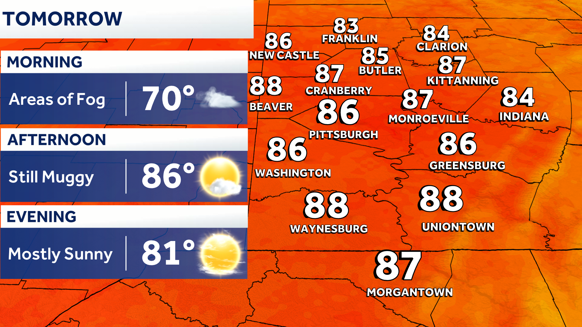
The rain and high humidity back off Sunday.
Impact Days: Monday and Tuesday
The unsettled pattern ramps back up next week with daily rain and storm chances. The best coverage will be Monday and Tuesday, which are now Impact Days. We will monitor for additional flash flooding threats and strong storms. The gusty winds could spell trouble for trees and the soggy ground. Storm chances continues through at least Thursday.
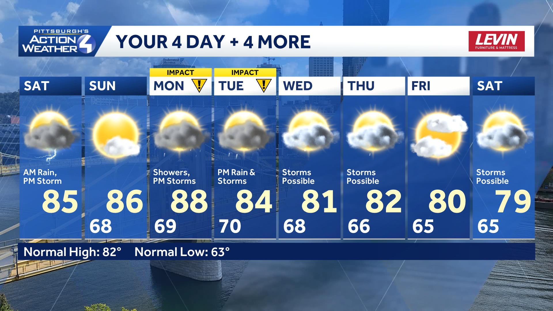
Two new Impact Days for more flash flooding and storm concerns next week.
TODAY: Morning rain and storms, steamy and breezy afternoon. High: 85°.
TONIGHT: Scattered rain and thunder late. Areas of fog by morning. Low: 68°.
SUNDAY: Areas of morning fog, mostly sunny and muggy. High: 86°, low: 69°.
MONDAY – Impact Day: Rain and storms, especially during the afternoon. High: 88°, low: 70°.
TUESDAY – Impact Day: More rain and storms. High: 84°, low: 68°.