
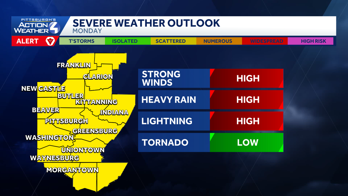
Damaging wind, flash flooding threaten western Pennsylvania with rounds of heavy rain

Days of heavy rain and thunderstorms are in the forecast through Thursday.
Days of thunderstorms and heavy rain
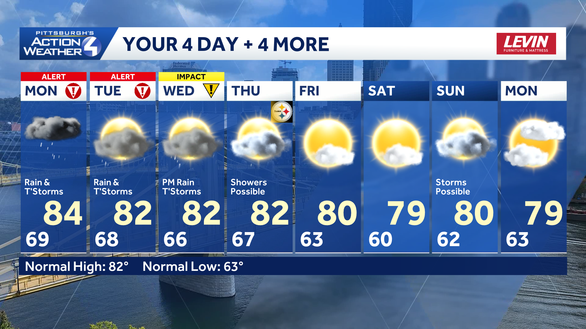
One to two inches of rain will fall, area wide, through Wednesday evening. Locally higher amounts up to four inches are possible. Flooding and severe weather threats will be on display. Monday & Tuesday are Severe Weather Alert Days; Wednesday is an Impact Day with the potential to be upgraded.
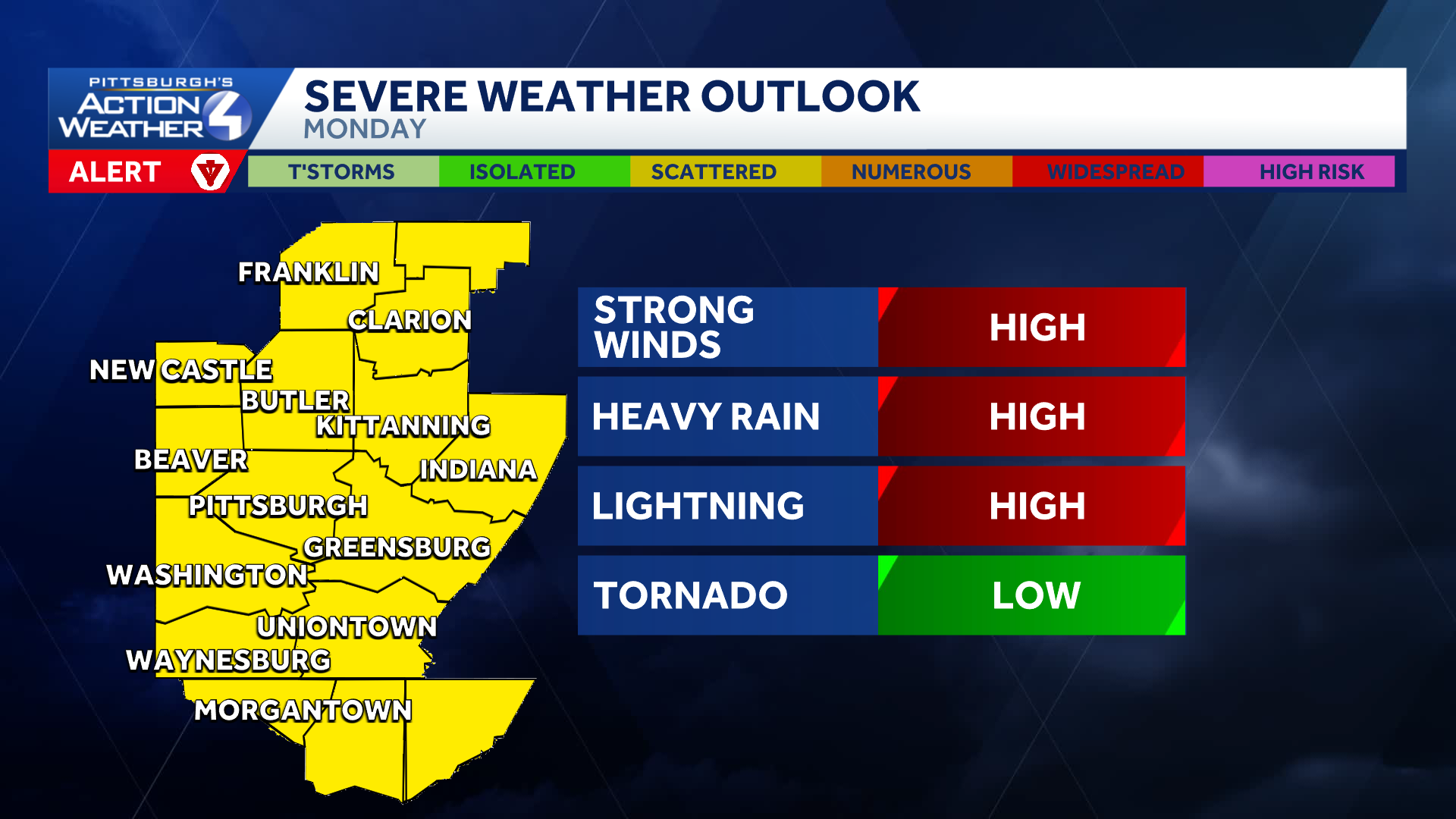 Alert & Impact Days
Another week with rounds of heavy rain and severe storms. Heavy rain and damaging wind are the primary concerns. Showers and storms expected to fire off by late morning and continue into the early afternoon. Evening storms will get more isolated in nature but still need to be aware of heavy downpours that could trigger flash flooding.
Another line of storms enters western PA, Tuesday morning, to bring a renewed threat of damaging wind and flooding. Additional storms could fire in the afternoon, but the bulk of Tuesday rain will be in the morning, making it a Severe Weather Alert Day.
 Steelers pre-season opener
Scattered variety showers and isolated t’storms will be possible on Thursday. This could mean dodging some raindrops for tailgating and the Steelers’ preseason game against the Packers.
TODAY – Severe Weather Alert Day: Sct’d rain & storms. Some severe High: 84°
TONIGHT: Isolated evening storms, mostly cloudy. Low 68°.
TUESDAY – Impact Day: Morning rain and storms. High: 82°, low: 68°.
WENDESDAY – Impact Day: Afternoon thunderstorms with heavy rain. High: 82°, low: 66°.