
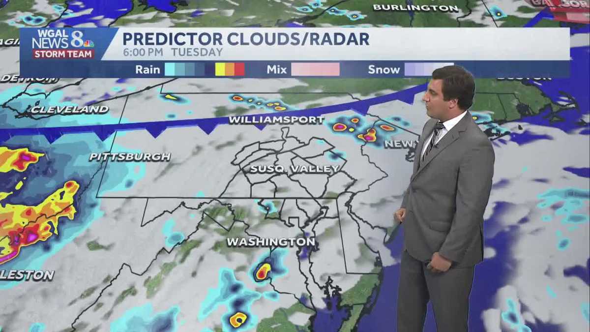
Mostly cloudy evening with stray shower or thunderstorm, scattered showers & storms overnight in south central Pennsylvania
Shower and storm chances drop each day; however, they are still possible until a cold front sweeps through Thursday evening. More comfortable weather returns to end the week.


Good evening,
Other than a stray shower or thunderstorm, this evening is looking to remain dry with partly to mostly cloudy skies. A light breeze will do little to cut through the humidity. Temperatures fall through the 70s.
RAIN & STORMS OVERNIGHT:
Tonight, another complex of thunderstorms will approach from Ohio. Scattered showers and thunderstorms are possible overnight through sunrise Wednesday. The storms have a very low chance of being severe, but because of the heavy rain threat, we have made it an Impact night. Overnight lows will drop to near 70 degrees, and patchy fog is possible.
After early morning showers and thunderstorms end, look for partly sunny skies and a stray afternoon thunderstorm Wednesday. It will still be warm and humid, with highs in the mid-80s.
A cold front will drop south Thursday, leading to a few thunderstorms. Highs will reach the mid-80s, and it will still be humid.
PLEASANT END TO WEEK
You’ll feel the drop in humidity Friday and Saturday. Dry weather is expected both days. Another cold front slowly approaches Sunday, bringing shower and storm chances during the late afternoon and evening. Storms may still be possible Monday until the front is pushing out of the area. Pleasant temperatures and lower humidity return early next week.
Have a great night!