
Pittsburgh: Impact Day Friday for morning rain
Rain should exit by lunch, then we are dry until Sunday.
 PITTSBURGH —
Another dry day for us to absorb all of the water from earlier this week. Some of us will see rain to start Friday before we dry start to the weekend. More rain and storms return on Sunday.
Impact Day Friday
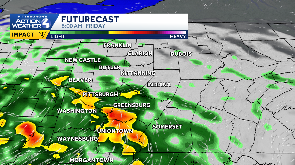
A decaying cluster of thunderstorms will approach Western PA right around sunrise Friday. The worst of the rain and storms look to pass south of our area, with a few storms possible south of Interstate 70. The northern edge of the rain should be around US 422. Rain will taper off from west to east by lunchtime with skies clearing in the afternoon. A half an inch or so is expected, which we should be able to handle thanks to a couple of dry days.
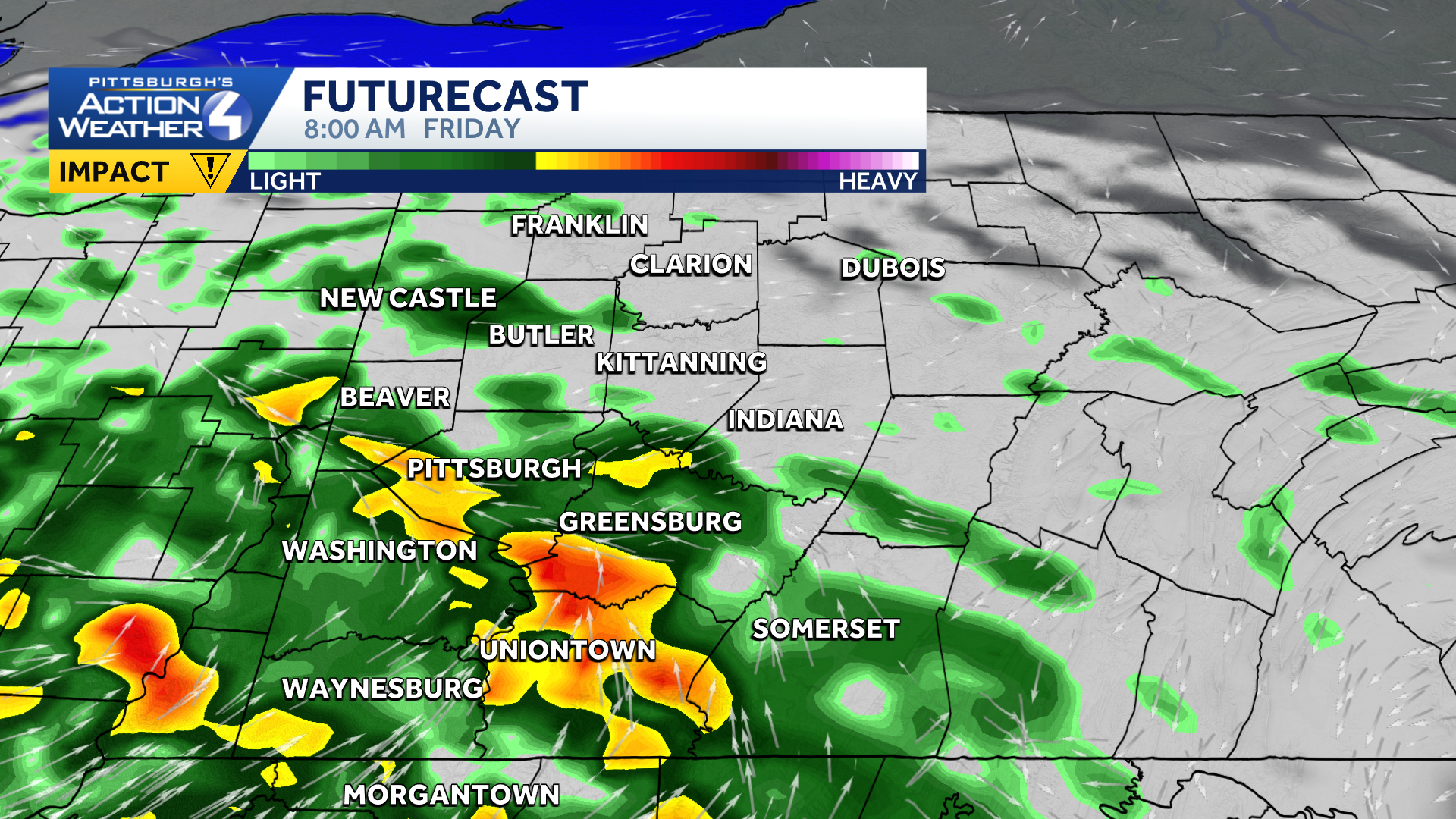
Rain will be around for the morning commute Friday, prompting an Impact Day.
Active pattern ends and humidity drops
The non-stop daily rain and storms will finally end ahead of the weekend. Humidity levels will drop too with almost a fall feel on Saturday morning. Although most of the weekend is dry, a cold front will bring rain showers and thunderstorms to the region on Sunday. Timing is still a question, and we could see multiple rounds of rain and storms, so we will continue to monitor and fine tune the forecast. We may upgrade Sunday should the forecast warrant.
Leftover showers will continue into Monday before we dry out again for the middle of next week. A cold front on Thursday may bring a few showers to the area.
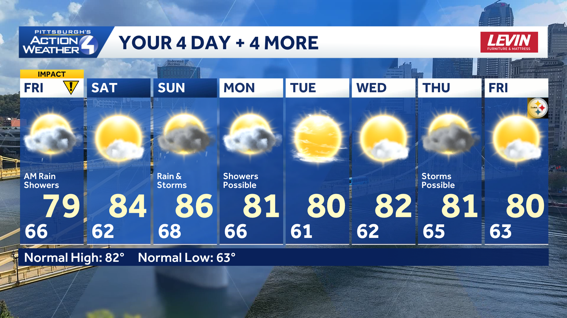
Saturday is the best day of the weekend as it is bookended by rain chances Friday and Sunday.
TONIGHT: Mostly cloudy with rain showers by sunrise. Low 66°
FRIDAY – Impact Day: Rain until midday then clearing skies. High: 79°, low: 62°.
SATURDAY: Partly cloudy. High: 84°, low: 68°.
SUNDAY: Mostly cloudy with scattered rain showers and thunderstorms. High: 86°, low: 66°.