
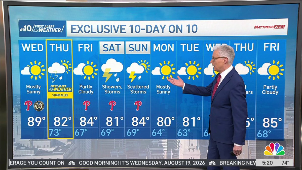
Get ready for a nice warm summer day on Wednesday with lots of sunshine.
A few pockets of fog to start with in South Jersey will quickly dissipate, and sunshine will warm us into the 80s this afternoon up to 89° for Philadelphia.
As the morning progresses the humidity will be dropping. You’ll feel the difference later on Wednesday morning into the afternoon, making for a warm but more comfortable day.
Clouds return tonight and the humidity increases, leading to a potentially stormy day Thursday.
Scattered morning showers are possible, but the heavy weather is most likely to arrive in the afternoon.
Thunderstorms could produce damaging wind and heavy rainfall leading to localized flooding during the afternoon and evening hours.
Those storms are being pushed by a cold front which swings through Thursday night, clearing the showers out and bringing us a pleasant day Friday with a high of 84°.
Chances for showers and thunderstorms return for the weekend. Saturday mostly cloudy with a high of 81° and scattered showers and thunderstorms possible, then turning partly sunny Sunday with a chance of scattered thunderstorms. High temperatures in the low 80s both days.
Pleasant weather returns for next week with highs in the low 80s and much lower humidity to begin the work week.
Get the latest weather updates by downloading the NBC10 app and following the NBC10 First Alert Weather team.