
Heat advisory tops 100 degrees as strong thunderstorms threaten Pittsburgh area

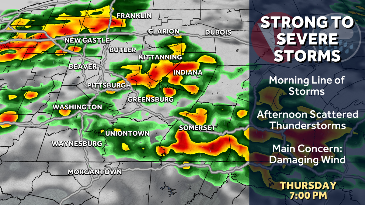
Severe Weather Alert Day today with hot and humid conditions plus the risk for severe thunderstorms. Friday is an Impact Day for more storm chances, especially before noon.
Severe Thunderstorm Warning
A Severe Thunderstorm Warnings issued for parts of Westmoreland County and Indiana County until 9 a.m.
Locations include: Greensburg, Jeannette, Latrobe, Murrysville, Irwin, McChesneytown-Loyalhanna, Blairsville, Manor, Trafford, Youngwood, Derry, Delmont, Lawson Heights, New Stanton, Ligonier, Black Lick and Calumet-Norvelt.
Severe Weather Alert Day
The best chance for strong thunderstorms will be today. A few waves of showers and storms will move across the region. Scattered strong to severe thunderstorms making it a Severe Weather Alert Day. Severe weather is possible with damaging winds, large hail, and heavy downpours.
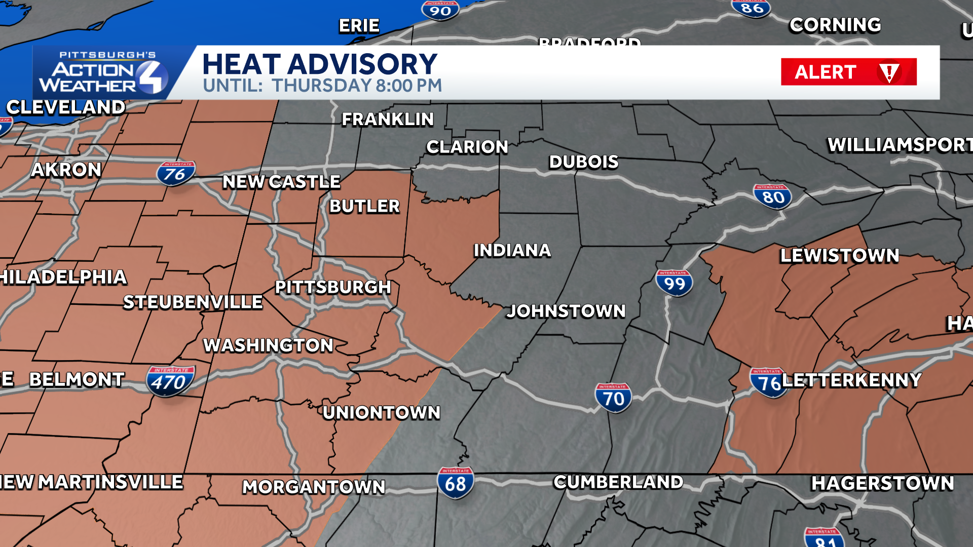
A Heat Advisory is in effect until 8 pm for Allegheny, Armstrong, Beaver, Greene, Lawrence, Washington and the lowlands of Monongalia, Fayette, and Westmoreland Counties. Heat index values could top 100 degrees.
Dry, Comfortable Labor Day Weekend
Showers and storms will likely hang through Friday, especially in the morning. The rain and storm chance makes Friday an Impact Day. Rain should end in time for high school football Friday night. Quieter weather arrives just in time for Labor Day weekend. Our area will enjoy dry and more comfortable conditions.
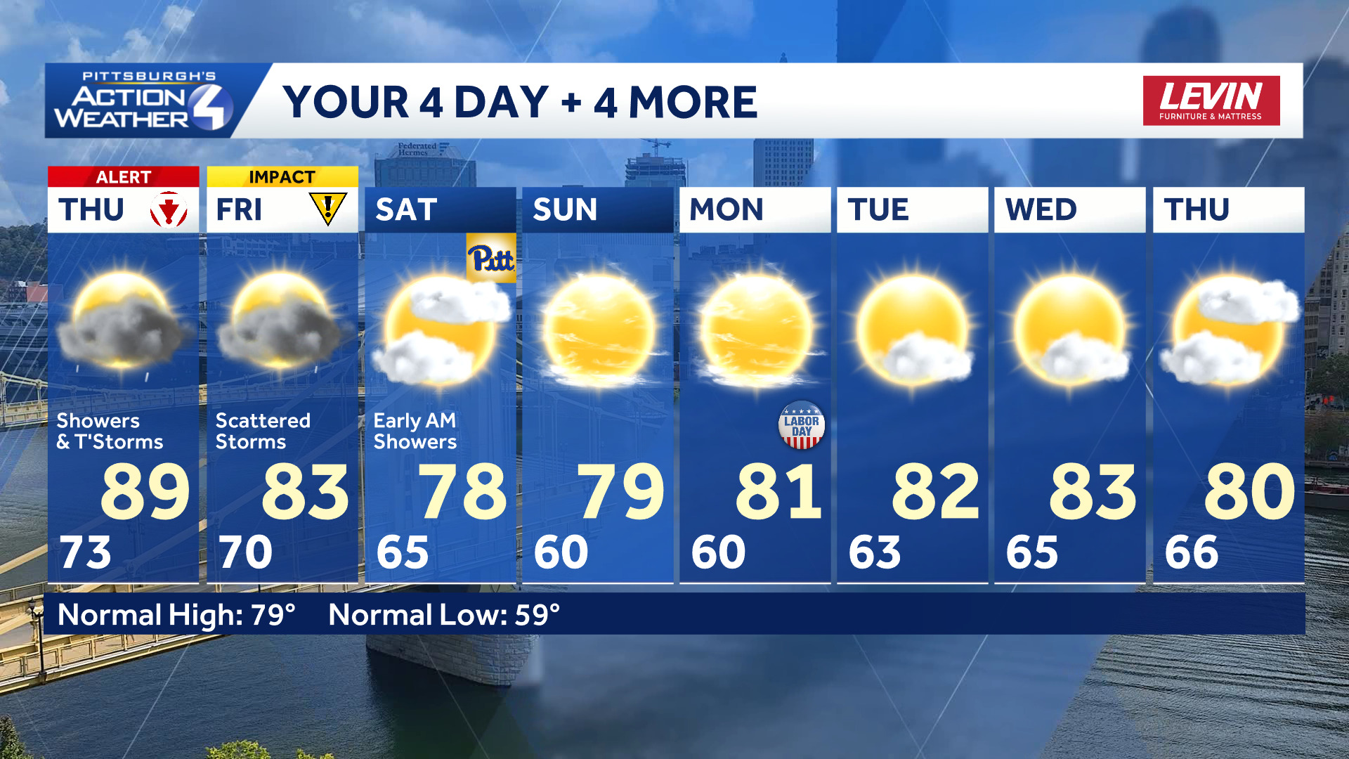
TODAY:Severe Weather Alert Day: Scattered rain and storms. High: 89°.
TONIGHT:
FRIDAY – Impact Day: Mostly cloudy with AM showers. High: 83°. low: 65°.
SATURDAY: Mostly cloudy and less humid. High: 78°, low: 60°.