
High school football games canceled as severe storms hit Western Pennsylvania
Strong storms brought heavy rainfall to the Pittsburgh region Thursday night
PITTSBURGH —
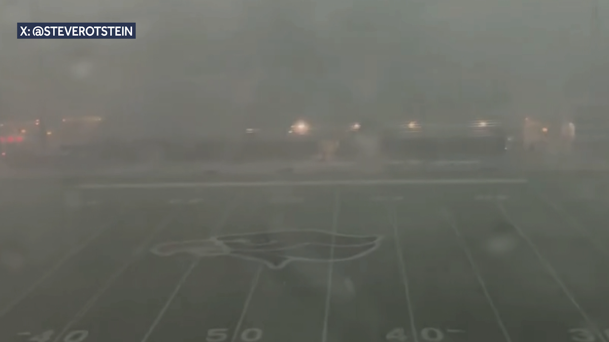
WPIAL high school football games were canceled on Thursday night as severe storms brought heavy rainfall to Western Pennsylvania.
The North Hills-Seneca Valley game at Martorelli Stadium was canceled due to the weather.
“The game is ruled as a no contest and will not be rescheduled,” said a social media post by North Hills Athletics.
Share your weather photos: Click here to upload photos to u local, or email to webstaff@wtae.com
Bethel Park was scheduled to host Moon Area in another Thursday night matchup. That contest was also canceled.
“We’ll share updates as we get them,” a Bethel Park spokesperson said.
Operation Football: See the latest high school football scores
Also canceled was the Shenango-Beaver Falls game at Geneva College on Thursday night.
Flash Flood Warning
The National Weather Service has issued a flash flood warning for counties including Allegheny, Washington, Armstrong, Butler, Beaver, Fayette, Westmoreland and Indiana on Thursday night.
Thunderstorms are producing heavy rain across the warned area. Between 1 and 2 inches of rain have fallen. Additional rainfall amounts of 0.5 to 1.5 inches are possible in the warned area. Flash flooding is ongoing or expected to begin shortly.
IMPACT…Flash flooding of small creeks and streams, urban areas, highways, streets and underpasses as well as other poor drainage and low-lying areas.
Some locations that will experience flash flooding include… Pittsburgh, Penn Hills, Mt. Lebanon, Bethel Park, Ross Township, McCandless Township, Monroeville, Moon Township, McMurray, Weirton, McKeesport, Franklin Park, Aliquippa, Canonsburg, Gastonville, Shaler Township, Plum, West Mifflin and North Side Pittsburgh.
Some locations that will experience flash flooding include… Latrobe, Homer City, Mount Pleasant, McChesneytown-Loyalhanna, Blairsville, Derry, Lawson Heights, Ligonier, Black Lick, Calumet-Norvelt, New Florence, Seward, Bolivar, Youngstown, Laurel Mountain, Armagh, Donegal, Lucerne Mines and Jacksonville.
Some locations that will experience flash flooding include… Monroeville, Greensburg, Jeannette, Vandergrift, Apollo, Murrysville, White Oak, Irwin, Manor, Trafford, Youngwood, Delmont, West Newton, New Stanton, Leechburg, North Apollo, West Leechburg and Avonmore.
Some locations that will experience flash flooding include… McCandless Township, Cranberry, Franklin Park, East Liverpool, Aliquippa, Beaver Falls, Monaca, Economy, Ellwood City, Wexford, New Brighton, Beaver, Calcutta, Baden, Zelienople, Rochester, Ohioville, Harmony Township and Seven Fields.
Some locations that will experience flash flooding include… New Castle, Columbiana, East Palestine, Lisbon, Oakwood, Leetonia, New Castle Northwest, New Waterford, Big Beaver, New Beaver, Bessemer, Koppel, Wampum, South New Castle, New Galilee, Enon Valley, Darlington and Rogers.
PRECAUTIONARY/PREPAREDNESS ACTIONS… Turn around, don’t drown when encountering flooded roads. Most flood deaths occur in vehicles.
Severe Thunderstorm Watch
A severe thunderstorm watch has been issued for counties including Allegheny, Armstrong, Beaver, Butler, Fayette, Greene, Indiana, Lawrence, Mercer, Venango, Washington and Westmoreland until 10 p.m.
Damaging winds are the top threat for the late-day round of thunderstorms.
The severe risk continues with damaging winds topping the storm threats list. Wind could gust above 70 mph especially to the northwest of Pittsburgh.
Large hail, heavy rain and a low tornado risk are also possible.