
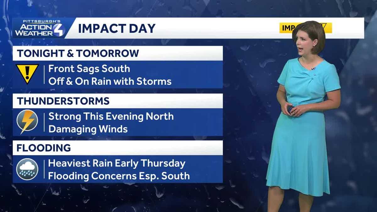
Western PA: Rain returns tonight, Impact Day Thursday
Rain with embedded storms will work from north to south.
 PITTSBURGH —
Heat and humidity this afternoon will be followed by rain and storms overnight. Tomorrow is an Impact Day with off and on rain that could lead to flooding concerns. Comfortable conditions will return ahead of the weekend.
Summer feeling returns today
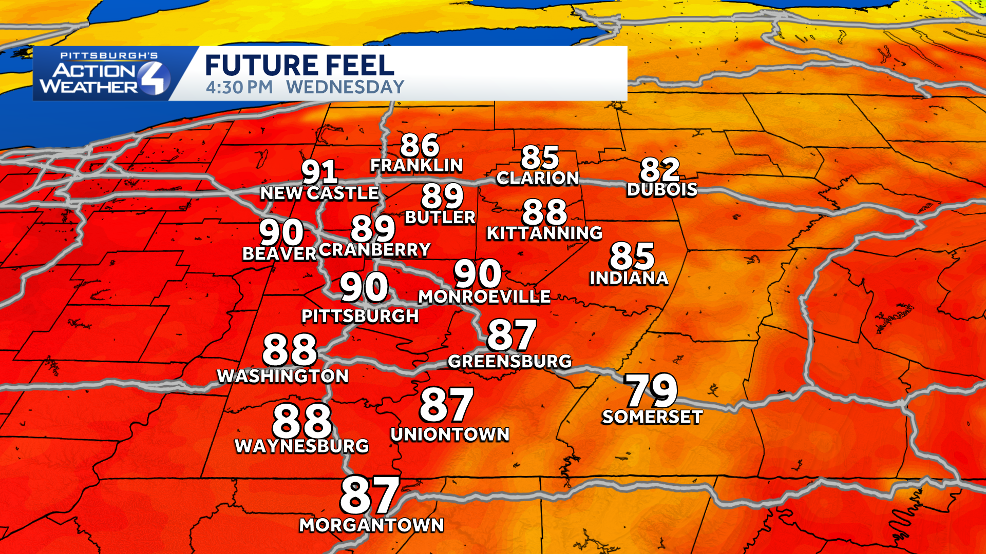
Temperatures will be on the toasty side this afternoon with highs in the low to mid 80s. Humidity levels tick higher too, which will make it feel like the lower 90s. Skies will feature a mix of sunshine and clouds over western Pennsylvania.
Hearst OwnedHearst
Feeling like 90 degrees this afternoon around western PA.
Rain returns tonight, Impact Day Thursday
Hearst OwnedHearst
A band of rain with embedded strong thunderstorms show up after dark for areas to the north.
A cold front will drop through the region, tonight and Thursday. The majority of the rain will likely hold off until closer to midnight. A few stronger thunderstorms possible north of Pittsburgh.
Hearst OwnedHearst
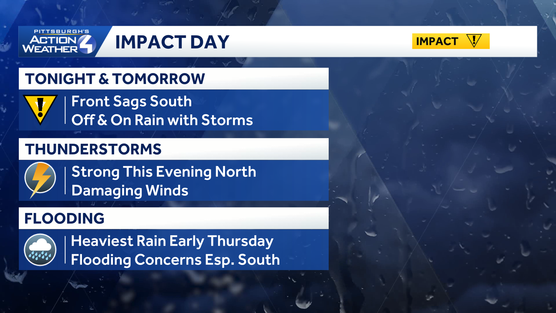
Thursday’s Impact Day is for off and on rain, which could lead to flooding concerns.
Thursday is an Impact Day with periods of rain and the potential for storms. At this point, no widespread severe weather is expected. Any storm that does develop will have the potential to produce gusty winds and heavy rain. The front will slowly work from north to south and clear late Thursday into Friday morning. By the time we are done, many of us will see over an inch of rain, which could lead to flooding problems.
Mainly dry weekend
Friday will be a comfortable day with more sunshine. The forecast looks great for a busy weekend of football around Western PA with games for high schools, Pitt, and the Steelers on deck. The only bump in the road is the possibility of a few light showers Saturday afternoon. Otherwise, the majority of the weekend will be dry.
Hearst OwnedHearst
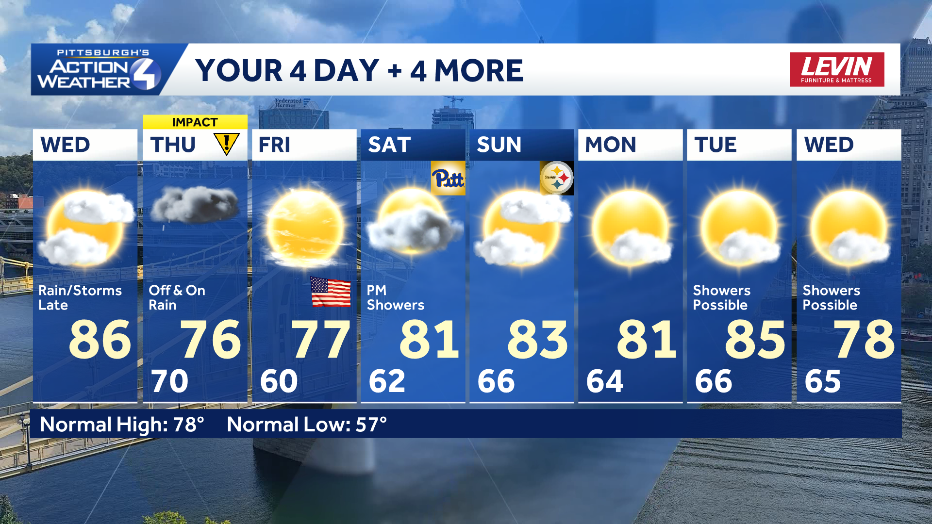
Temperatures trend above average into next week.
TODAY: Increasing clouds, breezy and warm. Feels like temperatures around 90° High: 86°.
TONIGHT: Rain and storms drop south, low: 70°.
THURSDAY – Impact Day: Periods of rain, heavy at times with storms possible. High: 76°, low: 60°.
FRIDAY: Turning mostly sunny and more comfortable. High: 77°, low: 62°.
SATURDAY: Partly cloudy with a few afternoon showers possible. High: 82°, low: 66°.