
SHORT TERM FORECAST
TONIGHT: Mostly cloudy, warmer, and muggy with a few showers or a thundershower, mostly after midnight. Low: 70
THURSDAY: Clouds and a spotty shower early…then partly sunny; warm and humid with a spotty thundershower late, especially south of the Lehigh Valley. High: 84
THURSDAY NIGHT: Partly to mostly cloudy with a spotty shower; turning less humid overnight. Low: 61
FORECAST SUMMARY
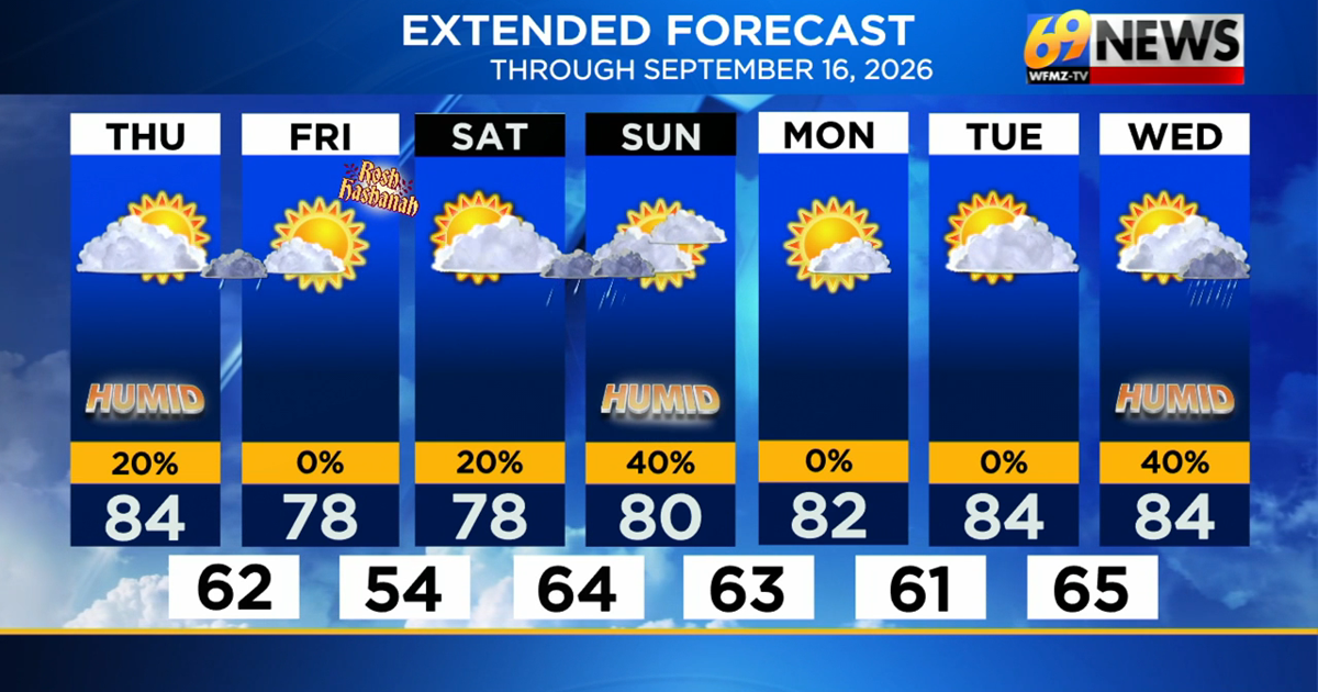
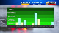
It was a warm and more humid Wednesday, and while some patchy midday clouds and even a few brief showers traveled along the Blue Mountain ridge, most of the day was dry. An approaching cold front will bring a slightly better chance for a few scattered showers area-wide tonight, most likely after midnight through around sunrise Thursday morning. Thursday’s forecast has dried out and brightened up a bit, with just a spotty morning shower early in the day, a late-day or overnight shower, especially south of the I-78 corridor, and some sunshine, 80-85° highs, and a mostly dry day in between. Friday continues to look to be the pick day of the forecast, with plenty of sunshine, lower humidity, and comfortably warm highs in the upper 70s. For the weekend, Saturday looks mostly dry, but with sunshine giving way to increasing clouds and some showers perhaps knocking on our door by evening. The best chance of weekend rain will be Saturday night, and even then, it will be some light rain, but showers that could spill over into early Sunday morning. We’ll dry out later Sunday and perhaps clear out, before more appreciable sunshine and warmer temperatures return by early next week.

DETAILED FORECAST
TONIGHT
Expect a mostly cloudy and much warmer and muggier night than recent cool and comfier ones. As a cold front approaches, a weakening area of scattered showers will likely slide through after midnight and wrap up around sunrise. Not everyone gets wet, and if you do, it’s most likely a shower or rumble of thunder, and a few hundredths of an inch of rain. Lows will be near 70 degrees, thanks to the high humidity.
THURSDAY
A cold front will slowly cross our area on Thursday, with a warm and still humid day out ahead of it, before humidity levels steadily drop in its wake Thursday night. While we probably wake up to some lingering clouds and maybe a sunrise scattered shower, the forecast has turned brighter and drier overall for the day. Skies should become partly sunny, with highs in the low to mid 80s and a mostly dry day. That being said, a shower or thundershower is possible later Thursday or even more likely Thursday night as the cold front comes through, with areas south of I-78 more favored for any shower or thundershower activity, and again, only light rainfall totals expected.
FRIDAY
Friday looks to be the nicest day of the forecast, and be quite similar to the sun-sational Labor Day Monday we enjoyed to start the week. Look for mostly sunny skies, lower humidity levels, and comfortably warm highs in the upper 70s. A mostly clear and calm night will lead to a return of the cool and comfy sleeping weather, with overnight lows back down into the mid 50s for the comfortable encore.
SATURDAY
Saturday looks to be the better of the two weekend days (not that Sunday is all bad). We’ll start with sunshine, and likely see increasing clouds as the day progresses. Highs will again be in the upper 70s with low humidity and light winds, and the daytime hours are mostly dry. Showers are likely to overspread the area sometime Saturday evening or overnight, with mostly light rain expected.
SATURDAY NIGHT AND SUNDAY
A weak area of low pressure will ripple along a front stalled to our south, giving us a cloudier middle part of the weekend. Expect mostly cloudy skies Saturday night with some occasional mostly light rain showers, and those showers could spill over into early Sunday morning. Rainfall amounts look mostly light but widespread, and a few tenths of an inch of light rain will be possible. Sunday should at least dry out by late morning to afternoon, although clouds could be a little slow to break. More appreciable clearing occurs Sunday night into early next week. Sunday’s highs will be around 80 degrees, and it will be a noticeably more humid day as well.
EARLY NEXT WEEK
Monday and Tuesday look to be some fairly nice days to start the last full week of summer, with partly to mostly sunny skies, lower humidity, and seasonably warm highs around 80-85°. Rain chances look to return towards the middle and especially end of next week.
TRACK THE WEATHER:
LINKS: HOUR BY HOUR | RADAR | TRAFFIC