
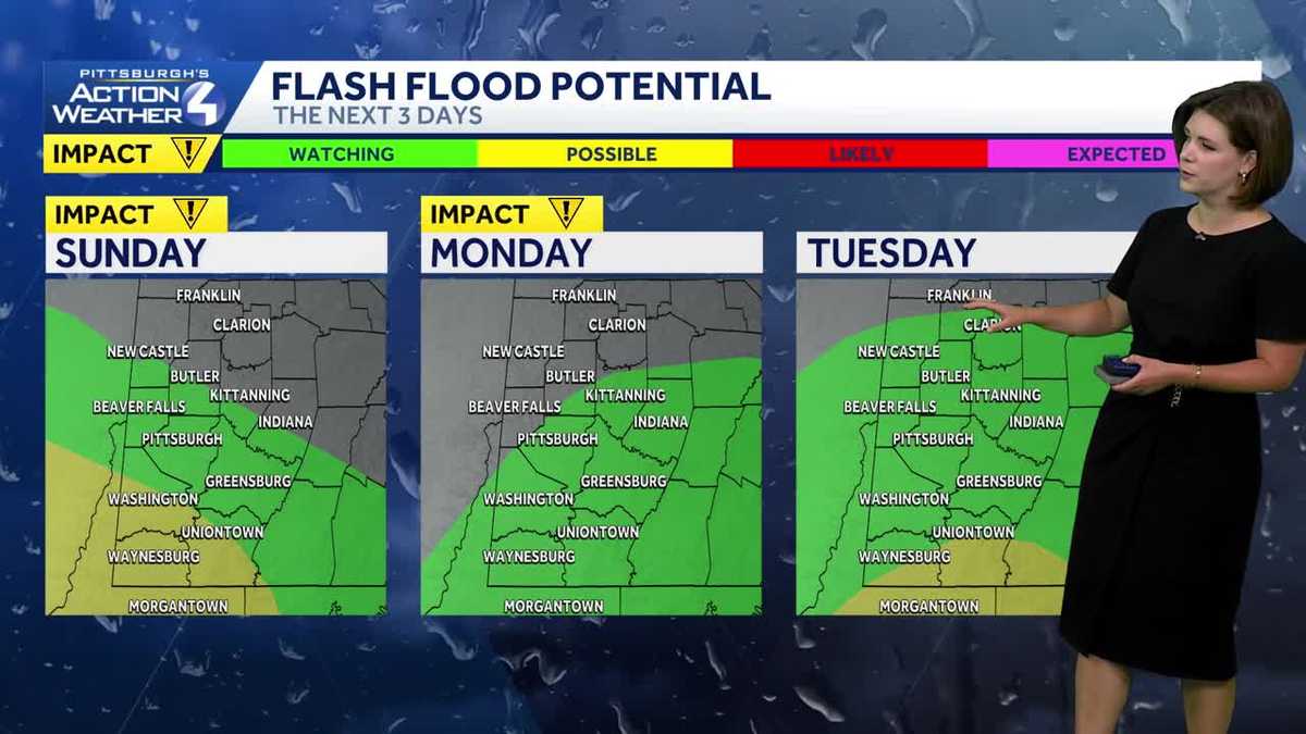
Flood Warning, Flood Watch issued for much of Western Pennsylvania
This is the beginning of a soggy week.

Periods of rain will continue through mid-afternoon for western Pennsylvania. The axis of heaviest rain will set up near the I-70 corridor. It’s back-to-back Impact Days now to kick off the new week.
Flood Warning
Southwestern Allegheny County and Central Washington County are under a Flood Warning until 4 p.m.
Flooding at rivers, creeks, streams, and other low-lying and flood-prone locations is imminent or occurring.
Flood Watch
A flood watch is in effect through most of Western Pennsylvania through Monday morning.
The following counties are under a Flood Watch: Allegheny, Beaver, Fayette, Greene, Higher Elevations of Fayette, Higher Elevations of Westmoreland, Washington and Westmoreland.
Impact Days for periods of rain through Monday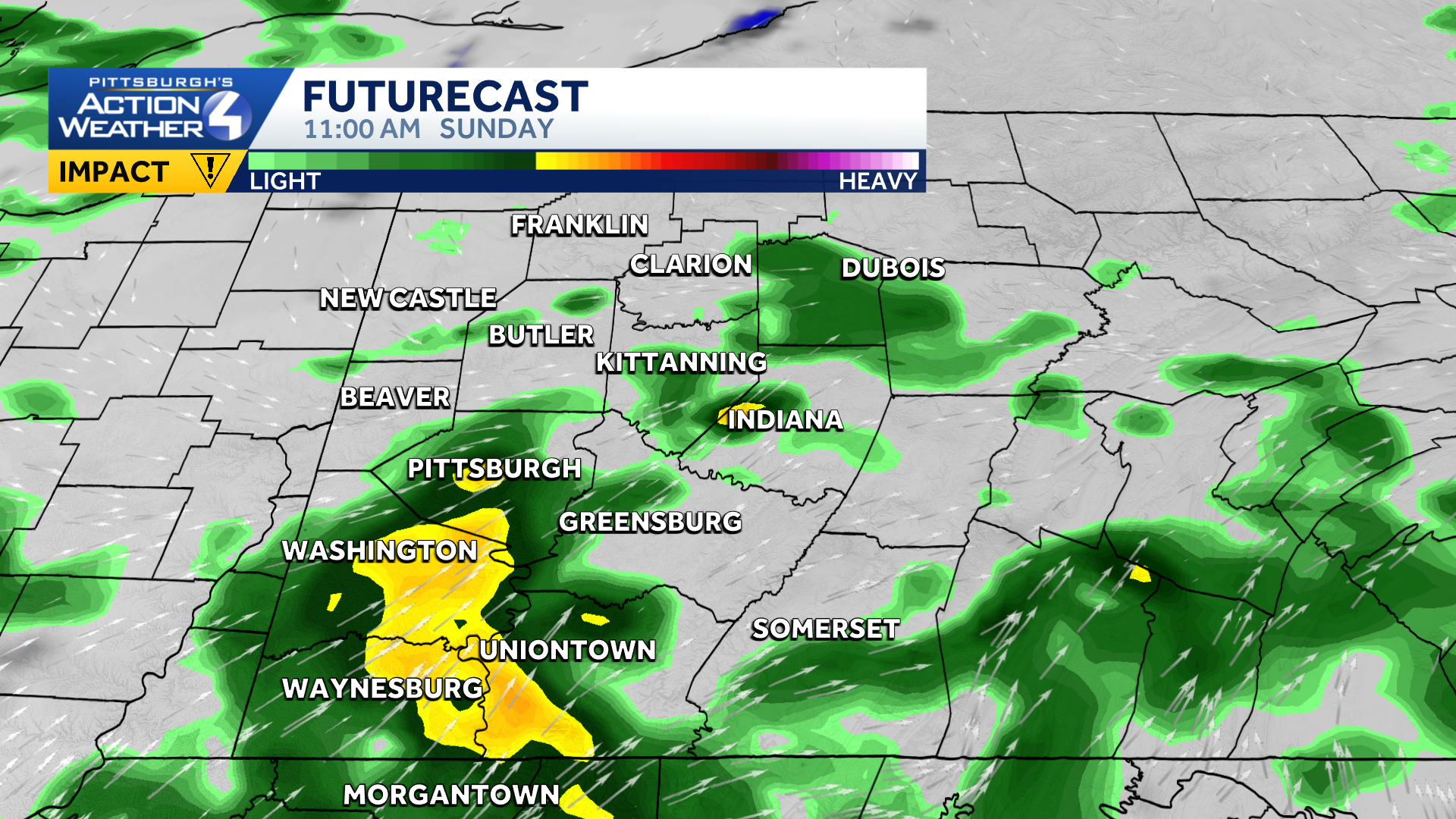
Hearst OwnedHearst
Heavy rain will continue through mid-day.
Today and tomorrow are Impact Days for periods of rain. The wet weather will stretch through mid-afternoon today. This evening will trend drier, and we may be able to drop the Impact Day. We will have to watch areas south of Pittsburgh for flooding. Rounds of heavy rain will hit these spots.
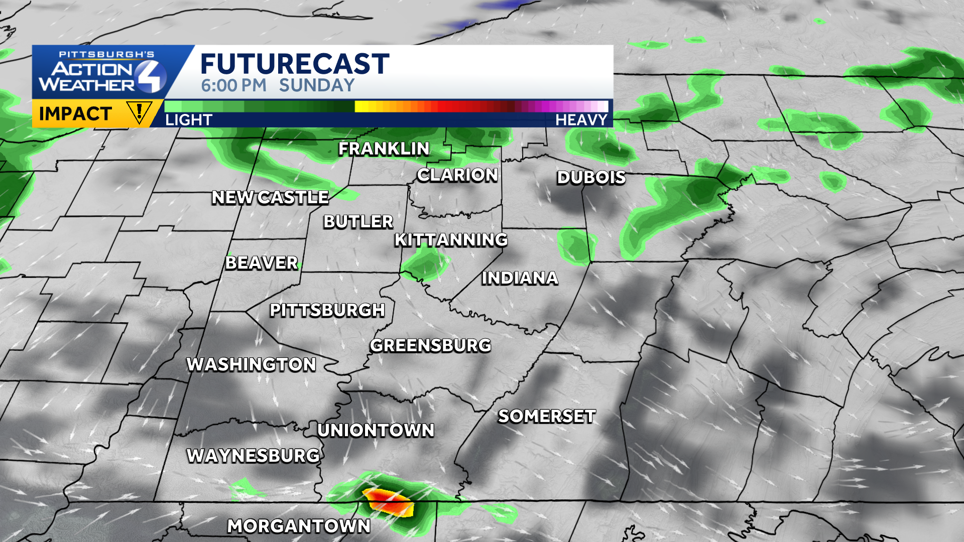
Hearst OwnedHearst
The Impact Day could be dropped once scattered showers taper off this evening.
Rain will return late tonight. Monday is now an Impact Day for two main waves of rain: one in the morning and another arriving by the evening. Rain showers will linger into Tuesday.
Fall air arrives
Along with a soggy set up, we are tracking the arrival of fall air this week. And it’s just in time for the first day of fall on Tuesday. Our highs will likely stay in the 60s until next weekend with some of us potentially staying in the 50s for highs by midweek. Wednesday will be the “chilliest” day.
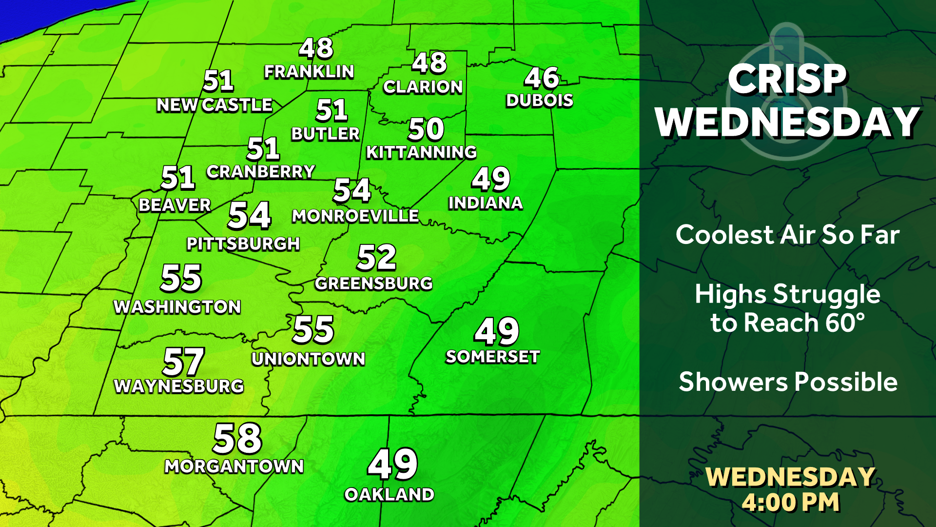
Hearst OwnedHearst
The last time Pittsburgh didn’t make it out of the 60s was in early May.
Drying out by the weekend
This week’s rain totals could be in the range of 1.5″ to 3″. Flash and river flooding are possible with this amount of rain coming our way. Areas south of Pittsburgh will deal with the brunt of the heavy rainfall. The outlook is drier starting on Thursday and through next weekend.

Hearst OwnedHearst
The rain may dry up, but the fall air will stick around through the end of the week.
TODAY – Impact Day: Rain, heavy at times. High: 72°,
TONIGHT: Rain returns overnight, low: 57°.
MONDAY – Impact Day: More rain in the morning and again late. Cloudy, breezy and cooler. High: 63°, low: 56°.
TUESDAY: Feeling like fall with rain showers. High: 62°, low: 54°.