
SHORT TERM FORECAST
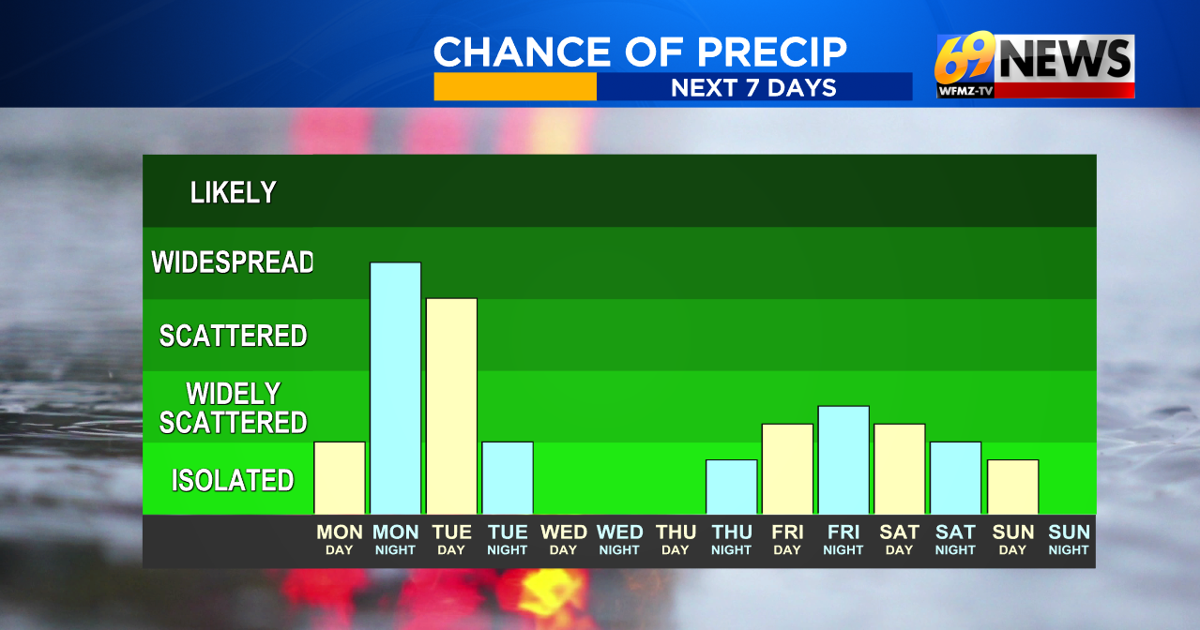
TONIGHT: Mainly cloudy with rain showers developing overnight. Low: 50
TUESDAY: Cloudy, brisk, and cool with morning rain showers ending; a drier afternoon. High: 61
TUESDAY NIGHT: Mostly cloudy, brisk, and cool. Low: 48

FORECAST SUMMARY
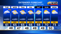
The countdown to fall has just about reached its end, as autumn officially arrives Tuesday evening at 8:05pm with the arrival of the autumnal equinox. But it seems a fall-ish feel has arrived early a few days early weather-wise, as highs dropped from the low to mid 80s late last week to around 70 degrees the last few days, with even cooler weather to come this week. For the rest of the week, the main players on the weather playing field will be a strong area of cool high pressure over eastern Canada, and a few areas of low pressure to our south across the lower Mid-Atlantic and off the East Coast. The first low pressure will pass by to our south over the next 24 hours, with some rain/rain showers overnight into Tuesday. But as that high pressure noses in from the north, drier air will nose in too, meaning the wettest weather and highest rainfall totals will be farther south through Pennsylvania and New Jersey. Then we’ll all dry out as the high pressure wins out Wednesday and Thursday, and perhaps beyond that as well. However, by the end of the week, low pressure number two will evolve into a stronger coastal storm/Nor’easter, but likely be well off the East Coast. The current projected path would keep most of the wet weather along the immediate coast (NJ/DE) and over eastern New England, but this should be watched to see how it actually evolves. While it will be breezy all week with east to northeast winds funneling in between our high and lows and it will therefore be cool due to the ocean breeze, it may end up mostly dry after Tuesday for much of the area, save the immediate coast. Highs will mostly be in the 60s to near 70 degrees, cooler than our average high for late September, which should still be in the mid 70s.
DETAILED FORECAST
TONIGHT
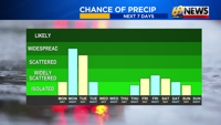
Expect a mainly cloudy night with another area of rain/rain showers sliding in from the west overnight. High pressure and drier air will be pushing down from the north, so the steadiest rain will be forced south, with it being wetter the farther south from I-78 that you travel. The Poconos and far northwestern New Jersey will be the driest, with perhaps just a few showers possible if any, especially north of the I-80 corridor. Meanwhile, areas south and west of the Lehigh Valley could pick up ¼ to a ½ inch of rain through Tuesday morning. Overnight lows will be on the cool side and around 50 degrees, with some 40s in the higher elevations.
TUESDAY
That drier air pushing in from the north should win out as the day progresses on Tuesday, forcing any morning showers or light rain farther south, and the day to dry out as it goes. So while the day may be mostly dry in the Poconos and North Jersey, any morning rain along and especially south of I-78 should come to an end from north to south as the high pressure presses more strongly. Highs will only be in the low 60s, with a brisk northeast wind around 10-15mph with gusts to 20mph adding to the cool feel of the equinox. Don’t forget…summer officially ends Tuesday evening with the fall equinox, officially here at 8:05pm. And it will sure feel like fall for the transition!
WEDNESDAY AND THURSDAY
For the middle of this week, the themes look to be cool, breezy, but mostly dry as our Canadian high pressure wins the battle, at least for now. Look for clouds, some intervals of sunshine, an occasionally brisk east to northeast breeze (10-15mph sustained, gusting 20-30mph), and unseasonably cool temps. Average highs for early fall should be in the mid 70s, and we’ll likely be in the mid to upper 60s. But it does look drier than it once looked for this time period, as that high flexes its muscle and suppresses any rain chances farther to our south and east through the midweek stretch.
FRIDAY INTO THE WEEKEND
All eyes will be off the East Coast for late this week and into the first weekend of fall. Our high pressure will still be in stubbornly fixed in place over eastern Canada, while a low pressure strengthens into a Nor’easter well off the East Coast. The track looks far enough offshore to limit most impacts in the heart of our area, with some waves, winds, and tidal flooding along the Mid-Atlantic coast. However, the storm “could” try to hook back just far enough west when it gets southeast of New England to spread some fringe clouds or showers our way Friday into Saturday. Either way, it looks cool and breezy, as it does all
TRACK THE WEATHER:
LINKS: HOUR BY HOUR | RADAR | TRAFFIC