
After an unseasonably warm day Saturday with high temperatures in the upper 60s with plenty of sunshine conditions begin to change Sunday before a significant drop in temperatures arrives for next week.
Our Sunday will start with sunshine mixed with a few areas of patchy dense fog. As the fog dissipates it’ll be replaced with increasing clouds and even a few stray showers along the I-95 corridor through midday. That rain will clear out through early this afternoon with a few peeks of sunshine possible.

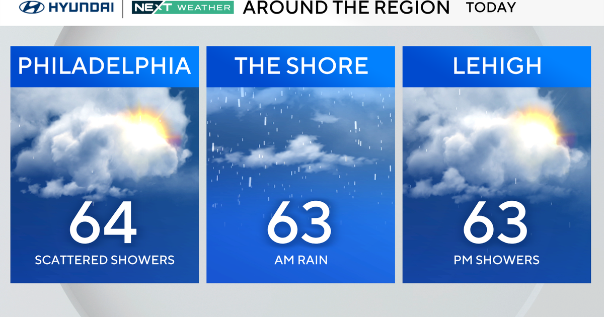
In the meantime, thanks to a southerly flow ahead of an approaching cold front, temperatures will warm into the middle 60s this afternoon despite mostly cloudy skies. Showers ahead of that front will return to the region going into this evening and continue to move through the area overnight.
Temperatures tonight will remain relatively mild with lows in the upper 40s. Skies will also remain mostly cloudy Monday as cooler air starts to push in from the northwest. While temperatures start near 50 degrees Monday morning, they will only warm three to five degrees with highs in the middle 50s.

As the cooler air rushes into the region the winds will begin to increase going into Monday night. Temperatures will drop into the low 30s and upper 20s Tuesday morning, but because of the wind it’ll feel more like the low-middle 20s to start Tuesday morning.
This cold northwesterly winds will produce some lake-effect snow which could carry a few snowflakes into the Poconos and northern Lehigh Valley through midday Tuesday. Otherwise, conditions will remain blustery into Tuesday afternoon with high temperatures only in the middle 40s.
Temperatures will rebound back into the low 50s through the second half of the week, which while warmer than Tuesday, will remain cooler than normal through next weekend. The normal high temperature for the middle of November is 59 degrees.
Here’s your 7-day forecast:

Sunday: A few showers. 64 degrees
Monday: Turning colder. High 53, Low 48
Tuesday: Chill arrives. High 44, Low 31
Wednesday: Much milder. High 54, Low 35
Thursday: Mostly sunny. High 54, Low 42
Friday: Partly cloudy. High 53, Low 38
Saturday: Mostly sunny. High 52, Low 35