
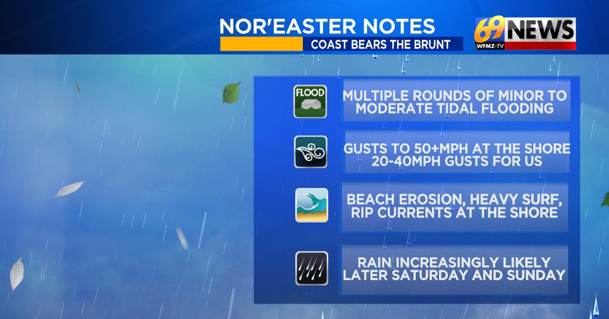
It’s the first week of fall, and already, we’re tracking the development of the first nor’easter of the season. It’s a complex setup, as the storm will move up the coast but fairly far off the coast, before turning left and backing in towards the shore over the weekend. It will also pass over the warm Gulf Stream waters of the western Atlantic, and while it should be a nor’easter, it could try to take on a few tropical characteristics as well. At this time, though, it’s not expected to become tropical in nature, and it doesn’t matter as the expected impacts would likely be roughly the same.
So what are those expected impacts? And what remains uncertain? Here’s our weather team’s latest thoughts:
DRY THROUGH FRIDAY
INCREASING RAIN CHANCES THIS WEEKEND
As our storm backs in west towards the coast, our rain chances seem to be increasing for the weekend, especially the second half of the weekend.
Right now, it looks like Saturday could start dry, but rain chances will rise from east to west later Saturday, and especially Saturday night.
Sunday looks to have occasional rain, which will be steadier and heavier points east and closer to the shore.
Rainfall amounts are still highly uncertain, except for the rule that the coast looks to get the most, then rainfall amounts will taper off the farther west/inland you travel.
For now, it looks like several inches of rain is possible in New Jersey, highest along the shore. Up to 1″ of rain is possible in far eastern Pennsylvania, then amounts will diminish points west into central PA.

BREEZY FOR US…BUT DESTRUCTIVE WINDS ARE NOT EXPECTED
We’ve had a northeast breeze that’s been brisk all week, 10- 15 mph sustained, gusting 25- 35 mph. We’ll have that again on Friday.
For the weekend, northeast breezes continue, with similar gusts. Peak gusts could creep up to 35- 40 mph, but aren’t expected to reach levels where power outages or tree damage are a concern.
Winds linger through Saturday and Sunday, and finally diminish Monday as our storm weakens and slips away.
COAST GETS THE MOST…AND BEARS THE BRUNT
This idea remains the same; the strongest winds and the heaviest rain will be along the shore. Winds could gust 40- 60 mph at the beaches and on the barrier islands, and rainfall of several inches appears possible.
Multiple rounds of tidal flooding (widespread minor to moderate, possible major) will impact flood-prone areas along the barrier islands and back bays.
Beach erosion, heavy surf, and rip currents will all be additional extended concerns for all coastal communities.
COMPLICATED SETUP…SO FORECAST CAN CHANGE
Could the storm become “a little tropical”? Where will the storm stall, or bend west, and how close to the coast will it get? Will it do a loop off the coast, and if so, where? Finally, how strong will the storm get, and how low of a low pressure be?
The answers to all of the above questions will dictate just how far west the storm gets, and how much rain can spread inland.
The moral: For us, it’s a cool and breezy weekend regardless. But is it cool, breezy, and dry, a little wet, or very wet? That is still uncertain, though rain chances have increased over the last few days. The shore will definitely have the most impactful part of this first of the season nor’easter.
TRACK THE WEATHER:
LINKS: HOUR BY HOUR | RADAR | TRAFFIC