
TODAY: Partly sunny and breezy. High: 71
TONIGHT: Partly to mostly cloudy; brisk and cool. Low: 52
SATURDAY: Breezy with some sun, then clouds; showers arrive late afternoon/evening. High: 68 Low: 53
THE BIG PICTURE
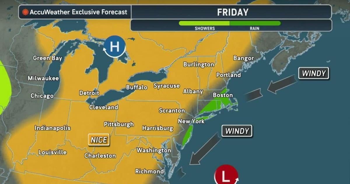
The cool, brisk and mostly sunny start to fall continued on Thursday, with conditions similar to what we saw Wednesday. We’ll do it again Friday, with a brisk northeast breeze back for another day, and at least a mix of clouds and sunshine to round out the week. Highs will inch up a bit compared to the mid to upper 60s we’ve seen the past three days, as we should sneak just past the 70° mark Friday afternoon. For the weekend, all eyes are on the East Coast, or more specifically, a stronger storm that will be moving up the East Coast, and then perhaps backing in a bit towards it. It’s true that the beaches and immediate coast from the Mid-Atlantic to New England will bear the brunt of this storm, from multiple rounds of significant tidal flooding to heavy surf and beach erosion and rip currents, and possibly strong wind gusts and heavy rain as well. For us farther inland, the impacts will be more muted, but northeast winds could still gust 25-35mph over the weekend, and some rain is possible Saturday into Sunday, making for a brisk and wet first weekend of fall. Just how much rain will depend on how close to the coast our nor’easter decides to tuck in, but around 1/2″ to 1″ of rain looks possible in far eastern PA, with lighter amounts farther west, and 1-2″+ of rain farther east into New Jersey. As our storm departs early next week, winds should finally subside, skies should clear, and temperatures should warm back into the more seasonably warm 70s.
FORECAST DETAILS
FRIDAY
Look for another brisk and dry day on Friday to round out the work and school week, with a mix of clouds and sunshine, with more sun north/west and more clouds closer to the coast, again a common theme all week. We’ve held in the 60s the last three days, but we should break that streak on Friday, as we inch a few degrees higher into the low 70s. That persistent northeast breeze will be back yet again, around 10-15mph sustained and gusting 20-30mph, with higher gusts along the shore naturally.
THIS WEEKEND
The first nor’easter of the season is early, coinciding with the first weekend of fall, and likely throwing a wrench in many outdoor plans one or both weekend days. The idea that the beaches will take the biggest battering remains steadfast, with significant tidal flooding, beach erosion, waves, rip currents, and some steadier rain and possibly strong winds. Winds may gust over 40-50mph along the shore; moderate (to perhaps major) tidal flooding is expected, and several inches of rain is also possible. For us, it will be breezy with a healthy northeast breeze at 10-20mph, with gusts to 30-35mph possible, and perhaps some 40mph gusts in the Poconos. That’s not enough wind for damage/power outage concerns, but along the shore it will be a different story. For us, some rain will likely back its way onshore and then overspread our area, most likely later Saturday into Sunday. But how much rain is still unclear, as it depends how close to the coast our storm gets. Right now, NJ could see several inches, eastern PA up to 1 inch, and then lighter amounts farther west towards central PA.
EARLY NEXT WEEK
As our storm slowly weakens and departs, our weather should steadily improve from Monday through Wednesday next week. Winds should finally diminish with some gradual clearing later Monday, then more sunshine and warmth with highs building into the low to mid 70s will be likely through the middle of the week. Some rain chances should return, but only scattered showers, by week’s end.