
Friday night, expect some high clouds ahead of Isaias but conditions remain dry and cool with lows in the lower 50s.
Saturday is a nice day. We’ll remain dry as clouds slowly thicken throughout the day and highs reach the lower 70s.
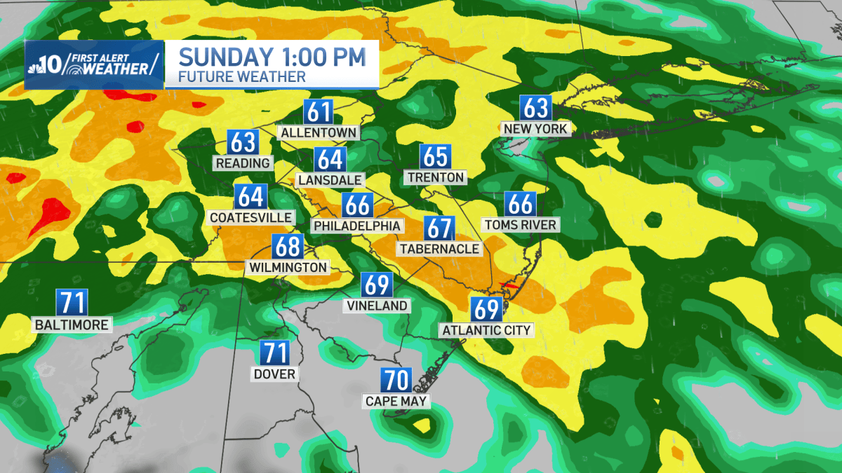
A First Alert will be in effect on Sunday as rain from the remnants of Isaias will arrive early Sunday morning close to 2 a.m.
The rain will become heavier by dawn on Sunday and winds pick up too.
The worst conditions from the storm will be late morning through late afternoon.
NBC10NBC10
Pockets of flash flooding is possible and some isolated severe storms.
Plus, an isolated spin-up tornado is possible in far South Jersey and Delaware.
Rain will taper off late Sunday night and linger into early Monday.
Sunday’s high temperature will only be in the middle 60s.
Early rainfall on Monday will lead to breezy, mostly cloudy skies for the afternoon with highs in the lower 70s.
Tuesday will be beautiful with highs in near 80 degrees and mostly sunny skies.
Wednesday is very nice as well as conditions stay above average with highs in the middle 70s with sunshine.